Explore Available Collections in Copernicus Data Space Ecosystem (CDSE) STAC Catalouge#
Notebook Description#
This Jupyter Notebook demonstrates how to explore and interact with the Copernicus Data Space Ecosystem (CDSE) STAC API using Python. The notebook provides step-by-step instructions to query and visualize data from various Sentinel satellite collections.
Key Steps#
Introduction to CDSE STAC API:
Explains the purpose of the Copernicus Data Space Ecosystem and its STAC API.
Library Imports:
Utilizes libraries such as
pystac,pystac_client,matplotlib,Pillow, andrequestsfor querying and visualizing satellite data.
API Initialization:
Demonstrates how to set up the STAC client using the API base URL.
Catalog Exploration:
Retrieves and displays metadata about the STAC catalog, including available collections and child links.
Data Search and Visualization:
Searches for data in specific collections (e.g., Sentinel-2, Sentinel-1, Sentinel-3) based on spatial and temporal filters.
Filters results by criteria such as cloud cover and acquisition date.
Visualizes thumbnails of the retrieved satellite images in a grid format.
Collections Covered:
Sentinel-2 L2A: Optical imagery with cloud cover filtering.
Sentinel-1 GRD: Radar imagery without cloud filtering.
Sentinel-3 OLCI: Ocean and land color imagery.
Import the required libraries#
from datetime import datetime
import pystac
from pystac_client import Client
import matplotlib.pyplot as plt
from PIL import Image
import requests
from io import BytesIO
Define API base URL#
BASE_URL = "https://stac.dataspace.copernicus.eu/v1/" # new version
# BASE_URL = "https://catalogue.dataspace.copernicus.eu/stac"
Initiate the STAC client using PYSTAC_CLIENT#
client = Client.open(BASE_URL)
Get details of the STAC Catalogue#
print(f"Catalog ID: {client.id}")
print (f"Catalog Title: {client.title}")
print(f"Description: {client.description}")
print("\nAvailable Collections:")
for collection in client.get_all_collections():
    print(f"- {collection.id}: {collection.description}")
    print (f"Spatial Extent: {collection.extent.spatial.bboxes}")
    print (f"Temporal Extent: {collection.extent.temporal.intervals}")
Catalog ID: cdse-stac
Catalog Title: Copernicus Data Space Ecosystem (CDSE) asset-level STAC catalogue
Description: A comprehensive and searchable catalog of Earth observation and scientific datasets that is actively maintained and updated by the Copernicus Data Space Ecosystem. The integrated STAC (SpatioTemporal Asset Catalog) API, which follows the open STAC specification, enables users to access detailed asset-level metadata, including spatial information, temporal coverage, and data specifications. This standardized interface facilitates efficient data discovery and retrieval across the extensive collection of environmental and scientific resources. More information: https://documentation.dataspace.copernicus.eu/

Available Collections:
- sentinel-3-olci-2-wfr-nrt: This collection provides Sentinel-3 OLCI Level-2 Water Full Resolution products containing data on water-leaving reflectance, ocean color, and more.
Spatial Extent: [[-180, -90, 180, 90]]
Temporal Extent: [[datetime.datetime(2017, 11, 1, 0, 7, 1, 738487, tzinfo=tzutc()), None]]
- sentinel-3-sl-2-aod-nrt: The Copernicus Sentinel-3 SLSTR AOD product quantifies the abundance of aerosol particles, and monitors their global distribution & long-range transport, at the scale of 9.5 x 9.5 km2. All observations are made available in less than 3 hours from the SLSTR observation sensing time.
Spatial Extent: [[-180, -90, 180, 90]]
Temporal Extent: [[datetime.datetime(2021, 2, 14, 1, 3, 38, 750903, tzinfo=tzutc()), None]]
- sentinel-1-grd: Level-1 Ground Range Detected (GRD) products consist of focused SAR data that has been detected, multi-looked and projected to ground range using the Earth ellipsoid model WGS84. The ellipsoid projection of the GRD products is corrected using the terrain height specified in the product general annotation. The terrain height used varies in azimuth and it is constant in range (For IW/EW modes only the terrain height of first subswath is considered)
Spatial Extent: [[-180, -90, 180, 90]]
Temporal Extent: [[datetime.datetime(2014, 10, 4, 3, 12, 47, tzinfo=tzutc()), None]]
- sentinel-1-global-mosaics: Sentinel-1 monthly mosaics are generated from monthly stacks of Sentinel-1 GRD data by calculating the weighted sum of the terrain corrected backscatter observations. Two different Sentinel-1 mosaics are being produced for each month: IW mosaic and DH mosaic.
Spatial Extent: [[-180, -90, 180, 90]]
Temporal Extent: [[datetime.datetime(2020, 1, 1, 0, 0, tzinfo=tzutc()), None]]
- sentinel-2-l2a: The Sentinel-2 Level-2A Collection 1 product provides orthorectified Surface Reflectance (Bottom-Of-Atmosphere: BOA), with sub-pixel multispectral and multitemporal registration accuracy. Scene Classification (including Clouds and Cloud Shadows), AOT (Aerosol Optical Thickness) and WV (Water Vapour) maps are included in the product.
Spatial Extent: [[-180, -90, 180, 90]]
Temporal Extent: [[datetime.datetime(2015, 6, 27, 10, 25, 31, tzinfo=tzutc()), None]]
- sentinel-2-l1c: The Level-1C product is composed of 110x110 km2 tiles (ortho-images in UTM/WGS84 projection). Earth is subdivided on a predefined set of tiles, defined in UTM/WGS84 projection and using a 100 km step. However, each tile has a surface of 110x110 km² in order to provide large overlap with the neighbouring. The Level-1C product results from using a Digital Elevation Model (DEM) to project the image in cartographic geometry. Per-pixel radiometric measurements are provided in Top Of Atmosphere (TOA) reflectances along with the parameters to transform them into radiances.
Spatial Extent: [[-180, -90, 180, 90]]
Temporal Extent: [[datetime.datetime(2015, 6, 27, 10, 25, 31, tzinfo=tzutc()), None]]
- sentinel-2-global-mosaics: The mosaics have four bands of data (Red (B04), Green (B03), Blue (B02) and wide band Near Infrared (B08)). First, cloud masking based on the scene classification layer of the Sentinel-2 level 2 algorithm was applied, then for each pixel and band, within three-month time periods, the first quartile of the distribution of the pixel values was taken as the output value to filter out any bright pixels misclassified as not clouds. If there are no valid pixels for the given timeframe, the pixel is left empty. Sentinel-2 cloudless mosaics can be used for various purposes such as land cover classification, land use planning, or for the creation of basemaps. These images are especially useful for showing large and cloudy areas with interesting large-scale patterns. Iceland is a prime example, with frequent cloud cover and large areal extent spanning several Sentinel-2 swaths.
Spatial Extent: [[-180, -90, 180, 90]]
Temporal Extent: [[datetime.datetime(2020, 1, 1, 0, 0, tzinfo=tzutc()), None]]
- sentinel-3-sl-2-wst-nrt: This Collection provides Sentinel-3 SLSTR Level-2 Water Surface Temperature products containing data on sea surface temperature measurements on a 1km grid.
Spatial Extent: [[-180, -90, 180, 90]]
Temporal Extent: [[datetime.datetime(2017, 10, 31, 23, 59, 57, 451604, tzinfo=tzutc()), None]]
- sentinel-3-olci-1-efr-nrt: The Ocean and Land Color Instrument (OLCI) Earth Observation Full Resolution dataset contains top of atmosphere radiances at 21 spectral bands with center wavelengths ranging between 0.4µm and 1.02µm at spatial resolution of 300m with worldwide coverage every ~2 days.
Spatial Extent: [[-180, -90, 180, 90]]
Temporal Extent: [[datetime.datetime(2020, 4, 16, 19, 36, 28, 12367, tzinfo=tzutc()), None]]
- sentinel-3-olci-2-wrr-nrt: This collection provides Sentinel-3 OLCI Level-2 Water Reduced Resolution products containing data on water-leaving reflectance, ocean color, and more.
Spatial Extent: [[-180, -90, 180, 90]]
Temporal Extent: [[datetime.datetime(2017, 11, 1, 0, 7, 1, 738487, tzinfo=tzutc()), None]]
- sentinel-3-sl-2-lst-ntc: This Collection provides Sentinel-3 SLSTR Level-2 Land Surface Temperature products containing data on land surface temperature measurements on a 1km grid. Radiance is measured in two channels to determine the temperature of the Earth's surface skin in the instrument field of view, where the term "skin" refers to the top surface of bare soil or the effective emitting temperature of vegetation canopies as viewed from above.
Spatial Extent: [[-180, -90, 180, 90]]
Temporal Extent: [[datetime.datetime(2016, 4, 19, 1, 35, 17, 188500, tzinfo=tzutc()), None]]
- sentinel-3-olci-1-efr-ntc: The Ocean and Land Color Instrument (OLCI) Earth Observation Full Resolution dataset contains top of atmosphere radiances at 21 spectral bands with center wavelengths ranging between 0.4µm and 1.02µm at spatial resolution of 300m with worldwide coverage every ~2 days.
Spatial Extent: [[-180, -90, 180, 90]]
Temporal Extent: [[datetime.datetime(2020, 4, 16, 19, 36, 28, 12367, tzinfo=tzutc()), None]]
- sentinel-3-olci-2-wfr-ntc: This collection provides Sentinel-3 OLCI Level-2 Water Full Resolution products containing data on water-leaving reflectance, ocean color, and more.
Spatial Extent: [[-180, -90, 180, 90]]
Temporal Extent: [[datetime.datetime(2017, 11, 1, 0, 7, 1, 738487, tzinfo=tzutc()), None]]
- sentinel-3-olci-2-lfr-nrt: This collection provides Sentinel-3 OLCI Level-2 Land Full Resolution products containing data on global vegetation, chlorophyll, and water vapor.
Spatial Extent: [[-180, -90, 180, 90]]
Temporal Extent: [[datetime.datetime(2016, 4, 25, 11, 33, 47, 368562, tzinfo=tzutc()), None]]
- sentinel-3-sl-2-wst-ntc: This Collection provides Sentinel-3 SLSTR Level-2 Water Surface Temperature products containing data on sea surface temperature measurements on a 1km grid.
Spatial Extent: [[-180, -90, 180, 90]]
Temporal Extent: [[datetime.datetime(2017, 10, 31, 23, 59, 57, 451604, tzinfo=tzutc()), None]]
- sentinel-3-olci-1-err-nrt: The Ocean and Land Color Instrument (OLCI) Earth Observation Reduced Resolution dataset contains top of atmosphere radiances at 21 spectral bands with center wavelengths ranging between 0.4µm and 1.02µm at spatial resolution of 300m with worldwide coverage every ~2 days.
Spatial Extent: [[-180, -90, 180, 90]]
Temporal Extent: [[datetime.datetime(2020, 4, 16, 19, 36, 28, 12367, tzinfo=tzutc()), None]]
- sentinel-3-olci-2-lfr-ntc: This collection provides Sentinel-3 OLCI Level-2 Land Full Resolution products containing data on global vegetation, chlorophyll, and water vapor.
Spatial Extent: [[-180, -90, 180, 90]]
Temporal Extent: [[datetime.datetime(2016, 4, 25, 11, 33, 47, 368562, tzinfo=tzutc()), None]]
- sentinel-3-sl-2-frp-ntc: This Collection provides Sentinel-3 SLSTR Level-2 Fire Radiative Power (FRP) products containing data on fires detected over land and ocean.
Spatial Extent: [[-180, -90, 180, 90]]
Temporal Extent: [[datetime.datetime(2020, 8, 8, 23, 9, 58, 889991, tzinfo=tzutc()), None]]
- sentinel-3-olci-1-err-ntc: The Ocean and Land Color Instrument (OLCI) Earth Observation Reduced Resolution dataset contains top of atmosphere radiances at 21 spectral bands with center wavelengths ranging between 0.4µm and 1.02µm at spatial resolution of 300m with worldwide coverage every ~2 days.
Spatial Extent: [[-180, -90, 180, 90]]
Temporal Extent: [[datetime.datetime(2020, 4, 16, 19, 36, 28, 12367, tzinfo=tzutc()), None]]
- sentinel-3-sl-1-rbt-ntc: The Copernicus Sentinel-3 SLSTR RBT products provide global brightness temperatures and radiances with a spatial resolution of 500 meters for reflectance bands and 1 kilometer for thermal infrared bands, useful for environmental monitoring and climate studies.
Spatial Extent: [[-180, -90, 180, 90]]
Temporal Extent: [[datetime.datetime(2016, 4, 19, 0, 19, 32, 578034, tzinfo=tzutc()), None]]
- sentinel-3-olci-2-lrr-ntc: This collection provides Sentinel-3 OLCI Level-2 Land Reduced Resolution products containing data on global vegetation, chlorophyll, and water vapor.
Spatial Extent: [[-180, -90, 180, 90]]
Temporal Extent: [[datetime.datetime(2016, 4, 25, 11, 33, 47, 368562, tzinfo=tzutc()), None]]
- sentinel-3-sl-2-lst-nrt: This Collection provides Sentinel-3 SLSTR Level-2 Land Surface Temperature products containing data on land surface temperature measurements on a 1km grid. Radiance is measured in two channels to determine the temperature of the Earth's surface skin in the instrument field of view, where the term "skin" refers to the top surface of bare soil or the effective emitting temperature of vegetation canopies as viewed from above.
Spatial Extent: [[-180, -90, 180, 90]]
Temporal Extent: [[datetime.datetime(2016, 4, 19, 1, 35, 17, 188500, tzinfo=tzutc()), None]]
- sentinel-3-sl-1-rbt-nrt: The Copernicus Sentinel-3 SLSTR RBT products provide global brightness temperatures and radiances with a spatial resolution of 500 meters for reflectance bands and 1 kilometer for thermal infrared bands, useful for environmental monitoring and climate studies.
Spatial Extent: [[-180, -90, 180, 90]]
Temporal Extent: [[datetime.datetime(2016, 4, 19, 0, 19, 32, 578034, tzinfo=tzutc()), None]]
- sentinel-3-olci-2-lrr-nrt: This collection provides Sentinel-3 OLCI Level-2 Land Reduced Resolution products containing data on global vegetation, chlorophyll, and water vapor.
Spatial Extent: [[-180, -90, 180, 90]]
Temporal Extent: [[datetime.datetime(2016, 4, 25, 11, 33, 47, 368562, tzinfo=tzutc()), None]]
- sentinel-3-sl-2-frp-nrt: This Collection provides Sentinel-3 SLSTR Level-2 Fire Radiative Power (FRP) products containing data on fires detected over land and ocean.
Spatial Extent: [[-180, -90, 180, 90]]
Temporal Extent: [[datetime.datetime(2020, 8, 8, 23, 9, 58, 889991, tzinfo=tzutc()), None]]
- sentinel-5p-l1-ra-bd2-offl: This Collection provides Sentinel-5P Level-1 RA BD2 products, which contains Earth radiance spectra for spectral band 2.
Spatial Extent: [[-180, -90, 180, 90]]
Temporal Extent: [[datetime.datetime(2018, 4, 30, 0, 19, 50, tzinfo=tzutc()), None]]
- sentinel-3-sr-1-sra-a-nrt: This Collection provides Sentinel-3 SRAL Level-1A products, which contains geo-located bursts of echoes with all calibrations applied.
Spatial Extent: [[-180, -90, 180, 90]]
Temporal Extent: [[datetime.datetime(2023, 9, 20, 8, 8, 24, 314860, tzinfo=tzutc()), None]]
- sentinel-5p-l1-ra-bd2-nrti: This Collection provides Sentinel-5P Level-1 RA BD2 products, which contains Earth radiance spectra for spectral band 2.
Spatial Extent: [[-180, -90, 180, 90]]
Temporal Extent: [[datetime.datetime(2018, 4, 30, 0, 19, 50, tzinfo=tzutc()), None]]
- sentinel-3-sr-1-sra-a-stc: This Collection provides Sentinel-3 SRAL Level-1A products, which contains geo-located bursts of echoes with all calibrations applied.
Spatial Extent: [[-180, -90, 180, 90]]
Temporal Extent: [[datetime.datetime(2018, 7, 30, 23, 7, 40, 820385, tzinfo=tzutc()), None]]
- sentinel-5p-l1-ra-bd1-rpro: This Collection provides Sentinel-5P Level-1 RA BD1 products, which contains Earth radiance spectra for spectral band 1.
Spatial Extent: [[-180, -90, 180, 90]]
Temporal Extent: [[datetime.datetime(2018, 4, 30, 0, 19, 50, tzinfo=tzutc()), None]]
- sentinel-3-sr-1-sra-a-ntc: This Collection provides Sentinel-3 SRAL Level-1A products, which contains geo-located bursts of echoes with all calibrations applied.
Spatial Extent: [[-180, -90, 180, 90]]
Temporal Extent: [[datetime.datetime(2016, 3, 1, 14, 7, 51, 632846, tzinfo=tzutc()), None]]
- sentinel-3-sr-1-sra-bs-ntc: This Collection provides Sentinel-3 SRAL Level-1B-S products, which contains fully SAR-processed and calibrated High Resolution complex echoes arranged in stacks after slant range correction and prior to echo multi-look.
Spatial Extent: [[-180, -90, 180, 90]]
Temporal Extent: [[datetime.datetime(2016, 3, 1, 14, 7, 51, 632846, tzinfo=tzutc()), None]]
- sentinel-5p-l1-ra-bd5-nrti: This Collection provides Sentinel-5P Level-1 RA BD5 products, which contains Earth radiance spectra for spectral band 5.
Spatial Extent: [[-180, -90, 180, 90]]
Temporal Extent: [[datetime.datetime(2018, 4, 30, 0, 19, 50, tzinfo=tzutc()), None]]
- sentinel-3-sr-1-sra-bs-stc: This Collection provides Sentinel-3 SRAL Level-1B-S products, which contains fully SAR-processed and calibrated High Resolution complex echoes arranged in stacks after slant range correction and prior to echo multi-look.
Spatial Extent: [[-180, -90, 180, 90]]
Temporal Extent: [[datetime.datetime(2018, 7, 30, 23, 7, 40, 820385, tzinfo=tzutc()), None]]
- sentinel-5p-l1-ra-bd6-offl: This Collection provides Sentinel-5P Level-1 RA BD6 products, which contains Earth radiance spectra for spectral band 6.
Spatial Extent: [[-180, -90, 180, 90]]
Temporal Extent: [[datetime.datetime(2018, 4, 30, 0, 19, 50, tzinfo=tzutc()), None]]
- sentinel-5p-l1-ra-bd4-nrti: This Collection provides Sentinel-5P Level-1 RA BD4 products, which contains Earth radiance spectra for spectral band 4.
Spatial Extent: [[-180, -90, 180, 90]]
Temporal Extent: [[datetime.datetime(2018, 4, 30, 0, 19, 50, tzinfo=tzutc()), None]]
- sentinel-3-sr-1-sra-stc: This Collection provides Sentinel-3 SRAL Level-1B products, which contains geo-located and fully calibrated multi-looked High Resolution power echoes.
Spatial Extent: [[-180, -90, 180, 90]]
Temporal Extent: [[datetime.datetime(2018, 7, 30, 23, 7, 40, 820385, tzinfo=tzutc()), None]]
- sentinel-3-olci-2-wrr-ntc: This collection provides Sentinel-3 OLCI Level-2 Water Reduced Resolution products containing data on water-leaving reflectance, ocean color, and more.
Spatial Extent: [[-180, -90, 180, 90]]
Temporal Extent: [[datetime.datetime(2017, 11, 1, 0, 7, 1, 738487, tzinfo=tzutc()), None]]
- sentinel-5p-l1-ra-bd1-nrti: This Collection provides Sentinel-5P Level-1 RA BD1 products, which contains Earth radiance spectra for spectral band 1.
Spatial Extent: [[-180, -90, 180, 90]]
Temporal Extent: [[datetime.datetime(2018, 4, 30, 0, 19, 50, tzinfo=tzutc()), None]]
- sentinel-3-sr-1-sra-ntc: This Collection provides Sentinel-3 SRAL Level-1B products, which contains geo-located and fully calibrated multi-looked High Resolution power echoes.
Spatial Extent: [[-180, -90, 180, 90]]
Temporal Extent: [[datetime.datetime(2016, 3, 1, 14, 7, 51, 632846, tzinfo=tzutc()), None]]
- sentinel-5p-l1-ra-bd3-nrti: This Collection provides Sentinel-5P Level-1 RA BD3 products, which contains Earth radiance spectra for spectral band 3.
Spatial Extent: [[-180, -90, 180, 90]]
Temporal Extent: [[datetime.datetime(2018, 4, 30, 0, 19, 50, tzinfo=tzutc()), None]]
- sentinel-3-sr-1-sra-nrt: This Collection provides Sentinel-3 SRAL Level-1B products, which contains geo-located and fully calibrated multi-looked High Resolution power echoes.
Spatial Extent: [[-180, -90, 180, 90]]
Temporal Extent: [[datetime.datetime(2019, 6, 12, 7, 49, 50, 363091, tzinfo=tzutc()), None]]
- sentinel-5p-l1-ra-bd6-rpro: This Collection provides Sentinel-5P Level-1 RA BD6 products, which contains Earth radiance spectra for spectral band 6.
Spatial Extent: [[-180, -90, 180, 90]]
Temporal Extent: [[datetime.datetime(2018, 4, 30, 0, 19, 50, tzinfo=tzutc()), None]]
- sentinel-3-sr-2-lan-hy-nrt: This Collection provides Sentinel-3 SRAL Level-2 Land Altimetry Hydrology products, which contains surface topography estimations of lakes and rivers.
Spatial Extent: [[-180, -90, 180, 90]]
Temporal Extent: [[datetime.datetime(2023, 9, 20, 5, 36, 47, 501786, tzinfo=tzutc()), None]]
- sentinel-5p-l1-ra-bd5-rpro: This Collection provides Sentinel-5P Level-1 RA BD5 products, which contains Earth radiance spectra for spectral band 5.
Spatial Extent: [[-180, -90, 180, 90]]
Temporal Extent: [[datetime.datetime(2018, 4, 30, 0, 19, 50, tzinfo=tzutc()), None]]
- sentinel-3-sr-2-lan-hy-stc: This Collection provides Sentinel-3 SRAL Level-2 Land Altimetry Hydrology products, which contains surface topography estimations of lakes and rivers.
Spatial Extent: [[-180, -90, 180, 90]]
Temporal Extent: [[datetime.datetime(2023, 9, 18, 18, 8, 57, 3590, tzinfo=tzutc()), None]]
- sentinel-5p-l1-ra-bd8-rpro: This Collection provides Sentinel-5P Level-1 RA BD8 products, which contains Earth radiance spectra for spectral band 8.
Spatial Extent: [[-180, -90, 180, 90]]
Temporal Extent: [[datetime.datetime(2018, 4, 30, 0, 19, 50, tzinfo=tzutc()), None]]
- sentinel-3-sr-2-lan-hy-ntc: This Collection provides Sentinel-3 SRAL Level-2 Land Altimetry Hydrology products, which contains surface topography estimations of lakes and rivers.
Spatial Extent: [[-180, -90, 180, 90]]
Temporal Extent: [[datetime.datetime(2016, 3, 1, 14, 7, 51, 632846, tzinfo=tzutc()), None]]
- sentinel-5p-l1-ra-bd3-rpro: This Collection provides Sentinel-5P Level-1 RA BD3 products, which contains Earth radiance spectra for spectral band 3.
Spatial Extent: [[-180, -90, 180, 90]]
Temporal Extent: [[datetime.datetime(2018, 4, 30, 0, 19, 50, tzinfo=tzutc()), None]]
- sentinel-3-sr-2-lan-li-ntc: This Collection provides Sentinel-3 SRAL Level-2 Land Altimetry Land Ice products, which contains surface topography estimations of the Greenland and Antarctic ice sheets.
Spatial Extent: [[-180, -90, 180, 90]]
Temporal Extent: [[datetime.datetime(2016, 3, 1, 14, 7, 51, 632846, tzinfo=tzutc()), None]]
- sentinel-5p-l1-ra-bd7-offl: This Collection provides Sentinel-5P Level-1 RA BD7 products, which contains Earth radiance spectra for spectral band 7.
Spatial Extent: [[-180, -90, 180, 90]]
Temporal Extent: [[datetime.datetime(2018, 4, 30, 0, 19, 50, tzinfo=tzutc()), None]]
- sentinel-3-sr-2-lan-li-stc: This Collection provides Sentinel-3 SRAL Level-2 Land Altimetry Land Ice products, which contains surface topography estimations of the Greenland and Antarctic ice sheets.
Spatial Extent: [[-180, -90, 180, 90]]
Temporal Extent: [[datetime.datetime(2023, 9, 18, 17, 38, 57, 61085, tzinfo=tzutc()), None]]
- sentinel-5p-l1-ra-bd6-nrti: This Collection provides Sentinel-5P Level-1 RA BD6 products, which contains Earth radiance spectra for spectral band 6.
Spatial Extent: [[-180, -90, 180, 90]]
Temporal Extent: [[datetime.datetime(2018, 4, 30, 0, 19, 50, tzinfo=tzutc()), None]]
- sentinel-3-sr-2-lan-li-nrt: This Collection provides Sentinel-3 SRAL Level-2 Land Altimetry Land Ice products, which contains surface topography estimations of the Greenland and Antarctic ice sheets.
Spatial Extent: [[-180, -90, 180, 90]]
Temporal Extent: [[datetime.datetime(2023, 9, 20, 5, 36, 47, 501786, tzinfo=tzutc()), None]]
- sentinel-5p-l1-ra-bd5-offl: This Collection provides Sentinel-5P Level-1 RA BD5 products, which contains Earth radiance spectra for spectral band 5.
Spatial Extent: [[-180, -90, 180, 90]]
Temporal Extent: [[datetime.datetime(2018, 4, 30, 0, 19, 50, tzinfo=tzutc()), None]]
- sentinel-3-sr-2-lan-si-stc: This Collection provides Sentinel-3 SRAL Level-2 Land Altimetry Sea Ice products, which contains estimations of the radar freeboard over the Arctic and Antarctic sea ice.
Spatial Extent: [[-180, -90, 180, 90]]
Temporal Extent: [[datetime.datetime(2023, 9, 18, 17, 45, 4, 933375, tzinfo=tzutc()), None]]
- sentinel-5p-l1-ra-bd8-offl: This Collection provides Sentinel-5P Level-1 RA BD8 products, which contains Earth radiance spectra for spectral band 8.
Spatial Extent: [[-180, -90, 180, 90]]
Temporal Extent: [[datetime.datetime(2018, 4, 30, 0, 19, 50, tzinfo=tzutc()), None]]
- sentinel-3-sr-2-lan-si-nrt: This Collection provides Sentinel-3 SRAL Level-2 Land Altimetry Sea Ice products, which contains estimations of the radar freeboard over the Arctic and Antarctic sea ice.
Spatial Extent: [[-180, -90, 180, 90]]
Temporal Extent: [[datetime.datetime(2023, 9, 20, 5, 44, 46, 293587, tzinfo=tzutc()), None]]
- sentinel-5p-l1-ra-bd2-rpro: This Collection provides Sentinel-5P Level-1 RA BD2 products, which contains Earth radiance spectra for spectral band 2.
Spatial Extent: [[-180, -90, 180, 90]]
Temporal Extent: [[datetime.datetime(2018, 4, 30, 0, 19, 50, tzinfo=tzutc()), None]]
- sentinel-3-sr-2-lan-si-ntc: This Collection provides Sentinel-3 SRAL Level-2 Land Altimetry Sea Ice products, which contains estimations of the radar freeboard over the Arctic and Antarctic sea ice.
Spatial Extent: [[-180, -90, 180, 90]]
Temporal Extent: [[datetime.datetime(2016, 3, 1, 14, 7, 51, 632846, tzinfo=tzutc()), None]]
- sentinel-5p-l1-ra-bd4-offl: This Collection provides Sentinel-5P Level-1 RA BD4 products, which contains Earth radiance spectra for spectral band 4.
Spatial Extent: [[-180, -90, 180, 90]]
Temporal Extent: [[datetime.datetime(2018, 4, 30, 0, 19, 50, tzinfo=tzutc()), None]]
- sentinel-3-sr-2-lan-nrt: This Collection provides Sentinel-3 SRAL Level-2 Land Altimetry products, which contains data on land radar altimetry measurements. Each product contains three NetCDF files.
Spatial Extent: [[-180, -90, 180, 90]]
Temporal Extent: [[datetime.datetime(2019, 6, 11, 22, 27, 51, 924571, tzinfo=tzutc()), None]]
- sentinel-5p-l1-ra-bd7-rpro: This Collection provides Sentinel-5P Level-1 RA BD7 products, which contains Earth radiance spectra for spectral band 7.
Spatial Extent: [[-180, -90, 180, 90]]
Temporal Extent: [[datetime.datetime(2018, 4, 30, 0, 19, 50, tzinfo=tzutc()), None]]
- sentinel-3-sr-2-lan-stc: This Collection provides Sentinel-3 SRAL Level-2 Land Altimetry products, which contains data on land radar altimetry measurements. Each product contains three NetCDF files.
Spatial Extent: [[-180, -90, 180, 90]]
Temporal Extent: [[datetime.datetime(2018, 7, 30, 23, 7, 46, 541259, tzinfo=tzutc()), None]]
- sentinel-5p-l1-ra-bd8-nrti: This Collection provides Sentinel-5P Level-1 RA BD8 products, which contains Earth radiance spectra for spectral band 8.
Spatial Extent: [[-180, -90, 180, 90]]
Temporal Extent: [[datetime.datetime(2018, 4, 30, 0, 19, 50, tzinfo=tzutc()), None]]
- sentinel-3-sr-2-lan-ntc: This Collection provides Sentinel-3 SRAL Level-2 Land Altimetry products, which contains data on land radar altimetry measurements. Each product contains three NetCDF files.
Spatial Extent: [[-180, -90, 180, 90]]
Temporal Extent: [[datetime.datetime(2016, 3, 1, 14, 7, 51, 632846, tzinfo=tzutc()), None]]
- sentinel-5p-l1-ra-bd4-rpro: This Collection provides Sentinel-5P Level-1 RA BD4 products, which contains Earth radiance spectra for spectral band 4.
Spatial Extent: [[-180, -90, 180, 90]]
Temporal Extent: [[datetime.datetime(2018, 4, 30, 0, 19, 50, tzinfo=tzutc()), None]]
- sentinel-3-sr-2-wat-stc: This Collection provides Sentinel-3 SRAL Level-2 Ocean Altimetry products, which contain data on ocean radar altimetry measurements.
Spatial Extent: [[-180, -90, 180, 90]]
Temporal Extent: [[datetime.datetime(2017, 1, 28, 0, 59, 14, 149496, tzinfo=tzutc()), None]]
- sentinel-5p-l1-ra-bd7-nrti: This Collection provides Sentinel-5P Level-1 RA BD7 products, which contains Earth radiance spectra for spectral band 7.
Spatial Extent: [[-180, -90, 180, 90]]
Temporal Extent: [[datetime.datetime(2018, 4, 30, 0, 19, 50, tzinfo=tzutc()), None]]
- sentinel-3-sr-2-wat-nrt: This Collection provides Sentinel-3 SRAL Level-2 Ocean Altimetry products, which contain data on ocean radar altimetry measurements.
Spatial Extent: [[-180, -90, 180, 90]]
Temporal Extent: [[datetime.datetime(2017, 1, 28, 0, 59, 14, 149496, tzinfo=tzutc()), None]]
- sentinel-5p-l1-ra-bd3-offl: This Collection provides Sentinel-5P Level-1 RA BD3 products, which contains Earth radiance spectra for spectral band 3.
Spatial Extent: [[-180, -90, 180, 90]]
Temporal Extent: [[datetime.datetime(2018, 4, 30, 0, 19, 50, tzinfo=tzutc()), None]]
- sentinel-3-sr-2-wat-ntc: This Collection provides Sentinel-3 SRAL Level-2 Ocean Altimetry products, which contain data on ocean radar altimetry measurements.
Spatial Extent: [[-180, -90, 180, 90]]
Temporal Extent: [[datetime.datetime(2017, 1, 28, 0, 59, 14, 149496, tzinfo=tzutc()), None]]
- sentinel-5p-l1-ra-bd1-offl: This Collection provides Sentinel-5P Level-1 RA BD1 products, which contains Earth radiance spectra for spectral band 1.
Spatial Extent: [[-180, -90, 180, 90]]
Temporal Extent: [[datetime.datetime(2018, 4, 30, 0, 19, 50, tzinfo=tzutc()), None]]
- sentinel-3-syn-2-aod-ntc: This Collection provides the Sentinel-3 Synergy Level-2 Aerosol Optical Depth product, which is a downstream development of the Sentinel-2 Level-1 OLCI FR and SLSTR Radiances and Brightness Temperatures products. The dataset provides both retrieved and diagnostic global aerosol parameters at super-pixel (4.5 km x 4.5 km) resolution in a single NetCDF file for all regions over land and ocean free of snow/ice cover, excluding high cloud fraction data.
Spatial Extent: [[-180, -90, 180, 90]]
Temporal Extent: [[datetime.datetime(2020, 4, 16, 19, 36, 28, 12367, tzinfo=tzutc()), None]]
- sentinel-5p-l2-aer-ai-nrti: This Collection provides Sentinel-5P Level-2 AER AI products, which contains high-resolution imagery of the UV Aerosol Index (UVAI), also called the Absorbing Aerosol Index (AAI).
Spatial Extent: [[-180, -90, 180, 90]]
Temporal Extent: [[datetime.datetime(2018, 4, 30, 0, 18, 50, tzinfo=tzutc()), None]]
- sentinel-3-syn-2-syn-stc: This Collection provides the Sentinel-3 Synergy Level-2 Land Surface Reflectance and Aerosol product, which contains data on Surface Directional Reflectance, Aerosol Optical Thickness, and an Angstrom coefficient estimate over land.
Spatial Extent: [[-180, -90, 180, 90]]
Temporal Extent: [[datetime.datetime(2018, 9, 22, 16, 51, 0, 1276, tzinfo=tzutc()), None]]
- sentinel-5p-l2-aer-ai-offl: This Collection provides Sentinel-5P Level-2 AER AI products, which contains high-resolution imagery of the UV Aerosol Index (UVAI), also called the Absorbing Aerosol Index (AAI).
Spatial Extent: [[-180, -90, 180, 90]]
Temporal Extent: [[datetime.datetime(2018, 4, 30, 0, 18, 50, tzinfo=tzutc()), None]]
- sentinel-3-syn-2-syn-ntc: This Collection provides the Sentinel-3 Synergy Level-2 Land Surface Reflectance and Aerosol product, which contains data on Surface Directional Reflectance, Aerosol Optical Thickness, and an Angstrom coefficient estimate over land.
Spatial Extent: [[-180, -90, 180, 90]]
Temporal Extent: [[datetime.datetime(2018, 9, 22, 16, 51, 0, 1276, tzinfo=tzutc()), None]]
- sentinel-5p-l2-aer-ai-rpro: This Collection provides Sentinel-5P Level-2 AER AI products, which contains high-resolution imagery of the UV Aerosol Index (UVAI), also called the Absorbing Aerosol Index (AAI).
Spatial Extent: [[-180, -90, 180, 90]]
Temporal Extent: [[datetime.datetime(2018, 4, 30, 0, 18, 50, tzinfo=tzutc()), None]]
- sentinel-3-syn-2-v10-ntc: This Collection provides the Sentinel-3 Synergy Level-2 10-Day Surface Reflectance and NDVI products, which are SPOT VEGETATION Continuity Products similar to those obtained from the VEGETATION instrument onboard the SPOT-4 and SPOT-5 satellites.
Spatial Extent: [[-180, -90, 180, 90]]
Temporal Extent: [[datetime.datetime(2018, 9, 27, 11, 17, 21, tzinfo=tzutc()), None]]
- sentinel-5p-l2-aer-lh-nrti: This Collection provides Sentinel-5P Level-2 AER LH products, which contains high-resolution imagery of the UV Aerosol Index (UVAI), also called the Absorbing Layer Height (ALH).
Spatial Extent: [[-180, -90, 180, 90]]
Temporal Extent: [[datetime.datetime(2018, 4, 1, 0, 0, 11, tzinfo=tzutc()), None]]
- sentinel-3-syn-2-v10-stc: This Collection provides the Sentinel-3 Synergy Level-2 10-Day Surface Reflectance and NDVI products, which are SPOT VEGETATION Continuity Products similar to those obtained from the VEGETATION instrument onboard the SPOT-4 and SPOT-5 satellites.
Spatial Extent: [[-180, -90, 180, 90]]
Temporal Extent: [[datetime.datetime(2018, 9, 27, 11, 17, 21, tzinfo=tzutc()), None]]
- sentinel-5p-l2-aer-lh-offl: This Collection provides Sentinel-5P Level-2 AER LH products, which contains high-resolution imagery of the UV Aerosol Index (UVAI), also called the Absorbing Layer Height (ALH).
Spatial Extent: [[-180, -90, 180, 90]]
Temporal Extent: [[datetime.datetime(2018, 4, 1, 0, 0, 11, tzinfo=tzutc()), None]]
- sentinel-3-syn-2-vg1-ntc: This Collection provides the Sentinel-3 Synergy Level-2 1-Day Surface Reflectance and NDVI products, which are SPOT VEGETATION Continuity Products similar to those obtained from the VEGETATION instrument onboard the SPOT-4 and SPOT-5 satellites.
Spatial Extent: [[-180, -90, 180, 90]]
Temporal Extent: [[datetime.datetime(2018, 10, 4, 23, 17, 21, tzinfo=tzutc()), None]]
- sentinel-5p-l2-aer-lh-rpro: This Collection provides Sentinel-5P Level-2 AER LH products, which contains high-resolution imagery of the UV Aerosol Index (UVAI), also called the Absorbing Layer Height (ALH).
Spatial Extent: [[-180, -90, 180, 90]]
Temporal Extent: [[datetime.datetime(2018, 4, 1, 0, 0, 11, tzinfo=tzutc()), None]]
- sentinel-3-syn-2-vg1-stc: This Collection provides the Sentinel-3 Synergy Level-2 1-Day Surface Reflectance and NDVI products, which are SPOT VEGETATION Continuity Products similar to those obtained from the VEGETATION instrument onboard the SPOT-4 and SPOT-5 satellites.
Spatial Extent: [[-180, -90, 180, 90]]
Temporal Extent: [[datetime.datetime(2018, 10, 4, 23, 17, 21, tzinfo=tzutc()), None]]
- sentinel-5p-l2-ch4-offl: This Collection provides Sentinel-5P Level-2 CH4 products, which contains high-resolution imagery of methane concentrations.
Spatial Extent: [[-180, -90, 180, 90]]
Temporal Extent: [[datetime.datetime(2018, 4, 1, 1, 1, 34, tzinfo=tzutc()), None]]
- sentinel-3-syn-2-vgp-stc: This Collection provides the Sentinel-3 Synergy Level-2 Top of Atmosphere Reflectance product, which is a SPOT VEGETATION Continuity Product containing measurement data similar to that obtained by the VEGETATION instrument onboad the SPOT-3 and SPOT-4 satellites.
Spatial Extent: [[-180, -90, 180, 90]]
Temporal Extent: [[datetime.datetime(2018, 10, 8, 8, 9, 40, 491227, tzinfo=tzutc()), None]]
- sentinel-5p-l2-ch4-rpro: This Collection provides Sentinel-5P Level-2 CH4 products, which contains high-resolution imagery of methane concentrations.
Spatial Extent: [[-180, -90, 180, 90]]
Temporal Extent: [[datetime.datetime(2018, 4, 1, 1, 1, 34, tzinfo=tzutc()), None]]
- sentinel-3-syn-2-vgp-ntc: This Collection provides the Sentinel-3 Synergy Level-2 Top of Atmosphere Reflectance product, which is a SPOT VEGETATION Continuity Product containing measurement data similar to that obtained by the VEGETATION instrument onboad the SPOT-3 and SPOT-4 satellites.
Spatial Extent: [[-180, -90, 180, 90]]
Temporal Extent: [[datetime.datetime(2018, 10, 8, 8, 9, 40, 491227, tzinfo=tzutc()), None]]
- sentinel-5p-l2-cloud-nrti: This Collection provides Sentinel-5P Level-2 Cloud products, which contains high-resolution imagery of cloud parameters.
Spatial Extent: [[-180, -90, 180, 90]]
Temporal Extent: [[datetime.datetime(2018, 4, 30, 0, 18, 50, tzinfo=tzutc()), None]]
- sentinel-5p-l2-cloud-offl: This Collection provides Sentinel-5P Level-2 Cloud products, which contains high-resolution imagery of cloud parameters.
Spatial Extent: [[-180, -90, 180, 90]]
Temporal Extent: [[datetime.datetime(2018, 4, 30, 0, 18, 50, tzinfo=tzutc()), None]]
- sentinel-5p-l2-cloud-rpro: This Collection provides Sentinel-5P Level-2 Cloud products, which contains high-resolution imagery of cloud parameters.
Spatial Extent: [[-180, -90, 180, 90]]
Temporal Extent: [[datetime.datetime(2018, 4, 30, 0, 18, 50, tzinfo=tzutc()), None]]
- sentinel-5p-l2-co-rpro: This Collection provides Sentinel-5P Level-2 CO products, which contains high-resolution imagery of carbon monoxide concentrations.
Spatial Extent: [[-180, -90, 180, 90]]
Temporal Extent: [[datetime.datetime(2018, 4, 1, 0, 0, 11, tzinfo=tzutc()), None]]
- sentinel-5p-l2-co-nrti: This Collection provides Sentinel-5P Level-2 CO products, which contains high-resolution imagery of carbon monoxide concentrations.
Spatial Extent: [[-180, -90, 180, 90]]
Temporal Extent: [[datetime.datetime(2018, 4, 1, 0, 0, 11, tzinfo=tzutc()), None]]
- sentinel-5p-l2-co-offl: This Collection provides Sentinel-5P Level-2 CO products, which contains high-resolution imagery of carbon monoxide concentrations.
Spatial Extent: [[-180, -90, 180, 90]]
Temporal Extent: [[datetime.datetime(2018, 4, 1, 0, 0, 11, tzinfo=tzutc()), None]]
- sentinel-5p-l2-hcho-nrti: This Collection provides Sentinel-5P Level-2 HCHO products, which contains high-resolution imagery of atmospheric formaldehyde concentrations.
Spatial Extent: [[-180, -90, 180, 90]]
Temporal Extent: [[datetime.datetime(2018, 4, 30, 0, 18, 51, tzinfo=tzutc()), None]]
- sentinel-5p-l2-hcho-rpro: This Collection provides Sentinel-5P Level-2 HCHO products, which contains high-resolution imagery of atmospheric formaldehyde concentrations.
Spatial Extent: [[-180, -90, 180, 90]]
Temporal Extent: [[datetime.datetime(2018, 4, 30, 0, 18, 51, tzinfo=tzutc()), None]]
- sentinel-5p-l2-hcho-offl: This Collection provides Sentinel-5P Level-2 HCHO products, which contains high-resolution imagery of atmospheric formaldehyde concentrations.
Spatial Extent: [[-180, -90, 180, 90]]
Temporal Extent: [[datetime.datetime(2018, 4, 30, 0, 18, 51, tzinfo=tzutc()), None]]
- sentinel-5p-l2-no2-offl: This Collection provides Sentinel-5P Level-2 NO2 products, which contains high-resolution imagery of nitrogen dioxide concentrations.
Spatial Extent: [[-180, -90, 180, 90]]
Temporal Extent: [[datetime.datetime(2018, 4, 30, 0, 18, 51, tzinfo=tzutc()), None]]
- sentinel-5p-l2-no2-rpro: This Collection provides Sentinel-5P Level-2 NO2 products, which contains high-resolution imagery of nitrogen dioxide concentrations.
Spatial Extent: [[-180, -90, 180, 90]]
Temporal Extent: [[datetime.datetime(2018, 4, 30, 0, 18, 51, tzinfo=tzutc()), None]]
- sentinel-5p-l2-no2-nrti: This Collection provides Sentinel-5P Level-2 NO2 products, which contains high-resolution imagery of nitrogen dioxide concentrations.
Spatial Extent: [[-180, -90, 180, 90]]
Temporal Extent: [[datetime.datetime(2018, 4, 30, 0, 18, 51, tzinfo=tzutc()), None]]
- sentinel-5p-l2-np-bd3-rpro: This Collection provides Sentinel-5P Level-2 NP BD3 products, which contains information on cloud and scene homogeneity.
Spatial Extent: [[-180, -90, 180, 90]]
Temporal Extent: [[datetime.datetime(2018, 4, 30, 0, 18, 51, tzinfo=tzutc()), None]]
- sentinel-5p-l2-np-bd3-offl: This Collection provides Sentinel-5P Level-2 NP BD3 products, which contains information on cloud and scene homogeneity.
Spatial Extent: [[-180, -90, 180, 90]]
Temporal Extent: [[datetime.datetime(2018, 4, 30, 0, 18, 51, tzinfo=tzutc()), None]]
- sentinel-5p-l2-np-bd6-rpro: This Collection provides Sentinel-5P Level-2 NP BD6 products, which contains information on cloud and scene homogeneity.
Spatial Extent: [[-180, -90, 180, 90]]
Temporal Extent: [[datetime.datetime(2018, 4, 30, 0, 18, 51, tzinfo=tzutc()), None]]
- sentinel-5p-l2-np-bd6-offl: This Collection provides Sentinel-5P Level-2 NP BD6 products, which contains information on cloud and scene homogeneity.
Spatial Extent: [[-180, -90, 180, 90]]
Temporal Extent: [[datetime.datetime(2018, 4, 30, 0, 18, 51, tzinfo=tzutc()), None]]
- sentinel-5p-l2-np-bd7-rpro: This Collection provides Sentinel-5P Level-2 NP BD7 products, which contains information on cloud and scene homogeneity.
Spatial Extent: [[-180, -90, 180, 90]]
Temporal Extent: [[datetime.datetime(2018, 4, 30, 0, 18, 51, tzinfo=tzutc()), None]]
- sentinel-5p-l2-np-bd7-offl: This Collection provides Sentinel-5P Level-2 NP BD7 products, which contains information on cloud and scene homogeneity.
Spatial Extent: [[-180, -90, 180, 90]]
Temporal Extent: [[datetime.datetime(2018, 4, 30, 0, 18, 51, tzinfo=tzutc()), None]]
- sentinel-5p-l2-o3-pr-nrti: This Collection provides Sentinel-5P Level-2 O3 PR products, which contains ozone concentration for 33 levels in the atmosphere.
Spatial Extent: [[-180, -90, 180, 90]]
Temporal Extent: [[datetime.datetime(2018, 4, 1, 0, 0, 11, tzinfo=tzutc()), None]]
- sentinel-5p-l2-o3-pr-rpro: This Collection provides Sentinel-5P Level-2 O3 PR products, which contains ozone concentration for 33 levels in the atmosphere.
Spatial Extent: [[-180, -90, 180, 90]]
Temporal Extent: [[datetime.datetime(2018, 4, 1, 0, 0, 11, tzinfo=tzutc()), None]]
- sentinel-5p-l2-o3-pr-offl: This Collection provides Sentinel-5P Level-2 O3 PR products, which contains ozone concentration for 33 levels in the atmosphere.
Spatial Extent: [[-180, -90, 180, 90]]
Temporal Extent: [[datetime.datetime(2018, 4, 1, 0, 0, 11, tzinfo=tzutc()), None]]
- sentinel-5p-l2-o3-tcl-offl: This Collection provides Sentinel-5P Level-2 O3 TCL products, which contains high-resolution imagery of tropospheric ozone concentrations.
Spatial Extent: [[-180, -90, 180, 90]]
Temporal Extent: [[datetime.datetime(2018, 4, 30, 10, 50, 26, tzinfo=tzutc()), None]]
- sentinel-5p-l2-o3-tcl-nrti: This Collection provides Sentinel-5P Level-2 O3 TCL products, which contains high-resolution imagery of tropospheric ozone concentrations.
Spatial Extent: [[-180, -90, 180, 90]]
Temporal Extent: [[datetime.datetime(2018, 4, 30, 10, 50, 26, tzinfo=tzutc()), None]]
- sentinel-5p-l2-o3-tcl-rpro: This Collection provides Sentinel-5P Level-2 O3 TCL products, which contains high-resolution imagery of tropospheric ozone concentrations.
Spatial Extent: [[-180, -90, 180, 90]]
Temporal Extent: [[datetime.datetime(2018, 4, 30, 10, 50, 26, tzinfo=tzutc()), None]]
- sentinel-5p-l2-o3-rpro: This Collection provides Sentinel-5P Level-2 O3 products, which contains high-resolution imagery of total column ozone concentrations.
Spatial Extent: [[-180, -90, 180, 90]]
Temporal Extent: [[datetime.datetime(2018, 4, 30, 0, 18, 51, tzinfo=tzutc()), None]]
- sentinel-5p-l2-o3-nrti: This Collection provides Sentinel-5P Level-2 O3 products, which contains high-resolution imagery of total column ozone concentrations.
Spatial Extent: [[-180, -90, 180, 90]]
Temporal Extent: [[datetime.datetime(2018, 4, 30, 0, 18, 51, tzinfo=tzutc()), None]]
- sentinel-5p-l2-o3-offl: This Collection provides Sentinel-5P Level-2 O3 products, which contains high-resolution imagery of total column ozone concentrations.
Spatial Extent: [[-180, -90, 180, 90]]
Temporal Extent: [[datetime.datetime(2018, 4, 30, 0, 18, 51, tzinfo=tzutc()), None]]
- sentinel-5p-l2-so2-offl: This Collection provides Sentinel-5P Level-2 SO2 products, which contains high-resolution imagery of atmospheric sulfur dioxide concentrations.
Spatial Extent: [[-180, -90, 180, 90]]
Temporal Extent: [[datetime.datetime(2018, 4, 30, 0, 18, 50, tzinfo=tzutc()), None]]
- sentinel-5p-l2-so2-nrti: This Collection provides Sentinel-5P Level-2 SO2 products, which contains high-resolution imagery of atmospheric sulfur dioxide concentrations.
Spatial Extent: [[-180, -90, 180, 90]]
Temporal Extent: [[datetime.datetime(2018, 4, 30, 0, 18, 50, tzinfo=tzutc()), None]]
- sentinel-5p-l2-so2-rpro: This Collection provides Sentinel-5P Level-2 SO2 products, which contains high-resolution imagery of atmospheric sulfur dioxide concentrations.
Spatial Extent: [[-180, -90, 180, 90]]
Temporal Extent: [[datetime.datetime(2018, 4, 30, 0, 18, 50, tzinfo=tzutc()), None]]
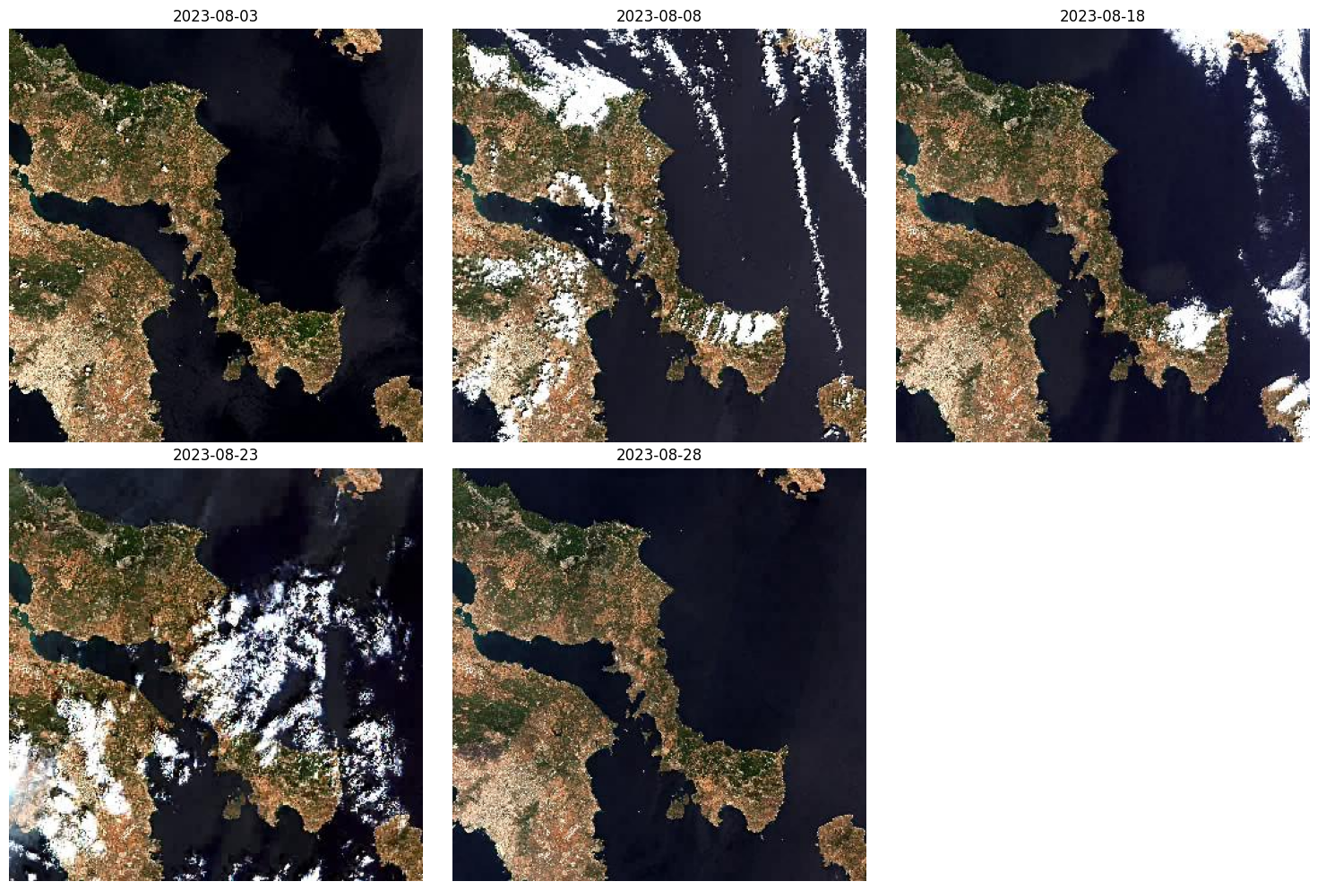
Search the sentinel-2-l2a collection and visualize the thumbnails#
search = client.search(
    collections=["sentinel-2-l2a"],
    bbox=[23.6, 37.9, 24.1, 38.1],  # Area over Athens
    datetime="2023-08-01/2023-08-30",
    query={"eo:cloud_cover": {"lt": 20}},
)

all_items = list(search.get_items())
unique_items = {}
for item in all_items:
    acq_date = item.datetime.date()
    if acq_date not in unique_items:
        unique_items[acq_date] = item

items = list(unique_items.values())
items = sorted(items, key=lambda item: item.datetime)
print(f"Reduced to {len(items)} unique acquisition dates.")
cols = 3
rows = (len(items) + cols - 1) // cols
fig, axs = plt.subplots(rows, cols, figsize=(15, 5 * rows))

for i, item in enumerate(items):
    row = i // cols
    col = i % cols
    ax = axs[row, col] if rows > 1 else axs[col]

    if 'thumbnail' in item.assets:
        thumb_url = item.assets['thumbnail'].href
        response = requests.get(thumb_url)
        img = Image.open(BytesIO(response.content))
        ax.imshow(img)
        ax.set_title(item.datetime.strftime('%Y-%m-%d'), fontsize=12)
    else:
        ax.set_title("No thumbnail available")

    ax.axis("off")

for j in range(len(items), rows * cols):
    row = j // cols
    col = j % cols
    ax = axs[row, col] if rows > 1 else axs[col]
    ax.axis("off")

plt.tight_layout()
plt.show()
/Users/syam/virtualenvs/myvenv/lib/python3.13/site-packages/pystac_client/item_search.py:881: FutureWarning: get_items() is deprecated, use items() instead
  warnings.warn(
Reduced to 5 unique acquisition dates.
items[0]
- type "Feature"
- stac_version "1.1.0"
stac_extensions[] 15 items
- 0 "https://cs-si.github.io/eopf-stac-extension/v1.2.0/schema.json"
- 1 "https://stac-extensions.github.io/alternate-assets/v1.2.0/schema.json"
- 2 "https://stac-extensions.github.io/authentication/v1.1.0/schema.json"
- 3 "https://stac-extensions.github.io/classification/v2.0.0/schema.json"
- 4 "https://stac-extensions.github.io/eo/v2.0.0/schema.json"
- 5 "https://stac-extensions.github.io/file/v2.1.0/schema.json"
- 6 "https://stac-extensions.github.io/grid/v1.1.0/schema.json"
- 7 "https://stac-extensions.github.io/processing/v1.2.0/schema.json"
- 8 "https://stac-extensions.github.io/product/v0.1.0/schema.json"
- 9 "https://stac-extensions.github.io/projection/v2.0.0/schema.json"
- 10 "https://stac-extensions.github.io/raster/v2.0.0/schema.json"
- 11 "https://stac-extensions.github.io/sat/v1.1.0/schema.json"
- 12 "https://stac-extensions.github.io/storage/v2.0.0/schema.json"
- 13 "https://stac-extensions.github.io/timestamps/v1.1.0/schema.json"
- 14 "https://stac-extensions.github.io/view/v1.0.0/schema.json"
- id "S2A_MSIL2A_20230803T090601_N0510_R050_T35SKC_20241026T141345"
geometry
- type "Polygon"
coordinates[] 1 items
0[] 5 items
0[] 2 items
- 0 23.545497035913204
- 1 38.797894647715
1[] 2 items
- 0 24.808652743577326
- 1 38.82843976082239
2[] 2 items
- 0 24.838247804919654
- 1 37.83959549435291
3[] 2 items
- 0 23.59208533856415
- 1 37.81010790673744
4[] 2 items
- 0 23.545497035913204
- 1 38.797894647715
bbox[] 4 items
- 0 23.545497035913204
- 1 37.81010790673744
- 2 24.838247804919654
- 3 38.82843976082239
properties
- gsd 10
- created "2025-02-19T16:06:51.219000Z"
- updated "2025-03-14T22:56:06.570284Z"
- datetime "2023-08-03T09:06:01.024000Z"
- platform "sentinel-2a"
- grid:code "MGRS-35SKC"
proj:bbox[] 4 items
- 0 23.545497035913204
- 1 37.81010790673744
- 2 24.838247804919654
- 3 38.82843976082239
- published "2025-03-14T22:56:06.570284Z"
statistics
- water 59.716868
- nodata 0.0
- dark_area 0.11092900000000001
- vegetation 16.675684
- thin_cirrus 0.000206
- cloud_shadow 0.148264
- unclassified 0.034555
- not_vegetated 23.095714
- high_proba_clouds 0.083643
- medium_proba_clouds 0.133948
- saturated_defective 0.0
instruments[] 1 items
- 0 "msi"
auth:schemes
s3
- type "s3"
oidc
- type "openIdConnect"
- openIdConnectUrl "https://identity.dataspace.copernicus.eu/auth/realms/CDSE/.well-known/openid-configuration"
- end_datetime "2023-08-03T09:06:01.024Z"
- product:type "S2MSI2A"
- view:azimuth 154.85886702765234
- constellation "sentinel-2"
- eo:snow_cover 0.0
- eo:cloud_cover 0.22
- start_datetime "2023-08-03T09:06:01.024Z"
- sat:orbit_state "descending"
storage:schemes
cdse-s3
- type "custom-s3"
- title "Copernicus Data Space Ecosystem S3"
- platform "https://eodata.dataspace.copernicus.eu"
- description "This endpoint provides access to EO data which is stored on the Object Storage. A Global Service Load Balancer (GSLB) directs the request to either CloudFerro Cloud or OpenTelekom Cloud (OTC) S3 endpoint based on the location of the DNS resolver."
- requester_pays False
creodias-s3
- type "custom-s3"
- title "CREODIAS S3"
- platform "https://eodata.cloudferro.com"
- description "Comprehensive Earth Observation Data (EODATA) archive offered by CREODIAS as a commercial part of CDSE, designed to provide users with access to a vast repository of satellite data without predefined quota limits"
- requester_pays True
- eopf:datatake_id "GS2A_20230803T090601_042375_N05.10"
- processing:level "L2"
- view:sun_azimuth 139.036965342159
- eopf:datastrip_id "S2A_OPER_MSI_L2A_DS_S2RP_20241026T141345_S20230803T091014_N05.10"
- processing:version "05.10"
- product:timeliness "PT24H"
- sat:absolute_orbit 42375
- sat:relative_orbit 50
- view:sun_elevation 64.24338183169431
- processing:datetime "2024-10-26T14:13:45.000000Z"
- processing:facility "ESA"
- eopf:instrument_mode "INS-NOBS"
- eopf:origin_datetime "2025-02-19T16:06:51.219000Z"
- view:incidence_angle 2.9233655979001454
- product:timeliness_category "NRT"
- sat:platform_international_designator "2015-028A"
links[] 5 items
0
- rel "collection"
- href "https://stac.dataspace.copernicus.eu/v1/collections/sentinel-2-l2a"
- type "application/json"
1
- rel "parent"
- href "https://stac.dataspace.copernicus.eu/v1/collections/sentinel-2-l2a"
- type "application/json"
2
- rel "root"
- href "https://stac.dataspace.copernicus.eu/v1/"
- type "application/json"
- title "Copernicus Data Space Ecosystem (CDSE) asset-level STAC catalogue"
3
- rel "self"
- href "https://stac.dataspace.copernicus.eu/v1/collections/sentinel-2-l2a/items/S2A_MSIL2A_20230803T090601_N0510_R050_T35SKC_20241026T141345"
- type "application/geo+json"
4
- rel "version-history"
- href "https://trace.dataspace.copernicus.eu/api/v1/traces/name/S2A_MSIL2A_20230803T090601_N0510_R050_T35SKC_20241026T141345.SAFE.zip"
- type "application/json"
- title "Product history record from the CDSE traceability service"
assets
AOT_10m
- href "s3://eodata/Sentinel-2/MSI/L2A_N0500/2023/08/03/S2A_MSIL2A_20230803T090601_N0510_R050_T35SKC_20241026T141345.SAFE/GRANULE/L2A_T35SKC_A042375_20230803T091014/IMG_DATA/R10m/T35SKC_20230803T090601_AOT_10m.jp2"
- type "image/jp2"
- title "Aerosol optical thickness (AOT) - 10m"
alternate
https
- href "https://zipper.dataspace.copernicus.eu/odata/v1/Products(73b75ce5-a1d8-4607-8555-bcb6ea6c02ee)/Nodes(S2A_MSIL2A_20230803T090601_N0510_R050_T35SKC_20241026T141345.SAFE)/Nodes(GRANULE)/Nodes(L2A_T35SKC_A042375_20230803T091014)/Nodes(IMG_DATA)/Nodes(R10m)/Nodes(T35SKC_20230803T090601_AOT_10m.jp2)/$value"
auth:refs[] 1 items
- 0 "oidc"
- alternate:name "HTTPS"
- file:size 2135196
proj:bbox[] 4 items
- 0 199980
- 1 4190220
- 2 309780
- 3 4300020
- proj:code "EPSG:32635"
- file:checksum "1620528d49c75a02e95ed3d6c0b6e594a7dd7c67c0f7c6d6f223f16b98be51c190ec"
proj:transform[] 6 items
- 0 10
- 1 0
- 2 199980
- 3 0
- 4 -10
- 5 4300020
- file:local_path "S2A_MSIL2A_20230803T090601_N0510_R050_T35SKC_20241026T141345.SAFE/GRANULE/L2A_T35SKC_A042375_20230803T091014/IMG_DATA/R10m/T35SKC_20230803T090601_AOT_10m.jp2"
- gsd 10
- nodata 0
auth:refs[] 1 items
- 0 "s3"
- data_type "uint16"
proj:shape[] 2 items
- 0 10980
- 1 10980
- raster:scale 0.0001
storage:refs[] 2 items
- 0 "cdse-s3"
- 1 "creodias-s3"
- raster:offset -0.1
- alternate:name "S3"
roles[] 2 items
- 0 "data"
- 1 "gsd:10m"
AOT_20m
- href "s3://eodata/Sentinel-2/MSI/L2A_N0500/2023/08/03/S2A_MSIL2A_20230803T090601_N0510_R050_T35SKC_20241026T141345.SAFE/GRANULE/L2A_T35SKC_A042375_20230803T091014/IMG_DATA/R20m/T35SKC_20230803T090601_AOT_20m.jp2"
- type "image/jp2"
- title "Aerosol optical thickness (AOT) - 20m"
alternate
https
- href "https://zipper.dataspace.copernicus.eu/odata/v1/Products(73b75ce5-a1d8-4607-8555-bcb6ea6c02ee)/Nodes(S2A_MSIL2A_20230803T090601_N0510_R050_T35SKC_20241026T141345.SAFE)/Nodes(GRANULE)/Nodes(L2A_T35SKC_A042375_20230803T091014)/Nodes(IMG_DATA)/Nodes(R20m)/Nodes(T35SKC_20230803T090601_AOT_20m.jp2)/$value"
auth:refs[] 1 items
- 0 "oidc"
- alternate:name "HTTPS"
- file:size 1620174
proj:bbox[] 4 items
- 0 199980
- 1 4190220
- 2 309780
- 3 4300020
- proj:code "EPSG:32635"
- file:checksum "1620929150a51f1e5624f9456b99055b277d7fa4b5f404003d9c184792414401fd5b"
proj:transform[] 6 items
- 0 20
- 1 0
- 2 199980
- 3 0
- 4 -20
- 5 4300020
- file:local_path "S2A_MSIL2A_20230803T090601_N0510_R050_T35SKC_20241026T141345.SAFE/GRANULE/L2A_T35SKC_A042375_20230803T091014/IMG_DATA/R20m/T35SKC_20230803T090601_AOT_20m.jp2"
- gsd 20
- nodata 0
auth:refs[] 1 items
- 0 "s3"
- data_type "uint16"
proj:shape[] 2 items
- 0 5490
- 1 5490
- raster:scale 0.0001
storage:refs[] 2 items
- 0 "cdse-s3"
- 1 "creodias-s3"
- raster:offset -0.1
- alternate:name "S3"
roles[] 2 items
- 0 "data"
- 1 "gsd:20m"
AOT_60m
- href "s3://eodata/Sentinel-2/MSI/L2A_N0500/2023/08/03/S2A_MSIL2A_20230803T090601_N0510_R050_T35SKC_20241026T141345.SAFE/GRANULE/L2A_T35SKC_A042375_20230803T091014/IMG_DATA/R60m/T35SKC_20230803T090601_AOT_60m.jp2"
- type "image/jp2"
- title "Aerosol optical thickness (AOT) - 60m"
alternate
https
- href "https://zipper.dataspace.copernicus.eu/odata/v1/Products(73b75ce5-a1d8-4607-8555-bcb6ea6c02ee)/Nodes(S2A_MSIL2A_20230803T090601_N0510_R050_T35SKC_20241026T141345.SAFE)/Nodes(GRANULE)/Nodes(L2A_T35SKC_A042375_20230803T091014)/Nodes(IMG_DATA)/Nodes(R60m)/Nodes(T35SKC_20230803T090601_AOT_60m.jp2)/$value"
auth:refs[] 1 items
- 0 "oidc"
- alternate:name "HTTPS"
- file:size 396419
proj:bbox[] 4 items
- 0 199980
- 1 4190220
- 2 309780
- 3 4300020
- proj:code "EPSG:32635"
- file:checksum "162040986832654d7c999d34cdbadb0e071150f41d05328f4d48978d014628e6e62a"
proj:transform[] 6 items
- 0 60
- 1 0
- 2 199980
- 3 0
- 4 -60
- 5 4300020
- file:local_path "S2A_MSIL2A_20230803T090601_N0510_R050_T35SKC_20241026T141345.SAFE/GRANULE/L2A_T35SKC_A042375_20230803T091014/IMG_DATA/R60m/T35SKC_20230803T090601_AOT_60m.jp2"
- gsd 60
- nodata 0
auth:refs[] 1 items
- 0 "s3"
- data_type "uint16"
proj:shape[] 2 items
- 0 1830
- 1 1830
- raster:scale 0.0001
storage:refs[] 2 items
- 0 "cdse-s3"
- 1 "creodias-s3"
- raster:offset -0.1
- alternate:name "S3"
roles[] 2 items
- 0 "data"
- 1 "gsd:60m"
B01_20m
- href "s3://eodata/Sentinel-2/MSI/L2A_N0500/2023/08/03/S2A_MSIL2A_20230803T090601_N0510_R050_T35SKC_20241026T141345.SAFE/GRANULE/L2A_T35SKC_A042375_20230803T091014/IMG_DATA/R20m/T35SKC_20230803T090601_B01_20m.jp2"
- type "image/jp2"
- title "Coastal aerosol (band 1) - 20m"
bands[] 1 items
0
- description "Coastal aerosol (band 1)"
- eo:center_wavelength 0.443
- eo:full_width_half_max 0.228
- name "B01"
- eo:common_name "coastal"
alternate
https
- href "https://zipper.dataspace.copernicus.eu/odata/v1/Products(73b75ce5-a1d8-4607-8555-bcb6ea6c02ee)/Nodes(S2A_MSIL2A_20230803T090601_N0510_R050_T35SKC_20241026T141345.SAFE)/Nodes(GRANULE)/Nodes(L2A_T35SKC_A042375_20230803T091014)/Nodes(IMG_DATA)/Nodes(R20m)/Nodes(T35SKC_20230803T090601_B01_20m.jp2)/$value"
auth:refs[] 1 items
- 0 "oidc"
- alternate:name "HTTPS"
- file:size 18245163
proj:bbox[] 4 items
- 0 199980
- 1 4190220
- 2 309780
- 3 4300020
- proj:code "EPSG:32635"
- view:azimuth 153.06784179706
- file:checksum "1620d0bc60f2d344c523d3637e6d927e05e83f0896bec291c00591d0a3657e01f958"
proj:transform[] 6 items
- 0 20
- 1 0
- 2 199980
- 3 0
- 4 -20
- 5 4300020
- file:local_path "S2A_MSIL2A_20230803T090601_N0510_R050_T35SKC_20241026T141345.SAFE/GRANULE/L2A_T35SKC_A042375_20230803T091014/IMG_DATA/R20m/T35SKC_20230803T090601_B01_20m.jp2"
- view:incidence_angle 3.19679899325496
- gsd 20
- nodata 0
auth:refs[] 1 items
- 0 "s3"
- data_type "uint16"
proj:shape[] 2 items
- 0 5490
- 1 5490
- raster:scale 0.0001
storage:refs[] 2 items
- 0 "cdse-s3"
- 1 "creodias-s3"
- raster:offset -0.1
- alternate:name "S3"
roles[] 4 items
- 0 "data"
- 1 "reflectance"
- 2 "sampling:upsampled"
- 3 "gsd:20m"
B01_60m
- href "s3://eodata/Sentinel-2/MSI/L2A_N0500/2023/08/03/S2A_MSIL2A_20230803T090601_N0510_R050_T35SKC_20241026T141345.SAFE/GRANULE/L2A_T35SKC_A042375_20230803T091014/IMG_DATA/R60m/T35SKC_20230803T090601_B01_60m.jp2"
- type "image/jp2"
- title "Coastal aerosol (band 1) - 60m"
bands[] 1 items
0
- description "Coastal aerosol (band 1)"
- eo:center_wavelength 0.443
- eo:full_width_half_max 0.228
- name "B01"
- eo:common_name "coastal"
alternate
https
- href "https://zipper.dataspace.copernicus.eu/odata/v1/Products(73b75ce5-a1d8-4607-8555-bcb6ea6c02ee)/Nodes(S2A_MSIL2A_20230803T090601_N0510_R050_T35SKC_20241026T141345.SAFE)/Nodes(GRANULE)/Nodes(L2A_T35SKC_A042375_20230803T091014)/Nodes(IMG_DATA)/Nodes(R60m)/Nodes(T35SKC_20230803T090601_B01_60m.jp2)/$value"
auth:refs[] 1 items
- 0 "oidc"
- alternate:name "HTTPS"
- file:size 3638347
proj:bbox[] 4 items
- 0 199980
- 1 4190220
- 2 309780
- 3 4300020
- proj:code "EPSG:32635"
- view:azimuth 153.06784179706
- file:checksum "162087e6a201e5c43093db2035a88aa05ab6b03e7834803a818d81e1bd5080846041"
proj:transform[] 6 items
- 0 60
- 1 0
- 2 199980
- 3 0
- 4 -60
- 5 4300020
- file:local_path "S2A_MSIL2A_20230803T090601_N0510_R050_T35SKC_20241026T141345.SAFE/GRANULE/L2A_T35SKC_A042375_20230803T091014/IMG_DATA/R60m/T35SKC_20230803T090601_B01_60m.jp2"
- view:incidence_angle 3.19679899325496
- gsd 60
- nodata 0
auth:refs[] 1 items
- 0 "s3"
- data_type "uint16"
proj:shape[] 2 items
- 0 1830
- 1 1830
- raster:scale 0.0001
storage:refs[] 2 items
- 0 "cdse-s3"
- 1 "creodias-s3"
- raster:offset -0.1
- alternate:name "S3"
roles[] 4 items
- 0 "data"
- 1 "reflectance"
- 2 "sampling:original"
- 3 "gsd:60m"
B02_10m
- href "s3://eodata/Sentinel-2/MSI/L2A_N0500/2023/08/03/S2A_MSIL2A_20230803T090601_N0510_R050_T35SKC_20241026T141345.SAFE/GRANULE/L2A_T35SKC_A042375_20230803T091014/IMG_DATA/R10m/T35SKC_20230803T090601_B02_10m.jp2"
- type "image/jp2"
- title "Blue (band 2) - 10m"
bands[] 1 items
0
- description "Blue (band 2)"
- eo:center_wavelength 0.493
- eo:full_width_half_max 0.267
- name "B02"
- eo:common_name "blue"
alternate
https
- href "https://zipper.dataspace.copernicus.eu/odata/v1/Products(73b75ce5-a1d8-4607-8555-bcb6ea6c02ee)/Nodes(S2A_MSIL2A_20230803T090601_N0510_R050_T35SKC_20241026T141345.SAFE)/Nodes(GRANULE)/Nodes(L2A_T35SKC_A042375_20230803T091014)/Nodes(IMG_DATA)/Nodes(R10m)/Nodes(T35SKC_20230803T090601_B02_10m.jp2)/$value"
auth:refs[] 1 items
- 0 "oidc"
- alternate:name "HTTPS"
- file:size 116784015
proj:bbox[] 4 items
- 0 199980
- 1 4190220
- 2 309780
- 3 4300020
- proj:code "EPSG:32635"
- view:azimuth 159.148766576456
- file:checksum "16201c55b36b974b589bdadeed5ca8ea6e20510bffbd77d536e82f1f3c5b965a0dba"
proj:transform[] 6 items
- 0 10
- 1 0
- 2 199980
- 3 0
- 4 -10
- 5 4300020
- file:local_path "S2A_MSIL2A_20230803T090601_N0510_R050_T35SKC_20241026T141345.SAFE/GRANULE/L2A_T35SKC_A042375_20230803T091014/IMG_DATA/R10m/T35SKC_20230803T090601_B02_10m.jp2"
- view:incidence_angle 2.55514045690931
- gsd 10
- nodata 0
auth:refs[] 1 items
- 0 "s3"
- data_type "uint16"
proj:shape[] 2 items
- 0 10980
- 1 10980
- raster:scale 0.0001
storage:refs[] 2 items
- 0 "cdse-s3"
- 1 "creodias-s3"
- raster:offset -0.1
- alternate:name "S3"
roles[] 4 items
- 0 "data"
- 1 "reflectance"
- 2 "sampling:original"
- 3 "gsd:10m"
B02_20m
- href "s3://eodata/Sentinel-2/MSI/L2A_N0500/2023/08/03/S2A_MSIL2A_20230803T090601_N0510_R050_T35SKC_20241026T141345.SAFE/GRANULE/L2A_T35SKC_A042375_20230803T091014/IMG_DATA/R20m/T35SKC_20230803T090601_B02_20m.jp2"
- type "image/jp2"
- title "Blue (band 2) - 20m"
bands[] 1 items
0
- description "Blue (band 2)"
- eo:center_wavelength 0.493
- eo:full_width_half_max 0.267
- name "B02"
- eo:common_name "blue"
alternate
https
- href "https://zipper.dataspace.copernicus.eu/odata/v1/Products(73b75ce5-a1d8-4607-8555-bcb6ea6c02ee)/Nodes(S2A_MSIL2A_20230803T090601_N0510_R050_T35SKC_20241026T141345.SAFE)/Nodes(GRANULE)/Nodes(L2A_T35SKC_A042375_20230803T091014)/Nodes(IMG_DATA)/Nodes(R20m)/Nodes(T35SKC_20230803T090601_B02_20m.jp2)/$value"
auth:refs[] 1 items
- 0 "oidc"
- alternate:name "HTTPS"
- file:size 31617926
proj:bbox[] 4 items
- 0 199980
- 1 4190220
- 2 309780
- 3 4300020
- proj:code "EPSG:32635"
- view:azimuth 159.148766576456
- file:checksum "1620440e52fb29a7137be4059398c63f6f77c04e4977fc39081c2b093fe59ad6bc3f"
proj:transform[] 6 items
- 0 20
- 1 0
- 2 199980
- 3 0
- 4 -20
- 5 4300020
- file:local_path "S2A_MSIL2A_20230803T090601_N0510_R050_T35SKC_20241026T141345.SAFE/GRANULE/L2A_T35SKC_A042375_20230803T091014/IMG_DATA/R20m/T35SKC_20230803T090601_B02_20m.jp2"
- view:incidence_angle 2.55514045690931
- gsd 20
- nodata 0
auth:refs[] 1 items
- 0 "s3"
- data_type "uint16"
proj:shape[] 2 items
- 0 5490
- 1 5490
- raster:scale 0.0001
storage:refs[] 2 items
- 0 "cdse-s3"
- 1 "creodias-s3"
- raster:offset -0.1
- alternate:name "S3"
roles[] 4 items
- 0 "data"
- 1 "reflectance"
- 2 "sampling:downsampled"
- 3 "gsd:20m"
B02_60m
- href "s3://eodata/Sentinel-2/MSI/L2A_N0500/2023/08/03/S2A_MSIL2A_20230803T090601_N0510_R050_T35SKC_20241026T141345.SAFE/GRANULE/L2A_T35SKC_A042375_20230803T091014/IMG_DATA/R60m/T35SKC_20230803T090601_B02_60m.jp2"
- type "image/jp2"
- title "Blue (band 2) - 60m"
bands[] 1 items
0
- description "Blue (band 2)"
- eo:center_wavelength 0.493
- eo:full_width_half_max 0.267
- name "B02"
- eo:common_name "blue"
alternate
https
- href "https://zipper.dataspace.copernicus.eu/odata/v1/Products(73b75ce5-a1d8-4607-8555-bcb6ea6c02ee)/Nodes(S2A_MSIL2A_20230803T090601_N0510_R050_T35SKC_20241026T141345.SAFE)/Nodes(GRANULE)/Nodes(L2A_T35SKC_A042375_20230803T091014)/Nodes(IMG_DATA)/Nodes(R60m)/Nodes(T35SKC_20230803T090601_B02_60m.jp2)/$value"
auth:refs[] 1 items
- 0 "oidc"
- alternate:name "HTTPS"
- file:size 3764827
proj:bbox[] 4 items
- 0 199980
- 1 4190220
- 2 309780
- 3 4300020
- proj:code "EPSG:32635"
- view:azimuth 159.148766576456
- file:checksum "162034971650006e7bf29f104849250dfa785d5e82fc9b03dda7dd222092a4f0ce76"
proj:transform[] 6 items
- 0 60
- 1 0
- 2 199980
- 3 0
- 4 -60
- 5 4300020
- file:local_path "S2A_MSIL2A_20230803T090601_N0510_R050_T35SKC_20241026T141345.SAFE/GRANULE/L2A_T35SKC_A042375_20230803T091014/IMG_DATA/R60m/T35SKC_20230803T090601_B02_60m.jp2"
- view:incidence_angle 2.55514045690931
- gsd 60
- nodata 0
auth:refs[] 1 items
- 0 "s3"
- data_type "uint16"
proj:shape[] 2 items
- 0 1830
- 1 1830
- raster:scale 0.0001
storage:refs[] 2 items
- 0 "cdse-s3"
- 1 "creodias-s3"
- raster:offset -0.1
- alternate:name "S3"
roles[] 4 items
- 0 "data"
- 1 "reflectance"
- 2 "sampling:downsampled"
- 3 "gsd:60m"
B03_10m
- href "s3://eodata/Sentinel-2/MSI/L2A_N0500/2023/08/03/S2A_MSIL2A_20230803T090601_N0510_R050_T35SKC_20241026T141345.SAFE/GRANULE/L2A_T35SKC_A042375_20230803T091014/IMG_DATA/R10m/T35SKC_20230803T090601_B03_10m.jp2"
- type "image/jp2"
- title "Green (band 3) - 10m"
bands[] 1 items
0
- description "Green (band 3)"
- eo:center_wavelength 0.56
- eo:full_width_half_max 0.291
- name "B03"
- eo:common_name "green"
alternate
https
- href "https://zipper.dataspace.copernicus.eu/odata/v1/Products(73b75ce5-a1d8-4607-8555-bcb6ea6c02ee)/Nodes(S2A_MSIL2A_20230803T090601_N0510_R050_T35SKC_20241026T141345.SAFE)/Nodes(GRANULE)/Nodes(L2A_T35SKC_A042375_20230803T091014)/Nodes(IMG_DATA)/Nodes(R10m)/Nodes(T35SKC_20230803T090601_B03_10m.jp2)/$value"
auth:refs[] 1 items
- 0 "oidc"
- alternate:name "HTTPS"
- file:size 113713966
proj:bbox[] 4 items
- 0 199980
- 1 4190220
- 2 309780
- 3 4300020
- proj:code "EPSG:32635"
- view:azimuth 156.748839949368
- file:checksum "16202dd210243ea6c2d6f068e517d131c692b7d0328469ad96dc7378485cefda6b8a"
proj:transform[] 6 items
- 0 10
- 1 0
- 2 199980
- 3 0
- 4 -10
- 5 4300020
- file:local_path "S2A_MSIL2A_20230803T090601_N0510_R050_T35SKC_20241026T141345.SAFE/GRANULE/L2A_T35SKC_A042375_20230803T091014/IMG_DATA/R10m/T35SKC_20230803T090601_B03_10m.jp2"
- view:incidence_angle 2.66333167529336
- gsd 10
- nodata 0
auth:refs[] 1 items
- 0 "s3"
- data_type "uint16"
proj:shape[] 2 items
- 0 10980
- 1 10980
- raster:scale 0.0001
storage:refs[] 2 items
- 0 "cdse-s3"
- 1 "creodias-s3"
- raster:offset -0.1
- alternate:name "S3"
roles[] 4 items
- 0 "data"
- 1 "reflectance"
- 2 "sampling:original"
- 3 "gsd:10m"
B03_20m
- href "s3://eodata/Sentinel-2/MSI/L2A_N0500/2023/08/03/S2A_MSIL2A_20230803T090601_N0510_R050_T35SKC_20241026T141345.SAFE/GRANULE/L2A_T35SKC_A042375_20230803T091014/IMG_DATA/R20m/T35SKC_20230803T090601_B03_20m.jp2"
- type "image/jp2"
- title "Green (band 3) - 20m"
bands[] 1 items
0
- description "Green (band 3)"
- eo:center_wavelength 0.56
- eo:full_width_half_max 0.291
- name "B03"
- eo:common_name "green"
alternate
https
- href "https://zipper.dataspace.copernicus.eu/odata/v1/Products(73b75ce5-a1d8-4607-8555-bcb6ea6c02ee)/Nodes(S2A_MSIL2A_20230803T090601_N0510_R050_T35SKC_20241026T141345.SAFE)/Nodes(GRANULE)/Nodes(L2A_T35SKC_A042375_20230803T091014)/Nodes(IMG_DATA)/Nodes(R20m)/Nodes(T35SKC_20230803T090601_B03_20m.jp2)/$value"
auth:refs[] 1 items
- 0 "oidc"
- alternate:name "HTTPS"
- file:size 31104401
proj:bbox[] 4 items
- 0 199980
- 1 4190220
- 2 309780
- 3 4300020
- proj:code "EPSG:32635"
- view:azimuth 156.748839949368
- file:checksum "162051adef840bc3e7330b39feddc3ffe2f020070a575601f8c63c4a3104306b5730"
proj:transform[] 6 items
- 0 20
- 1 0
- 2 199980
- 3 0
- 4 -20
- 5 4300020
- file:local_path "S2A_MSIL2A_20230803T090601_N0510_R050_T35SKC_20241026T141345.SAFE/GRANULE/L2A_T35SKC_A042375_20230803T091014/IMG_DATA/R20m/T35SKC_20230803T090601_B03_20m.jp2"
- view:incidence_angle 2.66333167529336
- gsd 20
- nodata 0
auth:refs[] 1 items
- 0 "s3"
- data_type "uint16"
proj:shape[] 2 items
- 0 5490
- 1 5490
- raster:scale 0.0001
storage:refs[] 2 items
- 0 "cdse-s3"
- 1 "creodias-s3"
- raster:offset -0.1
- alternate:name "S3"
roles[] 4 items
- 0 "data"
- 1 "reflectance"
- 2 "sampling:downsampled"
- 3 "gsd:20m"
B03_60m
- href "s3://eodata/Sentinel-2/MSI/L2A_N0500/2023/08/03/S2A_MSIL2A_20230803T090601_N0510_R050_T35SKC_20241026T141345.SAFE/GRANULE/L2A_T35SKC_A042375_20230803T091014/IMG_DATA/R60m/T35SKC_20230803T090601_B03_60m.jp2"
- type "image/jp2"
- title "Green (band 3) - 60m"
bands[] 1 items
0
- description "Green (band 3)"
- eo:center_wavelength 0.56
- eo:full_width_half_max 0.291
- name "B03"
- eo:common_name "green"
alternate
https
- href "https://zipper.dataspace.copernicus.eu/odata/v1/Products(73b75ce5-a1d8-4607-8555-bcb6ea6c02ee)/Nodes(S2A_MSIL2A_20230803T090601_N0510_R050_T35SKC_20241026T141345.SAFE)/Nodes(GRANULE)/Nodes(L2A_T35SKC_A042375_20230803T091014)/Nodes(IMG_DATA)/Nodes(R60m)/Nodes(T35SKC_20230803T090601_B03_60m.jp2)/$value"
auth:refs[] 1 items
- 0 "oidc"
- alternate:name "HTTPS"
- file:size 3769546
proj:bbox[] 4 items
- 0 199980
- 1 4190220
- 2 309780
- 3 4300020
- proj:code "EPSG:32635"
- view:azimuth 156.748839949368
- file:checksum "1620e2262bb125da7df0595ef56cdbab16c44bb3810d55c159496b03b36ffadaaa86"
proj:transform[] 6 items
- 0 60
- 1 0
- 2 199980
- 3 0
- 4 -60
- 5 4300020
- file:local_path "S2A_MSIL2A_20230803T090601_N0510_R050_T35SKC_20241026T141345.SAFE/GRANULE/L2A_T35SKC_A042375_20230803T091014/IMG_DATA/R60m/T35SKC_20230803T090601_B03_60m.jp2"
- view:incidence_angle 2.66333167529336
- gsd 60
- nodata 0
auth:refs[] 1 items
- 0 "s3"
- data_type "uint16"
proj:shape[] 2 items
- 0 1830
- 1 1830
- raster:scale 0.0001
storage:refs[] 2 items
- 0 "cdse-s3"
- 1 "creodias-s3"
- raster:offset -0.1
- alternate:name "S3"
roles[] 4 items
- 0 "data"
- 1 "reflectance"
- 2 "sampling:downsampled"
- 3 "gsd:60m"
B04_10m
- href "s3://eodata/Sentinel-2/MSI/L2A_N0500/2023/08/03/S2A_MSIL2A_20230803T090601_N0510_R050_T35SKC_20241026T141345.SAFE/GRANULE/L2A_T35SKC_A042375_20230803T091014/IMG_DATA/R10m/T35SKC_20230803T090601_B04_10m.jp2"
- type "image/jp2"
- title "Red (band 4) - 10m"
bands[] 1 items
0
- description "Red (band 4)"
- eo:center_wavelength 0.665
- eo:full_width_half_max 0.342
- name "B04"
- eo:common_name "red"
alternate
https
- href "https://zipper.dataspace.copernicus.eu/odata/v1/Products(73b75ce5-a1d8-4607-8555-bcb6ea6c02ee)/Nodes(S2A_MSIL2A_20230803T090601_N0510_R050_T35SKC_20241026T141345.SAFE)/Nodes(GRANULE)/Nodes(L2A_T35SKC_A042375_20230803T091014)/Nodes(IMG_DATA)/Nodes(R10m)/Nodes(T35SKC_20230803T090601_B04_10m.jp2)/$value"
auth:refs[] 1 items
- 0 "oidc"
- alternate:name "HTTPS"
- file:size 113029535
proj:bbox[] 4 items
- 0 199980
- 1 4190220
- 2 309780
- 3 4300020
- proj:code "EPSG:32635"
- view:azimuth 155.347511247118
- file:checksum "16209f5b7d28e0d2a416ef339b61f93781c726fb7ecefe7fbd67e12063d2c077da4e"
proj:transform[] 6 items
- 0 10
- 1 0
- 2 199980
- 3 0
- 4 -10
- 5 4300020
- file:local_path "S2A_MSIL2A_20230803T090601_N0510_R050_T35SKC_20241026T141345.SAFE/GRANULE/L2A_T35SKC_A042375_20230803T091014/IMG_DATA/R10m/T35SKC_20230803T090601_B04_10m.jp2"
- view:incidence_angle 2.78485356151954
- gsd 10
- nodata 0
auth:refs[] 1 items
- 0 "s3"
- data_type "uint16"
proj:shape[] 2 items
- 0 10980
- 1 10980
- raster:scale 0.0001
storage:refs[] 2 items
- 0 "cdse-s3"
- 1 "creodias-s3"
- raster:offset -0.1
- alternate:name "S3"
roles[] 4 items
- 0 "data"
- 1 "reflectance"
- 2 "sampling:original"
- 3 "gsd:10m"
B04_20m
- href "s3://eodata/Sentinel-2/MSI/L2A_N0500/2023/08/03/S2A_MSIL2A_20230803T090601_N0510_R050_T35SKC_20241026T141345.SAFE/GRANULE/L2A_T35SKC_A042375_20230803T091014/IMG_DATA/R20m/T35SKC_20230803T090601_B04_20m.jp2"
- type "image/jp2"
- title "Red (band 4) - 20m"
bands[] 1 items
0
- description "Red (band 4)"
- eo:center_wavelength 0.665
- eo:full_width_half_max 0.342
- name "B04"
- eo:common_name "red"
alternate
https
- href "https://zipper.dataspace.copernicus.eu/odata/v1/Products(73b75ce5-a1d8-4607-8555-bcb6ea6c02ee)/Nodes(S2A_MSIL2A_20230803T090601_N0510_R050_T35SKC_20241026T141345.SAFE)/Nodes(GRANULE)/Nodes(L2A_T35SKC_A042375_20230803T091014)/Nodes(IMG_DATA)/Nodes(R20m)/Nodes(T35SKC_20230803T090601_B04_20m.jp2)/$value"
auth:refs[] 1 items
- 0 "oidc"
- alternate:name "HTTPS"
- file:size 31296309
proj:bbox[] 4 items
- 0 199980
- 1 4190220
- 2 309780
- 3 4300020
- proj:code "EPSG:32635"
- view:azimuth 155.347511247118
- file:checksum "1620fb4e2ee248d219eb85d3e7067fc420eea13bff263d63abc9efcd98fe6fe224e8"
proj:transform[] 6 items
- 0 20
- 1 0
- 2 199980
- 3 0
- 4 -20
- 5 4300020
- file:local_path "S2A_MSIL2A_20230803T090601_N0510_R050_T35SKC_20241026T141345.SAFE/GRANULE/L2A_T35SKC_A042375_20230803T091014/IMG_DATA/R20m/T35SKC_20230803T090601_B04_20m.jp2"
- view:incidence_angle 2.78485356151954
- gsd 20
- nodata 0
auth:refs[] 1 items
- 0 "s3"
- data_type "uint16"
proj:shape[] 2 items
- 0 5490
- 1 5490
- raster:scale 0.0001
storage:refs[] 2 items
- 0 "cdse-s3"
- 1 "creodias-s3"
- raster:offset -0.1
- alternate:name "S3"
roles[] 4 items
- 0 "data"
- 1 "reflectance"
- 2 "sampling:downsampled"
- 3 "gsd:20m"
B04_60m
- href "s3://eodata/Sentinel-2/MSI/L2A_N0500/2023/08/03/S2A_MSIL2A_20230803T090601_N0510_R050_T35SKC_20241026T141345.SAFE/GRANULE/L2A_T35SKC_A042375_20230803T091014/IMG_DATA/R60m/T35SKC_20230803T090601_B04_60m.jp2"
- type "image/jp2"
- title "Red (band 4) - 60m"
bands[] 1 items
0
- description "Red (band 4)"
- eo:center_wavelength 0.665
- eo:full_width_half_max 0.342
- name "B04"
- eo:common_name "red"
alternate
https
- href "https://zipper.dataspace.copernicus.eu/odata/v1/Products(73b75ce5-a1d8-4607-8555-bcb6ea6c02ee)/Nodes(S2A_MSIL2A_20230803T090601_N0510_R050_T35SKC_20241026T141345.SAFE)/Nodes(GRANULE)/Nodes(L2A_T35SKC_A042375_20230803T091014)/Nodes(IMG_DATA)/Nodes(R60m)/Nodes(T35SKC_20230803T090601_B04_60m.jp2)/$value"
auth:refs[] 1 items
- 0 "oidc"
- alternate:name "HTTPS"
- file:size 3763747
proj:bbox[] 4 items
- 0 199980
- 1 4190220
- 2 309780
- 3 4300020
- proj:code "EPSG:32635"
- view:azimuth 155.347511247118
- file:checksum "16200d6168cf073a50000f21ff344ee21176000ea51c430e1f03ed87e3de51963beb"
proj:transform[] 6 items
- 0 60
- 1 0
- 2 199980
- 3 0
- 4 -60
- 5 4300020
- file:local_path "S2A_MSIL2A_20230803T090601_N0510_R050_T35SKC_20241026T141345.SAFE/GRANULE/L2A_T35SKC_A042375_20230803T091014/IMG_DATA/R60m/T35SKC_20230803T090601_B04_60m.jp2"
- view:incidence_angle 2.78485356151954
- gsd 60
- nodata 0
auth:refs[] 1 items
- 0 "s3"
- data_type "uint16"
proj:shape[] 2 items
- 0 1830
- 1 1830
- raster:scale 0.0001
storage:refs[] 2 items
- 0 "cdse-s3"
- 1 "creodias-s3"
- raster:offset -0.1
- alternate:name "S3"
roles[] 4 items
- 0 "data"
- 1 "reflectance"
- 2 "sampling:downsampled"
- 3 "gsd:60m"
B05_20m
- href "s3://eodata/Sentinel-2/MSI/L2A_N0500/2023/08/03/S2A_MSIL2A_20230803T090601_N0510_R050_T35SKC_20241026T141345.SAFE/GRANULE/L2A_T35SKC_A042375_20230803T091014/IMG_DATA/R20m/T35SKC_20230803T090601_B05_20m.jp2"
- type "image/jp2"
- title "Red edge 1 (band 5) - 20m"
bands[] 1 items
0
- description "Red edge 1 (band 5)"
- eo:center_wavelength 0.704
- eo:full_width_half_max 0.357
- name "B05"
- eo:common_name "rededge071"
alternate
https
- href "https://zipper.dataspace.copernicus.eu/odata/v1/Products(73b75ce5-a1d8-4607-8555-bcb6ea6c02ee)/Nodes(S2A_MSIL2A_20230803T090601_N0510_R050_T35SKC_20241026T141345.SAFE)/Nodes(GRANULE)/Nodes(L2A_T35SKC_A042375_20230803T091014)/Nodes(IMG_DATA)/Nodes(R20m)/Nodes(T35SKC_20230803T090601_B05_20m.jp2)/$value"
auth:refs[] 1 items
- 0 "oidc"
- alternate:name "HTTPS"
- file:size 30509746
proj:bbox[] 4 items
- 0 199980
- 1 4190220
- 2 309780
- 3 4300020
- proj:code "EPSG:32635"
- view:azimuth 154.804520320426
- file:checksum "162028f7d1e3b08f7a069f202ad4eace0d007a67ab738aaf24ee72806dc2e371704a"
proj:transform[] 6 items
- 0 20
- 1 0
- 2 199980
- 3 0
- 4 -20
- 5 4300020
- file:local_path "S2A_MSIL2A_20230803T090601_N0510_R050_T35SKC_20241026T141345.SAFE/GRANULE/L2A_T35SKC_A042375_20230803T091014/IMG_DATA/R20m/T35SKC_20230803T090601_B05_20m.jp2"
- view:incidence_angle 2.858380587873
- gsd 20
- nodata 0
auth:refs[] 1 items
- 0 "s3"
- data_type "uint16"
proj:shape[] 2 items
- 0 5490
- 1 5490
- raster:scale 0.0001
storage:refs[] 2 items
- 0 "cdse-s3"
- 1 "creodias-s3"
- raster:offset -0.1
- alternate:name "S3"
roles[] 4 items
- 0 "data"
- 1 "reflectance"
- 2 "sampling:original"
- 3 "gsd:20m"
B05_60m
- href "s3://eodata/Sentinel-2/MSI/L2A_N0500/2023/08/03/S2A_MSIL2A_20230803T090601_N0510_R050_T35SKC_20241026T141345.SAFE/GRANULE/L2A_T35SKC_A042375_20230803T091014/IMG_DATA/R60m/T35SKC_20230803T090601_B05_60m.jp2"
- type "image/jp2"
- title "Red edge 1 (band 5) - 60m"
bands[] 1 items
0
- description "Red edge 1 (band 5)"
- eo:center_wavelength 0.704
- eo:full_width_half_max 0.357
- name "B05"
- eo:common_name "rededge071"
alternate
https
- href "https://zipper.dataspace.copernicus.eu/odata/v1/Products(73b75ce5-a1d8-4607-8555-bcb6ea6c02ee)/Nodes(S2A_MSIL2A_20230803T090601_N0510_R050_T35SKC_20241026T141345.SAFE)/Nodes(GRANULE)/Nodes(L2A_T35SKC_A042375_20230803T091014)/Nodes(IMG_DATA)/Nodes(R60m)/Nodes(T35SKC_20230803T090601_B05_60m.jp2)/$value"
auth:refs[] 1 items
- 0 "oidc"
- alternate:name "HTTPS"
- file:size 3755600
proj:bbox[] 4 items
- 0 199980
- 1 4190220
- 2 309780
- 3 4300020
- proj:code "EPSG:32635"
- view:azimuth 154.804520320426
- file:checksum "1620470645cc1c6ae4d15446d1d7aa168ffc8b076772a2f03d7e1134e370040c380a"
proj:transform[] 6 items
- 0 60
- 1 0
- 2 199980
- 3 0
- 4 -60
- 5 4300020
- file:local_path "S2A_MSIL2A_20230803T090601_N0510_R050_T35SKC_20241026T141345.SAFE/GRANULE/L2A_T35SKC_A042375_20230803T091014/IMG_DATA/R60m/T35SKC_20230803T090601_B05_60m.jp2"
- view:incidence_angle 2.858380587873
- gsd 60
- nodata 0
auth:refs[] 1 items
- 0 "s3"
- data_type "uint16"
proj:shape[] 2 items
- 0 1830
- 1 1830
- raster:scale 0.0001
storage:refs[] 2 items
- 0 "cdse-s3"
- 1 "creodias-s3"
- raster:offset -0.1
- alternate:name "S3"
roles[] 4 items
- 0 "data"
- 1 "reflectance"
- 2 "sampling:downsampled"
- 3 "gsd:60m"
B06_20m
- href "s3://eodata/Sentinel-2/MSI/L2A_N0500/2023/08/03/S2A_MSIL2A_20230803T090601_N0510_R050_T35SKC_20241026T141345.SAFE/GRANULE/L2A_T35SKC_A042375_20230803T091014/IMG_DATA/R20m/T35SKC_20230803T090601_B06_20m.jp2"
- type "image/jp2"
- title "Red edge 2 (band 6) - 20m"
bands[] 1 items
0
- description "Red edge 2 (band 6)"
- eo:center_wavelength 0.741
- eo:full_width_half_max 0.374
- name "B06"
- eo:common_name "rededge075"
alternate
https
- href "https://zipper.dataspace.copernicus.eu/odata/v1/Products(73b75ce5-a1d8-4607-8555-bcb6ea6c02ee)/Nodes(S2A_MSIL2A_20230803T090601_N0510_R050_T35SKC_20241026T141345.SAFE)/Nodes(GRANULE)/Nodes(L2A_T35SKC_A042375_20230803T091014)/Nodes(IMG_DATA)/Nodes(R20m)/Nodes(T35SKC_20230803T090601_B06_20m.jp2)/$value"
auth:refs[] 1 items
- 0 "oidc"
- alternate:name "HTTPS"
- file:size 30445499
proj:bbox[] 4 items
- 0 199980
- 1 4190220
- 2 309780
- 3 4300020
- proj:code "EPSG:32635"
- view:azimuth 154.36733113758
- file:checksum "16203a45ed29fb20b77acfbe5e5434c4848ddc14feacf24744c1d02f17c73aae4e66"
proj:transform[] 6 items
- 0 20
- 1 0
- 2 199980
- 3 0
- 4 -20
- 5 4300020
- file:local_path "S2A_MSIL2A_20230803T090601_N0510_R050_T35SKC_20241026T141345.SAFE/GRANULE/L2A_T35SKC_A042375_20230803T091014/IMG_DATA/R20m/T35SKC_20230803T090601_B06_20m.jp2"
- view:incidence_angle 2.9362765383263
- gsd 20
- nodata 0
auth:refs[] 1 items
- 0 "s3"
- data_type "uint16"
proj:shape[] 2 items
- 0 5490
- 1 5490
- raster:scale 0.0001
storage:refs[] 2 items
- 0 "cdse-s3"
- 1 "creodias-s3"
- raster:offset -0.1
- alternate:name "S3"
roles[] 4 items
- 0 "data"
- 1 "reflectance"
- 2 "sampling:original"
- 3 "gsd:20m"
B06_60m
- href "s3://eodata/Sentinel-2/MSI/L2A_N0500/2023/08/03/S2A_MSIL2A_20230803T090601_N0510_R050_T35SKC_20241026T141345.SAFE/GRANULE/L2A_T35SKC_A042375_20230803T091014/IMG_DATA/R60m/T35SKC_20230803T090601_B06_60m.jp2"
- type "image/jp2"
- title "Red edge 2 (band 6) - 60m"
bands[] 1 items
0
- description "Red edge 2 (band 6)"
- eo:center_wavelength 0.741
- eo:full_width_half_max 0.374
- name "B06"
- eo:common_name "rededge075"
alternate
https
- href "https://zipper.dataspace.copernicus.eu/odata/v1/Products(73b75ce5-a1d8-4607-8555-bcb6ea6c02ee)/Nodes(S2A_MSIL2A_20230803T090601_N0510_R050_T35SKC_20241026T141345.SAFE)/Nodes(GRANULE)/Nodes(L2A_T35SKC_A042375_20230803T091014)/Nodes(IMG_DATA)/Nodes(R60m)/Nodes(T35SKC_20230803T090601_B06_60m.jp2)/$value"
auth:refs[] 1 items
- 0 "oidc"
- alternate:name "HTTPS"
- file:size 3753001
proj:bbox[] 4 items
- 0 199980
- 1 4190220
- 2 309780
- 3 4300020
- proj:code "EPSG:32635"
- view:azimuth 154.36733113758
- file:checksum "1620ee61aeead6ec30872822e53a36dcd8f9fa731b9e28af136863d2b9d768834e14"
proj:transform[] 6 items
- 0 60
- 1 0
- 2 199980
- 3 0
- 4 -60
- 5 4300020
- file:local_path "S2A_MSIL2A_20230803T090601_N0510_R050_T35SKC_20241026T141345.SAFE/GRANULE/L2A_T35SKC_A042375_20230803T091014/IMG_DATA/R60m/T35SKC_20230803T090601_B06_60m.jp2"
- view:incidence_angle 2.9362765383263
- gsd 60
- nodata 0
auth:refs[] 1 items
- 0 "s3"
- data_type "uint16"
proj:shape[] 2 items
- 0 1830
- 1 1830
- raster:scale 0.0001
storage:refs[] 2 items
- 0 "cdse-s3"
- 1 "creodias-s3"
- raster:offset -0.1
- alternate:name "S3"
roles[] 4 items
- 0 "data"
- 1 "reflectance"
- 2 "sampling:downsampled"
- 3 "gsd:60m"
B07_20m
- href "s3://eodata/Sentinel-2/MSI/L2A_N0500/2023/08/03/S2A_MSIL2A_20230803T090601_N0510_R050_T35SKC_20241026T141345.SAFE/GRANULE/L2A_T35SKC_A042375_20230803T091014/IMG_DATA/R20m/T35SKC_20230803T090601_B07_20m.jp2"
- type "image/jp2"
- title "Red edge 3 (band 7) - 20m"
bands[] 1 items
0
- description "Red edge 3 (band 7)"
- eo:center_wavelength 0.783
- eo:full_width_half_max 0.399
- name "B07"
- eo:common_name "rededge078"
alternate
https
- href "https://zipper.dataspace.copernicus.eu/odata/v1/Products(73b75ce5-a1d8-4607-8555-bcb6ea6c02ee)/Nodes(S2A_MSIL2A_20230803T090601_N0510_R050_T35SKC_20241026T141345.SAFE)/Nodes(GRANULE)/Nodes(L2A_T35SKC_A042375_20230803T091014)/Nodes(IMG_DATA)/Nodes(R20m)/Nodes(T35SKC_20230803T090601_B07_20m.jp2)/$value"
auth:refs[] 1 items
- 0 "oidc"
- alternate:name "HTTPS"
- file:size 30508948
proj:bbox[] 4 items
- 0 199980
- 1 4190220
- 2 309780
- 3 4300020
- proj:code "EPSG:32635"
- view:azimuth 153.719512310983
- file:checksum "1620a7d07f673c90e745726181aa9d2e5877fc0379d76a0bfcb76a64ec08a7f6b25e"
proj:transform[] 6 items
- 0 20
- 1 0
- 2 199980
- 3 0
- 4 -20
- 5 4300020
- file:local_path "S2A_MSIL2A_20230803T090601_N0510_R050_T35SKC_20241026T141345.SAFE/GRANULE/L2A_T35SKC_A042375_20230803T091014/IMG_DATA/R20m/T35SKC_20230803T090601_B07_20m.jp2"
- view:incidence_angle 3.01986190909965
- gsd 20
- nodata 0
auth:refs[] 1 items
- 0 "s3"
- data_type "uint16"
proj:shape[] 2 items
- 0 5490
- 1 5490
- raster:scale 0.0001
storage:refs[] 2 items
- 0 "cdse-s3"
- 1 "creodias-s3"
- raster:offset -0.1
- alternate:name "S3"
roles[] 4 items
- 0 "data"
- 1 "reflectance"
- 2 "sampling:original"
- 3 "gsd:20m"
B07_60m
- href "s3://eodata/Sentinel-2/MSI/L2A_N0500/2023/08/03/S2A_MSIL2A_20230803T090601_N0510_R050_T35SKC_20241026T141345.SAFE/GRANULE/L2A_T35SKC_A042375_20230803T091014/IMG_DATA/R60m/T35SKC_20230803T090601_B07_60m.jp2"
- type "image/jp2"
- title "Red edge 3 (band 7) - 60m"
- gsd 60
bands[] 1 items
0
- description "Red edge 3 (band 7)"
- eo:center_wavelength 0.783
- eo:full_width_half_max 0.399
- name "B07"
- eo:common_name "rededge078"
alternate
https
- href "https://zipper.dataspace.copernicus.eu/odata/v1/Products(73b75ce5-a1d8-4607-8555-bcb6ea6c02ee)/Nodes(S2A_MSIL2A_20230803T090601_N0510_R050_T35SKC_20241026T141345.SAFE)/Nodes(GRANULE)/Nodes(L2A_T35SKC_A042375_20230803T091014)/Nodes(IMG_DATA)/Nodes(R60m)/Nodes(T35SKC_20230803T090601_B07_60m.jp2)/$value"
auth:refs[] 1 items
- 0 "oidc"
- alternate:name "HTTPS"
- file:size 3729245
proj:bbox[] 4 items
- 0 199980
- 1 4190220
- 2 309780
- 3 4300020
- proj:code "EPSG:32635"
- view:azimuth 153.719512310983
- file:checksum "16205debcbdab04c3be78d8e42af86144cd22ac3fe93f68f4282212bb006d460b3f8"
proj:transform[] 6 items
- 0 60
- 1 0
- 2 199980
- 3 0
- 4 -60
- 5 4300020
- file:local_path "S2A_MSIL2A_20230803T090601_N0510_R050_T35SKC_20241026T141345.SAFE/GRANULE/L2A_T35SKC_A042375_20230803T091014/IMG_DATA/R60m/T35SKC_20230803T090601_B07_60m.jp2"
- view:incidence_angle 3.01986190909965
- nodata 0
auth:refs[] 1 items
- 0 "s3"
- data_type "uint16"
proj:shape[] 2 items
- 0 1830
- 1 1830
- raster:scale 0.0001
storage:refs[] 2 items
- 0 "cdse-s3"
- 1 "creodias-s3"
- raster:offset -0.1
- alternate:name "S3"
roles[] 4 items
- 0 "data"
- 1 "reflectance"
- 2 "sampling:downsampled"
- 3 "gsd:60m"
B08_10m
- href "s3://eodata/Sentinel-2/MSI/L2A_N0500/2023/08/03/S2A_MSIL2A_20230803T090601_N0510_R050_T35SKC_20241026T141345.SAFE/GRANULE/L2A_T35SKC_A042375_20230803T091014/IMG_DATA/R10m/T35SKC_20230803T090601_B08_10m.jp2"
- type "image/jp2"
- title "NIR 1 (band 8) - 10m"
bands[] 1 items
0
- description "NIR 1 (band 8)"
- eo:center_wavelength 0.833
- eo:full_width_half_max 0.454
- name "B08"
- eo:common_name "nir"
alternate
https
- href "https://zipper.dataspace.copernicus.eu/odata/v1/Products(73b75ce5-a1d8-4607-8555-bcb6ea6c02ee)/Nodes(S2A_MSIL2A_20230803T090601_N0510_R050_T35SKC_20241026T141345.SAFE)/Nodes(GRANULE)/Nodes(L2A_T35SKC_A042375_20230803T091014)/Nodes(IMG_DATA)/Nodes(R10m)/Nodes(T35SKC_20230803T090601_B08_10m.jp2)/$value"
auth:refs[] 1 items
- 0 "oidc"
- alternate:name "HTTPS"
- file:size 111400961
proj:bbox[] 4 items
- 0 199980
- 1 4190220
- 2 309780
- 3 4300020
- proj:code "EPSG:32635"
- view:azimuth 157.803309903783
- file:checksum "1620950ce1b93e725036c8c3a3a9b12a875064af7c960fa6f4653ea9cf3dcfe78254"
proj:transform[] 6 items
- 0 10
- 1 0
- 2 199980
- 3 0
- 4 -10
- 5 4300020
- file:local_path "S2A_MSIL2A_20230803T090601_N0510_R050_T35SKC_20241026T141345.SAFE/GRANULE/L2A_T35SKC_A042375_20230803T091014/IMG_DATA/R10m/T35SKC_20230803T090601_B08_10m.jp2"
- view:incidence_angle 2.60575361413951
- gsd 10
- nodata 0
auth:refs[] 1 items
- 0 "s3"
- data_type "uint16"
proj:shape[] 2 items
- 0 10980
- 1 10980
- raster:scale 0.0001
storage:refs[] 2 items
- 0 "cdse-s3"
- 1 "creodias-s3"
- raster:offset -0.1
- alternate:name "S3"
roles[] 4 items
- 0 "data"
- 1 "reflectance"
- 2 "sampling:original"
- 3 "gsd:10m"
B09_60m
- href "s3://eodata/Sentinel-2/MSI/L2A_N0500/2023/08/03/S2A_MSIL2A_20230803T090601_N0510_R050_T35SKC_20241026T141345.SAFE/GRANULE/L2A_T35SKC_A042375_20230803T091014/IMG_DATA/R60m/T35SKC_20230803T090601_B09_60m.jp2"
- type "image/jp2"
- title "NIR 3 (band 9) - 60m"
bands[] 1 items
0
- description "NIR 3 (band 9)"
- eo:center_wavelength 0.945
- eo:full_width_half_max 0.479
- name "B09"
- eo:common_name "nir09"
alternate
https
- href "https://zipper.dataspace.copernicus.eu/odata/v1/Products(73b75ce5-a1d8-4607-8555-bcb6ea6c02ee)/Nodes(S2A_MSIL2A_20230803T090601_N0510_R050_T35SKC_20241026T141345.SAFE)/Nodes(GRANULE)/Nodes(L2A_T35SKC_A042375_20230803T091014)/Nodes(IMG_DATA)/Nodes(R60m)/Nodes(T35SKC_20230803T090601_B09_60m.jp2)/$value"
auth:refs[] 1 items
- 0 "oidc"
- alternate:name "HTTPS"
- file:size 3759130
proj:bbox[] 4 items
- 0 199980
- 1 4190220
- 2 309780
- 3 4300020
- proj:code "EPSG:32635"
- view:azimuth 152.879208867467
- file:checksum "16205413308b06ea77692fb8b441301164a22444b9bcd81df6247682cda33daf1878"
proj:transform[] 6 items
- 0 60
- 1 0
- 2 199980
- 3 0
- 4 -60
- 5 4300020
- file:local_path "S2A_MSIL2A_20230803T090601_N0510_R050_T35SKC_20241026T141345.SAFE/GRANULE/L2A_T35SKC_A042375_20230803T091014/IMG_DATA/R60m/T35SKC_20230803T090601_B09_60m.jp2"
- view:incidence_angle 3.2915079385702
- gsd 60
- nodata 0
auth:refs[] 1 items
- 0 "s3"
- data_type "uint16"
proj:shape[] 2 items
- 0 1830
- 1 1830
- raster:scale 0.0001
storage:refs[] 2 items
- 0 "cdse-s3"
- 1 "creodias-s3"
- raster:offset -0.1
- alternate:name "S3"
roles[] 4 items
- 0 "data"
- 1 "reflectance"
- 2 "sampling:original"
- 3 "gsd:60m"
B11_20m
- href "s3://eodata/Sentinel-2/MSI/L2A_N0500/2023/08/03/S2A_MSIL2A_20230803T090601_N0510_R050_T35SKC_20241026T141345.SAFE/GRANULE/L2A_T35SKC_A042375_20230803T091014/IMG_DATA/R20m/T35SKC_20230803T090601_B11_20m.jp2"
- type "image/jp2"
- title "SWIR 1 (band 11) - 20m"
bands[] 1 items
0
- description "SWIR 1 (band 11)"
- eo:center_wavelength 1.614
- eo:full_width_half_max 0.841
- name "B11"
- eo:common_name "swir16"
alternate
https
- href "https://zipper.dataspace.copernicus.eu/odata/v1/Products(73b75ce5-a1d8-4607-8555-bcb6ea6c02ee)/Nodes(S2A_MSIL2A_20230803T090601_N0510_R050_T35SKC_20241026T141345.SAFE)/Nodes(GRANULE)/Nodes(L2A_T35SKC_A042375_20230803T091014)/Nodes(IMG_DATA)/Nodes(R20m)/Nodes(T35SKC_20230803T090601_B11_20m.jp2)/$value"
auth:refs[] 1 items
- 0 "oidc"
- alternate:name "HTTPS"
- file:size 28092583
proj:bbox[] 4 items
- 0 199980
- 1 4190220
- 2 309780
- 3 4300020
- proj:code "EPSG:32635"
- view:azimuth 153.873373881579
- file:checksum "16201a729a649def946b66c316c39d3bb6fc2a63c60d2057d2d8358e8433a6915890"
proj:transform[] 6 items
- 0 20
- 1 0
- 2 199980
- 3 0
- 4 -20
- 5 4300020
- file:local_path "S2A_MSIL2A_20230803T090601_N0510_R050_T35SKC_20241026T141345.SAFE/GRANULE/L2A_T35SKC_A042375_20230803T091014/IMG_DATA/R20m/T35SKC_20230803T090601_B11_20m.jp2"
- view:incidence_angle 2.93141709428352
- gsd 20
- nodata 0
auth:refs[] 1 items
- 0 "s3"
- data_type "uint16"
proj:shape[] 2 items
- 0 5490
- 1 5490
- raster:scale 0.0001
storage:refs[] 2 items
- 0 "cdse-s3"
- 1 "creodias-s3"
- raster:offset -0.1
- alternate:name "S3"
roles[] 4 items
- 0 "data"
- 1 "reflectance"
- 2 "sampling:original"
- 3 "gsd:20m"
B11_60m
- href "s3://eodata/Sentinel-2/MSI/L2A_N0500/2023/08/03/S2A_MSIL2A_20230803T090601_N0510_R050_T35SKC_20241026T141345.SAFE/GRANULE/L2A_T35SKC_A042375_20230803T091014/IMG_DATA/R60m/T35SKC_20230803T090601_B11_60m.jp2"
- type "image/jp2"
- title "SWIR 1 (band 11) - 60m"
bands[] 1 items
0
- description "SWIR 1 (band 11)"
- eo:center_wavelength 1.614
- eo:full_width_half_max 0.841
- name "B11"
- eo:common_name "swir16"
alternate
https
- href "https://zipper.dataspace.copernicus.eu/odata/v1/Products(73b75ce5-a1d8-4607-8555-bcb6ea6c02ee)/Nodes(S2A_MSIL2A_20230803T090601_N0510_R050_T35SKC_20241026T141345.SAFE)/Nodes(GRANULE)/Nodes(L2A_T35SKC_A042375_20230803T091014)/Nodes(IMG_DATA)/Nodes(R60m)/Nodes(T35SKC_20230803T090601_B11_60m.jp2)/$value"
auth:refs[] 1 items
- 0 "oidc"
- alternate:name "HTTPS"
- file:size 3723208
proj:bbox[] 4 items
- 0 199980
- 1 4190220
- 2 309780
- 3 4300020
- proj:code "EPSG:32635"
- view:azimuth 153.873373881579
- file:checksum "1620dfb881959702d0cc733df96bec87b94c2be4e03e6b02ec8bb9599a50643cafc9"
proj:transform[] 6 items
- 0 60
- 1 0
- 2 199980
- 3 0
- 4 -60
- 5 4300020
- file:local_path "S2A_MSIL2A_20230803T090601_N0510_R050_T35SKC_20241026T141345.SAFE/GRANULE/L2A_T35SKC_A042375_20230803T091014/IMG_DATA/R60m/T35SKC_20230803T090601_B11_60m.jp2"
- view:incidence_angle 2.93141709428352
- gsd 60
- nodata 0
auth:refs[] 1 items
- 0 "s3"
- data_type "uint16"
proj:shape[] 2 items
- 0 1830
- 1 1830
- raster:scale 0.0001
storage:refs[] 2 items
- 0 "cdse-s3"
- 1 "creodias-s3"
- raster:offset -0.1
- alternate:name "S3"
roles[] 4 items
- 0 "data"
- 1 "reflectance"
- 2 "sampling:downsampled"
- 3 "gsd:60m"
B12_20m
- href "s3://eodata/Sentinel-2/MSI/L2A_N0500/2023/08/03/S2A_MSIL2A_20230803T090601_N0510_R050_T35SKC_20241026T141345.SAFE/GRANULE/L2A_T35SKC_A042375_20230803T091014/IMG_DATA/R20m/T35SKC_20230803T090601_B12_20m.jp2"
- type "image/jp2"
- title "SWIR 2 (band 12) - 20m"
bands[] 1 items
0
- description "SWIR 2 (band 12)"
- eo:center_wavelength 2.202
- eo:full_width_half_max 1.16
- name "B12"
- eo:common_name "swir22"
alternate
https
- href "https://zipper.dataspace.copernicus.eu/odata/v1/Products(73b75ce5-a1d8-4607-8555-bcb6ea6c02ee)/Nodes(S2A_MSIL2A_20230803T090601_N0510_R050_T35SKC_20241026T141345.SAFE)/Nodes(GRANULE)/Nodes(L2A_T35SKC_A042375_20230803T091014)/Nodes(IMG_DATA)/Nodes(R20m)/Nodes(T35SKC_20230803T090601_B12_20m.jp2)/$value"
auth:refs[] 1 items
- 0 "oidc"
- alternate:name "HTTPS"
- file:size 28178455
proj:bbox[] 4 items
- 0 199980
- 1 4190220
- 2 309780
- 3 4300020
- proj:code "EPSG:32635"
- view:azimuth 153.111878471117
- file:checksum "162061a149db836e6f6022897f7ff4f596618a6a639e0cebf8e039aee7576980c5a6"
proj:transform[] 6 items
- 0 20
- 1 0
- 2 199980
- 3 0
- 4 -20
- 5 4300020
- file:local_path "S2A_MSIL2A_20230803T090601_N0510_R050_T35SKC_20241026T141345.SAFE/GRANULE/L2A_T35SKC_A042375_20230803T091014/IMG_DATA/R20m/T35SKC_20230803T090601_B12_20m.jp2"
- view:incidence_angle 3.1314437589701
- gsd 20
- nodata 0
auth:refs[] 1 items
- 0 "s3"
- data_type "uint16"
proj:shape[] 2 items
- 0 5490
- 1 5490
- raster:scale 0.0001
storage:refs[] 2 items
- 0 "cdse-s3"
- 1 "creodias-s3"
- raster:offset -0.1
- alternate:name "S3"
roles[] 4 items
- 0 "data"
- 1 "reflectance"
- 2 "sampling:original"
- 3 "gsd:20m"
B12_60m
- href "s3://eodata/Sentinel-2/MSI/L2A_N0500/2023/08/03/S2A_MSIL2A_20230803T090601_N0510_R050_T35SKC_20241026T141345.SAFE/GRANULE/L2A_T35SKC_A042375_20230803T091014/IMG_DATA/R60m/T35SKC_20230803T090601_B12_60m.jp2"
- type "image/jp2"
- title "SWIR 2 (band 12) - 60m"
bands[] 1 items
0
- description "SWIR 2 (band 12)"
- eo:center_wavelength 2.202
- eo:full_width_half_max 1.16
- name "B12"
- eo:common_name "swir22"
alternate
https
- href "https://zipper.dataspace.copernicus.eu/odata/v1/Products(73b75ce5-a1d8-4607-8555-bcb6ea6c02ee)/Nodes(S2A_MSIL2A_20230803T090601_N0510_R050_T35SKC_20241026T141345.SAFE)/Nodes(GRANULE)/Nodes(L2A_T35SKC_A042375_20230803T091014)/Nodes(IMG_DATA)/Nodes(R60m)/Nodes(T35SKC_20230803T090601_B12_60m.jp2)/$value"
auth:refs[] 1 items
- 0 "oidc"
- alternate:name "HTTPS"
- file:size 3766461
proj:bbox[] 4 items
- 0 199980
- 1 4190220
- 2 309780
- 3 4300020
- proj:code "EPSG:32635"
- view:azimuth 153.111878471117
- file:checksum "162040e69ff42f9564db6b502472304ec72dda827b6727ab22ecbc4efb7140e0e624"
proj:transform[] 6 items
- 0 60
- 1 0
- 2 199980
- 3 0
- 4 -60
- 5 4300020
- file:local_path "S2A_MSIL2A_20230803T090601_N0510_R050_T35SKC_20241026T141345.SAFE/GRANULE/L2A_T35SKC_A042375_20230803T091014/IMG_DATA/R60m/T35SKC_20230803T090601_B12_60m.jp2"
- view:incidence_angle 3.1314437589701
- gsd 60
- nodata 0
auth:refs[] 1 items
- 0 "s3"
- data_type "uint16"
proj:shape[] 2 items
- 0 1830
- 1 1830
- raster:scale 0.0001
storage:refs[] 2 items
- 0 "cdse-s3"
- 1 "creodias-s3"
- raster:offset -0.1
- alternate:name "S3"
roles[] 4 items
- 0 "data"
- 1 "reflectance"
- 2 "sampling:downsampled"
- 3 "gsd:60m"
B8A_20m
- href "s3://eodata/Sentinel-2/MSI/L2A_N0500/2023/08/03/S2A_MSIL2A_20230803T090601_N0510_R050_T35SKC_20241026T141345.SAFE/GRANULE/L2A_T35SKC_A042375_20230803T091014/IMG_DATA/R20m/T35SKC_20230803T090601_B8A_20m.jp2"
- type "image/jp2"
- title "NIR 2 (band 8A) - 20m"
bands[] 1 items
0
- description "NIR 2 (band 8A)"
- eo:center_wavelength 0.865
- eo:full_width_half_max 0.441
- name "B8A"
- eo:common_name "nir08"
alternate
https
- href "https://zipper.dataspace.copernicus.eu/odata/v1/Products(73b75ce5-a1d8-4607-8555-bcb6ea6c02ee)/Nodes(S2A_MSIL2A_20230803T090601_N0510_R050_T35SKC_20241026T141345.SAFE)/Nodes(GRANULE)/Nodes(L2A_T35SKC_A042375_20230803T091014)/Nodes(IMG_DATA)/Nodes(R20m)/Nodes(T35SKC_20230803T090601_B8A_20m.jp2)/$value"
auth:refs[] 1 items
- 0 "oidc"
- alternate:name "HTTPS"
- file:size 30578291
proj:bbox[] 4 items
- 0 199980
- 1 4190220
- 2 309780
- 3 4300020
- proj:code "EPSG:32635"
- view:azimuth 153.434309868891
- file:checksum "1620dafedc4dad378dd823ef8176fd7cb154fb3770cbe433b4bd542087ed0c681f3b"
proj:transform[] 6 items
- 0 20
- 1 0
- 2 199980
- 3 0
- 4 -20
- 5 4300020
- file:local_path "S2A_MSIL2A_20230803T090601_N0510_R050_T35SKC_20241026T141345.SAFE/GRANULE/L2A_T35SKC_A042375_20230803T091014/IMG_DATA/R20m/T35SKC_20230803T090601_B8A_20m.jp2"
- view:incidence_angle 3.10562104656229
- gsd 20
- nodata 0
auth:refs[] 1 items
- 0 "s3"
- data_type "uint16"
proj:shape[] 2 items
- 0 5490
- 1 5490
- raster:scale 0.0001
storage:refs[] 2 items
- 0 "cdse-s3"
- 1 "creodias-s3"
- raster:offset -0.1
- alternate:name "S3"
roles[] 4 items
- 0 "data"
- 1 "reflectance"
- 2 "sampling:original"
- 3 "gsd:20m"
B8A_60m
- href "s3://eodata/Sentinel-2/MSI/L2A_N0500/2023/08/03/S2A_MSIL2A_20230803T090601_N0510_R050_T35SKC_20241026T141345.SAFE/GRANULE/L2A_T35SKC_A042375_20230803T091014/IMG_DATA/R60m/T35SKC_20230803T090601_B8A_60m.jp2"
- type "image/jp2"
- title "NIR 2 (band 8A) - 60m"
bands[] 1 items
0
- description "NIR 2 (band 8A)"
- eo:center_wavelength 0.865
- eo:full_width_half_max 0.441
- name "B8A"
- eo:common_name "nir08"
alternate
https
- href "https://zipper.dataspace.copernicus.eu/odata/v1/Products(73b75ce5-a1d8-4607-8555-bcb6ea6c02ee)/Nodes(S2A_MSIL2A_20230803T090601_N0510_R050_T35SKC_20241026T141345.SAFE)/Nodes(GRANULE)/Nodes(L2A_T35SKC_A042375_20230803T091014)/Nodes(IMG_DATA)/Nodes(R60m)/Nodes(T35SKC_20230803T090601_B8A_60m.jp2)/$value"
auth:refs[] 1 items
- 0 "oidc"
- alternate:name "HTTPS"
- file:size 3735502
proj:bbox[] 4 items
- 0 199980
- 1 4190220
- 2 309780
- 3 4300020
- proj:code "EPSG:32635"
- view:azimuth 153.434309868891
- file:checksum "1620cb70f2859d53881cffb7f66ad287915f86589e2fb471512b94749c764e730433"
proj:transform[] 6 items
- 0 60
- 1 0
- 2 199980
- 3 0
- 4 -60
- 5 4300020
- file:local_path "S2A_MSIL2A_20230803T090601_N0510_R050_T35SKC_20241026T141345.SAFE/GRANULE/L2A_T35SKC_A042375_20230803T091014/IMG_DATA/R60m/T35SKC_20230803T090601_B8A_60m.jp2"
- view:incidence_angle 3.10562104656229
- gsd 60
- nodata 0
auth:refs[] 1 items
- 0 "s3"
- data_type "uint16"
proj:shape[] 2 items
- 0 1830
- 1 1830
- raster:scale 0.0001
storage:refs[] 2 items
- 0 "cdse-s3"
- 1 "creodias-s3"
- raster:offset -0.1
- alternate:name "S3"
roles[] 4 items
- 0 "data"
- 1 "reflectance"
- 2 "sampling:downsampled"
- 3 "gsd:60m"
Product
- href "https://download.dataspace.copernicus.eu/odata/v1/Products(73b75ce5-a1d8-4607-8555-bcb6ea6c02ee)/$value"
- type "application/zip"
- title "Zipped product"
- file:size 1050567004
- file:checksum "d50110140e028af1855177e00d80e5dc0e9378"
- alternate:name "HTTPS"
- file:local_path "S2A_MSIL2A_20230803T090601_N0510_R050_T35SKC_20241026T141345.SAFE.zip"
auth:refs[] 1 items
- 0 "oidc"
roles[] 3 items
- 0 "data"
- 1 "metadata"
- 2 "archive"
SCL_20m
- href "s3://eodata/Sentinel-2/MSI/L2A_N0500/2023/08/03/S2A_MSIL2A_20230803T090601_N0510_R050_T35SKC_20241026T141345.SAFE/GRANULE/L2A_T35SKC_A042375_20230803T091014/IMG_DATA/R20m/T35SKC_20230803T090601_SCL_20m.jp2"
- type "image/jp2"
- title "Scene classification map (SCL) - 20m"
alternate
https
- href "https://zipper.dataspace.copernicus.eu/odata/v1/Products(73b75ce5-a1d8-4607-8555-bcb6ea6c02ee)/Nodes(S2A_MSIL2A_20230803T090601_N0510_R050_T35SKC_20241026T141345.SAFE)/Nodes(GRANULE)/Nodes(L2A_T35SKC_A042375_20230803T091014)/Nodes(IMG_DATA)/Nodes(R20m)/Nodes(T35SKC_20230803T090601_SCL_20m.jp2)/$value"
auth:refs[] 1 items
- 0 "oidc"
- alternate:name "HTTPS"
- file:size 1503886
proj:bbox[] 4 items
- 0 199980
- 1 4190220
- 2 309780
- 3 4300020
- proj:code "EPSG:32635"
- file:checksum "1620745de982eca3bff88205d22eaeb1481061324fd9522335e0fa88c56bd05177ea"
proj:transform[] 6 items
- 0 20
- 1 0
- 2 199980
- 3 0
- 4 -20
- 5 4300020
- file:local_path "S2A_MSIL2A_20230803T090601_N0510_R050_T35SKC_20241026T141345.SAFE/GRANULE/L2A_T35SKC_A042375_20230803T091014/IMG_DATA/R20m/T35SKC_20230803T090601_SCL_20m.jp2"
classification:classes[] 12 items
0
- percentage 0.0
- name "no_data"
- value 0
- nodata True
1
- name "saturated_or_defective"
- value 1
- percentage 0.0
2
- percentage 0.11092900000000001
- name "dark_area_pixels"
- value 2
3
- percentage 0.148264
- name "cloud_shadows"
- value 3
4
- percentage 16.675684
- name "vegetation"
- value 4
5
- percentage 23.095714
- name "not_vegetated"
- value 5
6
- percentage 59.716868
- name "water"
- value 6
7
- percentage 0.034555
- name "unclassified"
- value 7
8
- percentage 0.133948
- name "cloud_medium_probability"
- value 8
9
- percentage 0.083643
- name "cloud_high_probability"
- value 9
10
- percentage 0.000206
- name "thin_cirrus"
- value 10
11
- percentage 0.000189
- name "snow"
- value 11
- gsd 20
- nodata 0
auth:refs[] 1 items
- 0 "s3"
- data_type "uint8"
proj:shape[] 2 items
- 0 5490
- 1 5490
storage:refs[] 2 items
- 0 "cdse-s3"
- 1 "creodias-s3"
- alternate:name "S3"
roles[] 3 items
- 0 "data"
- 1 "sampling:original"
- 2 "gsd:20m"
SCL_60m
- href "s3://eodata/Sentinel-2/MSI/L2A_N0500/2023/08/03/S2A_MSIL2A_20230803T090601_N0510_R050_T35SKC_20241026T141345.SAFE/GRANULE/L2A_T35SKC_A042375_20230803T091014/IMG_DATA/R60m/T35SKC_20230803T090601_SCL_60m.jp2"
- type "image/jp2"
- title "Scene classification map (SCL) - 60m"
alternate
https
- href "https://zipper.dataspace.copernicus.eu/odata/v1/Products(73b75ce5-a1d8-4607-8555-bcb6ea6c02ee)/Nodes(S2A_MSIL2A_20230803T090601_N0510_R050_T35SKC_20241026T141345.SAFE)/Nodes(GRANULE)/Nodes(L2A_T35SKC_A042375_20230803T091014)/Nodes(IMG_DATA)/Nodes(R60m)/Nodes(T35SKC_20230803T090601_SCL_60m.jp2)/$value"
auth:refs[] 1 items
- 0 "oidc"
- alternate:name "HTTPS"
- file:size 285602
proj:bbox[] 4 items
- 0 199980
- 1 4190220
- 2 309780
- 3 4300020
- proj:code "EPSG:32635"
- file:checksum "1620e7ce054877aba84a678ee307d41d4e13ecfc475376caaef48ec97c1a57814657"
proj:transform[] 6 items
- 0 60
- 1 0
- 2 199980
- 3 0
- 4 -60
- 5 4300020
- file:local_path "S2A_MSIL2A_20230803T090601_N0510_R050_T35SKC_20241026T141345.SAFE/GRANULE/L2A_T35SKC_A042375_20230803T091014/IMG_DATA/R60m/T35SKC_20230803T090601_SCL_60m.jp2"
- gsd 60
- nodata 0
auth:refs[] 1 items
- 0 "s3"
- data_type "uint8"
proj:shape[] 2 items
- 0 1830
- 1 1830
storage:refs[] 2 items
- 0 "cdse-s3"
- 1 "creodias-s3"
- alternate:name "S3"
classification:classes[] 12 items
0
- name "no_data"
- value 0
- nodata True
1
- name "saturated_or_defective"
- value 1
2
- name "dark_area_pixels"
- value 2
3
- name "cloud_shadows"
- value 3
4
- name "vegetation"
- value 4
5
- name "not_vegetated"
- value 5
6
- name "water"
- value 6
7
- name "unclassified"
- value 7
8
- name "cloud_medium_probability"
- value 8
9
- name "cloud_high_probability"
- value 9
10
- name "thin_cirrus"
- value 10
11
- name "snow"
- value 11
roles[] 3 items
- 0 "data"
- 1 "sampling:downsampled"
- 2 "gsd:60m"
TCI_10m
- href "s3://eodata/Sentinel-2/MSI/L2A_N0500/2023/08/03/S2A_MSIL2A_20230803T090601_N0510_R050_T35SKC_20241026T141345.SAFE/GRANULE/L2A_T35SKC_A042375_20230803T091014/IMG_DATA/R10m/T35SKC_20230803T090601_TCI_10m.jp2"
- type "image/jp2"
- title "True color image"
bands[] 3 items
0
- eo:center_wavelength 0.665
- eo:full_width_half_max 0.342
- name "B04"
- description "Red (band 4)"
- eo:common_name "red"
1
- eo:center_wavelength 0.56
- eo:full_width_half_max 0.291
- name "B03"
- description "Green (band 3)"
- eo:common_name "green"
2
- eo:center_wavelength 0.493
- eo:full_width_half_max 0.267
- name "B02"
- description "Blue (band 2)"
- eo:common_name "blue"
alternate
https
- href "https://zipper.dataspace.copernicus.eu/odata/v1/Products(73b75ce5-a1d8-4607-8555-bcb6ea6c02ee)/Nodes(S2A_MSIL2A_20230803T090601_N0510_R050_T35SKC_20241026T141345.SAFE)/Nodes(GRANULE)/Nodes(L2A_T35SKC_A042375_20230803T091014)/Nodes(IMG_DATA)/Nodes(R10m)/Nodes(T35SKC_20230803T090601_TCI_10m.jp2)/$value"
auth:refs[] 1 items
- 0 "oidc"
- alternate:name "HTTPS"
- file:size 135354087
proj:bbox[] 4 items
- 0 199980
- 1 4190220
- 2 309780
- 3 4300020
- proj:code "EPSG:32635"
- file:checksum "16204ab1419086d453de734f498386df3bdfe775a8b2b11d9f898b745467b466888b"
proj:transform[] 6 items
- 0 10
- 1 0
- 2 199980
- 3 0
- 4 -10
- 5 4300020
- file:local_path "S2A_MSIL2A_20230803T090601_N0510_R050_T35SKC_20241026T141345.SAFE/GRANULE/L2A_T35SKC_A042375_20230803T091014/IMG_DATA/R10m/T35SKC_20230803T090601_TCI_10m.jp2"
- gsd 10
- nodata 0
auth:refs[] 1 items
- 0 "s3"
- data_type "uint8"
proj:shape[] 2 items
- 0 10980
- 1 10980
storage:refs[] 2 items
- 0 "cdse-s3"
- 1 "creodias-s3"
- alternate:name "S3"
roles[] 3 items
- 0 "visual"
- 1 "sampling:original"
- 2 "gsd:10m"
TCI_20m
- href "s3://eodata/Sentinel-2/MSI/L2A_N0500/2023/08/03/S2A_MSIL2A_20230803T090601_N0510_R050_T35SKC_20241026T141345.SAFE/GRANULE/L2A_T35SKC_A042375_20230803T091014/IMG_DATA/R20m/T35SKC_20230803T090601_TCI_20m.jp2"
- type "image/jp2"
- title "True color image"
bands[] 3 items
0
- eo:center_wavelength 0.665
- eo:full_width_half_max 0.342
- name "B04"
- description "Red (band 4)"
- eo:common_name "red"
1
- eo:center_wavelength 0.56
- eo:full_width_half_max 0.291
- name "B03"
- description "Green (band 3)"
- eo:common_name "green"
2
- eo:center_wavelength 0.493
- eo:full_width_half_max 0.267
- name "B02"
- description "Blue (band 2)"
- eo:common_name "blue"
alternate
https
- href "https://zipper.dataspace.copernicus.eu/odata/v1/Products(73b75ce5-a1d8-4607-8555-bcb6ea6c02ee)/Nodes(S2A_MSIL2A_20230803T090601_N0510_R050_T35SKC_20241026T141345.SAFE)/Nodes(GRANULE)/Nodes(L2A_T35SKC_A042375_20230803T091014)/Nodes(IMG_DATA)/Nodes(R20m)/Nodes(T35SKC_20230803T090601_TCI_20m.jp2)/$value"
auth:refs[] 1 items
- 0 "oidc"
- alternate:name "HTTPS"
- file:size 33878150
proj:bbox[] 4 items
- 0 199980
- 1 4190220
- 2 309780
- 3 4300020
- proj:code "EPSG:32635"
- file:checksum "1620d9d197a38b31935186a64bb52384fc65bd76f5882e3fbdd428437230a66deb41"
proj:transform[] 6 items
- 0 20
- 1 0
- 2 199980
- 3 0
- 4 -20
- 5 4300020
- file:local_path "S2A_MSIL2A_20230803T090601_N0510_R050_T35SKC_20241026T141345.SAFE/GRANULE/L2A_T35SKC_A042375_20230803T091014/IMG_DATA/R20m/T35SKC_20230803T090601_TCI_20m.jp2"
- gsd 20
- nodata 0
auth:refs[] 1 items
- 0 "s3"
- data_type "uint8"
proj:shape[] 2 items
- 0 5490
- 1 5490
storage:refs[] 2 items
- 0 "cdse-s3"
- 1 "creodias-s3"
- alternate:name "S3"
roles[] 3 items
- 0 "visual"
- 1 "sampling:downsampled"
- 2 "gsd:20m"
TCI_60m
- href "s3://eodata/Sentinel-2/MSI/L2A_N0500/2023/08/03/S2A_MSIL2A_20230803T090601_N0510_R050_T35SKC_20241026T141345.SAFE/GRANULE/L2A_T35SKC_A042375_20230803T091014/IMG_DATA/R60m/T35SKC_20230803T090601_TCI_60m.jp2"
- type "image/jp2"
- title "True color image"
bands[] 3 items
0
- eo:center_wavelength 0.665
- eo:full_width_half_max 0.342
- name "B04"
- description "Red (band 4)"
- eo:common_name "red"
1
- eo:center_wavelength 0.56
- eo:full_width_half_max 0.291
- name "B03"
- description "Green (band 3)"
- eo:common_name "green"
2
- eo:center_wavelength 0.493
- eo:full_width_half_max 0.267
- name "B02"
- description "Blue (band 2)"
- eo:common_name "blue"
alternate
https
- href "https://zipper.dataspace.copernicus.eu/odata/v1/Products(73b75ce5-a1d8-4607-8555-bcb6ea6c02ee)/Nodes(S2A_MSIL2A_20230803T090601_N0510_R050_T35SKC_20241026T141345.SAFE)/Nodes(GRANULE)/Nodes(L2A_T35SKC_A042375_20230803T091014)/Nodes(IMG_DATA)/Nodes(R60m)/Nodes(T35SKC_20230803T090601_TCI_60m.jp2)/$value"
auth:refs[] 1 items
- 0 "oidc"
- alternate:name "HTTPS"
- file:size 3751642
proj:bbox[] 4 items
- 0 199980
- 1 4190220
- 2 309780
- 3 4300020
- proj:code "EPSG:32635"
- file:checksum "162099646232bf6657baff67e07d115149aec2bace20e0f67040a8ff5de606484594"
proj:transform[] 6 items
- 0 60
- 1 0
- 2 199980
- 3 0
- 4 -60
- 5 4300020
- file:local_path "S2A_MSIL2A_20230803T090601_N0510_R050_T35SKC_20241026T141345.SAFE/GRANULE/L2A_T35SKC_A042375_20230803T091014/IMG_DATA/R60m/T35SKC_20230803T090601_TCI_60m.jp2"
- gsd 60
- nodata 0
auth:refs[] 1 items
- 0 "s3"
- data_type "uint8"
proj:shape[] 2 items
- 0 1830
- 1 1830
storage:refs[] 2 items
- 0 "cdse-s3"
- 1 "creodias-s3"
- alternate:name "S3"
roles[] 3 items
- 0 "visual"
- 1 "sampling:downsampled"
- 2 "gsd:60m"
WVP_10m
- href "s3://eodata/Sentinel-2/MSI/L2A_N0500/2023/08/03/S2A_MSIL2A_20230803T090601_N0510_R050_T35SKC_20241026T141345.SAFE/GRANULE/L2A_T35SKC_A042375_20230803T091014/IMG_DATA/R10m/T35SKC_20230803T090601_WVP_10m.jp2"
- type "image/jp2"
- title "Water vapour (WVP) - 10m"
alternate
https
- href "https://zipper.dataspace.copernicus.eu/odata/v1/Products(73b75ce5-a1d8-4607-8555-bcb6ea6c02ee)/Nodes(S2A_MSIL2A_20230803T090601_N0510_R050_T35SKC_20241026T141345.SAFE)/Nodes(GRANULE)/Nodes(L2A_T35SKC_A042375_20230803T091014)/Nodes(IMG_DATA)/Nodes(R10m)/Nodes(T35SKC_20230803T090601_WVP_10m.jp2)/$value"
auth:refs[] 1 items
- 0 "oidc"
- alternate:name "HTTPS"
- file:size 43017989
proj:bbox[] 4 items
- 0 199980
- 1 4190220
- 2 309780
- 3 4300020
- proj:code "EPSG:32635"
- file:checksum "1620638e9b9880db71d08a7aea2019d2a6253f8d9606c54375c2a4f1d94c88990f2b"
proj:transform[] 6 items
- 0 10
- 1 0
- 2 199980
- 3 0
- 4 -10
- 5 4300020
- file:local_path "S2A_MSIL2A_20230803T090601_N0510_R050_T35SKC_20241026T141345.SAFE/GRANULE/L2A_T35SKC_A042375_20230803T091014/IMG_DATA/R10m/T35SKC_20230803T090601_WVP_10m.jp2"
- gsd 10
- nodata 0
auth:refs[] 1 items
- 0 "s3"
- data_type "uint16"
proj:shape[] 2 items
- 0 10980
- 1 10980
- raster:scale 0.0001
storage:refs[] 2 items
- 0 "cdse-s3"
- 1 "creodias-s3"
- raster:offset -0.1
- alternate:name "S3"
roles[] 2 items
- 0 "data"
- 1 "gsd:10m"
WVP_20m
- href "s3://eodata/Sentinel-2/MSI/L2A_N0500/2023/08/03/S2A_MSIL2A_20230803T090601_N0510_R050_T35SKC_20241026T141345.SAFE/GRANULE/L2A_T35SKC_A042375_20230803T091014/IMG_DATA/R20m/T35SKC_20230803T090601_WVP_20m.jp2"
- type "image/jp2"
- title "Water vapour (WVP) - 20m"
alternate
https
- href "https://zipper.dataspace.copernicus.eu/odata/v1/Products(73b75ce5-a1d8-4607-8555-bcb6ea6c02ee)/Nodes(S2A_MSIL2A_20230803T090601_N0510_R050_T35SKC_20241026T141345.SAFE)/Nodes(GRANULE)/Nodes(L2A_T35SKC_A042375_20230803T091014)/Nodes(IMG_DATA)/Nodes(R20m)/Nodes(T35SKC_20230803T090601_WVP_20m.jp2)/$value"
auth:refs[] 1 items
- 0 "oidc"
- alternate:name "HTTPS"
- file:size 13529709
proj:bbox[] 4 items
- 0 199980
- 1 4190220
- 2 309780
- 3 4300020
- proj:code "EPSG:32635"
- file:checksum "1620a8bd4bbce5ebfc2ed1a7e28e306c0d2f2d7b2a8d9d15fef7a600f22ccfd31757"
proj:transform[] 6 items
- 0 20
- 1 0
- 2 199980
- 3 0
- 4 -20
- 5 4300020
- file:local_path "S2A_MSIL2A_20230803T090601_N0510_R050_T35SKC_20241026T141345.SAFE/GRANULE/L2A_T35SKC_A042375_20230803T091014/IMG_DATA/R20m/T35SKC_20230803T090601_WVP_20m.jp2"
- gsd 20
- nodata 0
auth:refs[] 1 items
- 0 "s3"
- data_type "uint16"
proj:shape[] 2 items
- 0 5490
- 1 5490
- raster:scale 0.0001
storage:refs[] 2 items
- 0 "cdse-s3"
- 1 "creodias-s3"
- raster:offset -0.1
- alternate:name "S3"
roles[] 2 items
- 0 "data"
- 1 "gsd:20m"
WVP_60m
- href "s3://eodata/Sentinel-2/MSI/L2A_N0500/2023/08/03/S2A_MSIL2A_20230803T090601_N0510_R050_T35SKC_20241026T141345.SAFE/GRANULE/L2A_T35SKC_A042375_20230803T091014/IMG_DATA/R60m/T35SKC_20230803T090601_WVP_60m.jp2"
- type "image/jp2"
- title "Water vapour (WVP) - 60m"
alternate
https
- href "https://zipper.dataspace.copernicus.eu/odata/v1/Products(73b75ce5-a1d8-4607-8555-bcb6ea6c02ee)/Nodes(S2A_MSIL2A_20230803T090601_N0510_R050_T35SKC_20241026T141345.SAFE)/Nodes(GRANULE)/Nodes(L2A_T35SKC_A042375_20230803T091014)/Nodes(IMG_DATA)/Nodes(R60m)/Nodes(T35SKC_20230803T090601_WVP_60m.jp2)/$value"
auth:refs[] 1 items
- 0 "oidc"
- alternate:name "HTTPS"
- file:size 1916092
proj:bbox[] 4 items
- 0 199980
- 1 4190220
- 2 309780
- 3 4300020
- proj:code "EPSG:32635"
- file:checksum "16209c7878e8293773d226c2d647c21565855b52cb60e37051f18905446a866f7513"
proj:transform[] 6 items
- 0 60
- 1 0
- 2 199980
- 3 0
- 4 -60
- 5 4300020
- file:local_path "S2A_MSIL2A_20230803T090601_N0510_R050_T35SKC_20241026T141345.SAFE/GRANULE/L2A_T35SKC_A042375_20230803T091014/IMG_DATA/R60m/T35SKC_20230803T090601_WVP_60m.jp2"
- gsd 60
- nodata 0
auth:refs[] 1 items
- 0 "s3"
- data_type "uint16"
proj:shape[] 2 items
- 0 1830
- 1 1830
- raster:scale 0.0001
storage:refs[] 2 items
- 0 "cdse-s3"
- 1 "creodias-s3"
- raster:offset -0.1
- alternate:name "S3"
roles[] 2 items
- 0 "data"
- 1 "gsd:60m"
thumbnail
- href "https://datahub.creodias.eu/odata/v1/Assets(31aa4b3a-420e-496d-9e9d-112443317b33)/$value"
- type "image/jpeg"
- title "Quicklook"
alternate
s3
- href "s3://eodata/Sentinel-2/MSI/L2A_N0500/2023/08/03/S2A_MSIL2A_20230803T090601_N0510_R050_T35SKC_20241026T141345.SAFE/S2A_MSIL2A_20230803T090601_N0510_R050_T35SKC_20241026T141345-ql.jpg"
auth:refs[] 1 items
- 0 "s3"
storage:refs[] 2 items
- 0 "cdse-s3"
- 1 "creodias-s3"
- alternate:name "S3"
- file:size 30376
- file:checksum "d50110fa226bd223fcce41ee51eecf6cbdf9de"
- file:local_path "S2A_MSIL2A_20230803T090601_N0510_R050_T35SKC_20241026T141345.SAFE/S2A_MSIL2A_20230803T090601_N0510_R050_T35SKC_20241026T141345-ql.jpg"
- data_type "uint8"
- proj:code None
proj:shape[] 2 items
- 0 343
- 1 343
- alternate:name "HTTPS"
roles[] 2 items
- 0 "thumbnail"
- 1 "overview"
safe_manifest
- href "s3://eodata/Sentinel-2/MSI/L2A_N0500/2023/08/03/S2A_MSIL2A_20230803T090601_N0510_R050_T35SKC_20241026T141345.SAFE/manifest.safe"
- type "application/xml"
- title "manifest.safe"
alternate
https
- href "https://zipper.dataspace.copernicus.eu/odata/v1/Products(73b75ce5-a1d8-4607-8555-bcb6ea6c02ee)/Nodes(S2A_MSIL2A_20230803T090601_N0510_R050_T35SKC_20241026T141345.SAFE)/Nodes(manifest.safe)/$value"
auth:refs[] 1 items
- 0 "oidc"
- alternate:name "HTTPS"
- file:size 68901
- file:checksum "d501101a5db091de853884ac91aea355b30f7b"
- file:local_path "S2A_MSIL2A_20230803T090601_N0510_R050_T35SKC_20241026T141345.SAFE/manifest.safe"
auth:refs[] 1 items
- 0 "s3"
storage:refs[] 2 items
- 0 "cdse-s3"
- 1 "creodias-s3"
- alternate:name "S3"
roles[] 1 items
- 0 "metadata"
granule_metadata
- href "s3://eodata/Sentinel-2/MSI/L2A_N0500/2023/08/03/S2A_MSIL2A_20230803T090601_N0510_R050_T35SKC_20241026T141345.SAFE/GRANULE/L2A_T35SKC_A042375_20230803T091014/MTD_TL.xml"
- type "application/xml"
- title "MTD_TL.xml"
alternate
https
- href "https://zipper.dataspace.copernicus.eu/odata/v1/Products(73b75ce5-a1d8-4607-8555-bcb6ea6c02ee)/Nodes(S2A_MSIL2A_20230803T090601_N0510_R050_T35SKC_20241026T141345.SAFE)/Nodes(GRANULE)/Nodes(L2A_T35SKC_A042375_20230803T091014)/Nodes(MTD_TL.xml)/$value"
auth:refs[] 1 items
- 0 "oidc"
- alternate:name "HTTPS"
- file:size 626708
- file:checksum "d50120ee81480c619184ef6257aa680c21452b288e4781edc3a1866a4599f4b726a2cb"
- file:local_path "S2A_MSIL2A_20230803T090601_N0510_R050_T35SKC_20241026T141345.SAFE/GRANULE/L2A_T35SKC_A042375_20230803T091014/MTD_TL.xml"
auth:refs[] 1 items
- 0 "s3"
storage:refs[] 2 items
- 0 "cdse-s3"
- 1 "creodias-s3"
- alternate:name "S3"
roles[] 1 items
- 0 "metadata"
inspire_metadata
- href "s3://eodata/Sentinel-2/MSI/L2A_N0500/2023/08/03/S2A_MSIL2A_20230803T090601_N0510_R050_T35SKC_20241026T141345.SAFE/INSPIRE.xml"
- type "application/xml"
- title "INSPIRE.xml"
alternate
https
- href "https://zipper.dataspace.copernicus.eu/odata/v1/Products(73b75ce5-a1d8-4607-8555-bcb6ea6c02ee)/Nodes(S2A_MSIL2A_20230803T090601_N0510_R050_T35SKC_20241026T141345.SAFE)/Nodes(INSPIRE.xml)/$value"
auth:refs[] 1 items
- 0 "oidc"
- alternate:name "HTTPS"
- file:size 18643
- file:checksum "d501202d2fb22b9933fa4169bb350949c895a9aa7e476ae86814aa1990f4070e1872dc"
- file:local_path "S2A_MSIL2A_20230803T090601_N0510_R050_T35SKC_20241026T141345.SAFE/INSPIRE.xml"
auth:refs[] 1 items
- 0 "s3"
storage:refs[] 2 items
- 0 "cdse-s3"
- 1 "creodias-s3"
- alternate:name "S3"
roles[] 1 items
- 0 "metadata"
product_metadata
- href "s3://eodata/Sentinel-2/MSI/L2A_N0500/2023/08/03/S2A_MSIL2A_20230803T090601_N0510_R050_T35SKC_20241026T141345.SAFE/MTD_MSIL2A.xml"
- type "application/xml"
- title "MTD_MSIL2A.xml"
alternate
https
- href "https://zipper.dataspace.copernicus.eu/odata/v1/Products(73b75ce5-a1d8-4607-8555-bcb6ea6c02ee)/Nodes(S2A_MSIL2A_20230803T090601_N0510_R050_T35SKC_20241026T141345.SAFE)/Nodes(MTD_MSIL2A.xml)/$value"
auth:refs[] 1 items
- 0 "oidc"
- alternate:name "HTTPS"
- file:size 54863
- file:checksum "d501202d499eed173c507b431f987a012057dc2efb9b5b6a84fef245b234058da10fbc"
- file:local_path "S2A_MSIL2A_20230803T090601_N0510_R050_T35SKC_20241026T141345.SAFE/MTD_MSIL2A.xml"
auth:refs[] 1 items
- 0 "s3"
storage:refs[] 2 items
- 0 "cdse-s3"
- 1 "creodias-s3"
- alternate:name "S3"
roles[] 1 items
- 0 "metadata"
datastrip_metadata
- href "s3://eodata/Sentinel-2/MSI/L2A_N0500/2023/08/03/S2A_MSIL2A_20230803T090601_N0510_R050_T35SKC_20241026T141345.SAFE/DATASTRIP/DS_S2RP_20241026T141345_S20230803T091014/MTD_DS.xml"
- type "application/xml"
- title "MTD_DS.xml"
alternate
https
- href "https://zipper.dataspace.copernicus.eu/odata/v1/Products(73b75ce5-a1d8-4607-8555-bcb6ea6c02ee)/Nodes(S2A_MSIL2A_20230803T090601_N0510_R050_T35SKC_20241026T141345.SAFE)/Nodes(DATASTRIP)/Nodes(DS_S2RP_20241026T141345_S20230803T091014)/Nodes(MTD_DS.xml)/$value"
auth:refs[] 1 items
- 0 "oidc"
- alternate:name "HTTPS"
- file:size 24055746
- file:checksum "d50120059441bdf6db09b4cf7e4be9ae17b9adbbc0e96366ff107748ab416e414f4ca0"
- file:local_path "S2A_MSIL2A_20230803T090601_N0510_R050_T35SKC_20241026T141345.SAFE/DATASTRIP/DS_S2RP_20241026T141345_S20230803T091014/MTD_DS.xml"
auth:refs[] 1 items
- 0 "s3"
storage:refs[] 2 items
- 0 "cdse-s3"
- 1 "creodias-s3"
- alternate:name "S3"
roles[] 1 items
- 0 "metadata"
- collection "sentinel-2-l2a"
Search the sentinel-1-grd collection and visualize the thumbnails#
# Sentinel-1 GRD search (no cloud filter)
search_s1 = client.search(
    collections=["sentinel-1-grd"],
    bbox=[23.6, 37.9, 24.1, 38.1],  # Athens
    datetime="2023-08-01/2023-08-30",
    # query={"sat:orbit_state": {"eq":"ascending"}},  # Only descending orbits
)

all_items_s1 = list(search_s1.get_items())

# Remove duplicates (one item per date)
unique_items_s1 = {}
for item in all_items_s1:
    acq_date = item.datetime.date()
    if acq_date not in unique_items_s1:
        unique_items_s1[acq_date] = item

items_s1 = list(unique_items_s1.values())
items_s1 = sorted(items_s1, key=lambda item: item.datetime)

print(f"Sentinel-1: Reduced to {len(items_s1)} unique acquisition dates.")

# Plotting
cols = 3
rows = (len(items_s1) + cols - 1) // cols
fig, axs = plt.subplots(rows, cols, figsize=(15, 5 * rows))

for i, item in enumerate(items_s1):
    row = i // cols
    col = i % cols
    ax = axs[row, col] if rows > 1 else axs[col]

    if 'thumbnail' in item.assets:
        thumb_url = item.assets['thumbnail'].href
        response = requests.get(thumb_url)
        img = Image.open(BytesIO(response.content))
        ax.imshow(img)
        ax.set_title(item.datetime.strftime('%Y-%m-%d'), fontsize=12)
    else:
        ax.set_title("No thumbnail available")

    ax.axis("off")

for j in range(len(items_s1), rows * cols):
    row = j // cols
    col = j % cols
    ax = axs[row, col] if rows > 1 else axs[col]
    ax.axis("off")

plt.tight_layout()
plt.show()
Sentinel-1: Reduced to 8 unique acquisition dates.
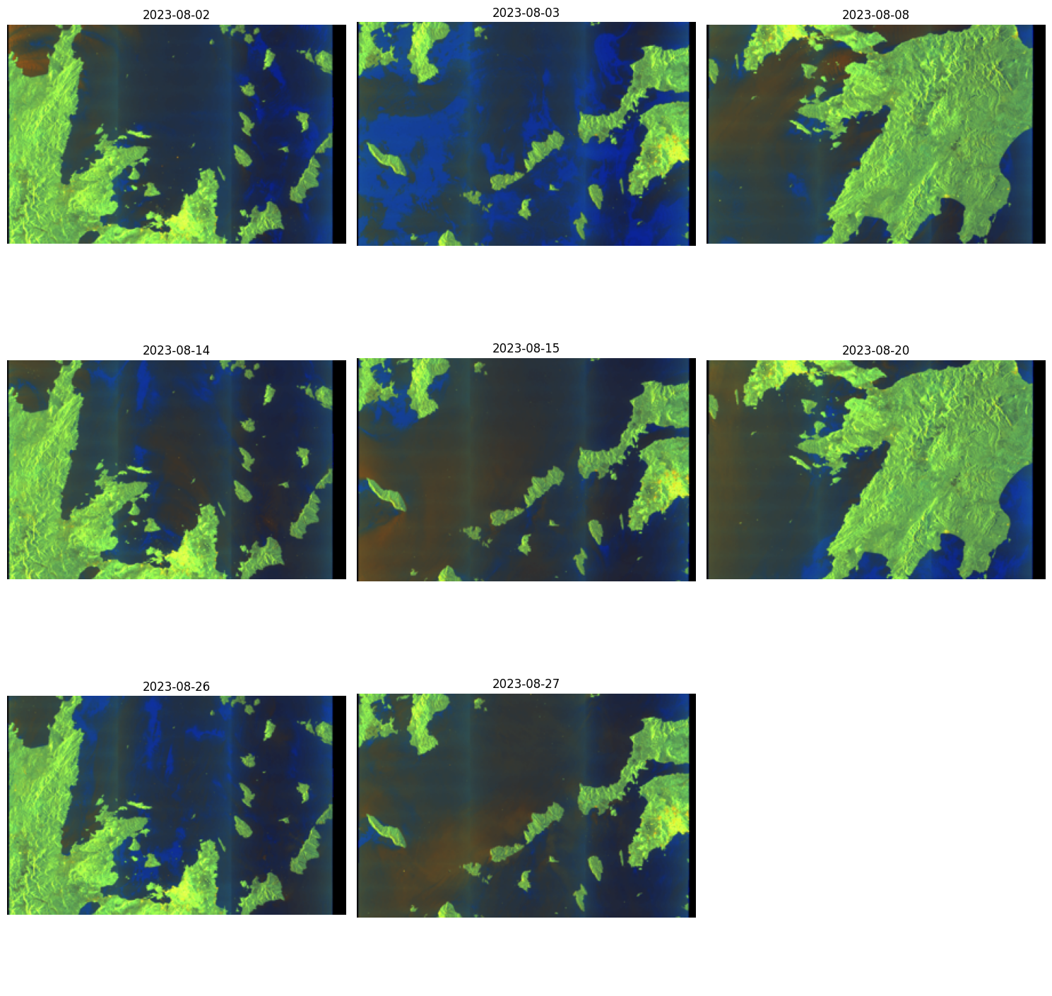
items_s1[0]
- type "Feature"
- stac_version "1.1.0"
stac_extensions[] 12 items
- 0 "https://stac-extensions.github.io/sat/v1.1.0/schema.json"
- 1 "https://stac-extensions.github.io/file/v2.1.0/schema.json"
- 2 "https://stac-extensions.github.io/processing/v1.2.0/schema.json"
- 3 "https://stac-extensions.github.io/product/v0.1.0/schema.json"
- 4 "https://stac-extensions.github.io/projection/v2.0.0/schema.json"
- 5 "https://stac-extensions.github.io/view/v1.0.0/schema.json"
- 6 "https://stac-extensions.github.io/alternate-assets/v1.2.0/schema.json"
- 7 "https://stac-extensions.github.io/timestamps/v1.1.0/schema.json"
- 8 "https://stac-extensions.github.io/authentication/v1.1.0/schema.json"
- 9 "https://stac-extensions.github.io/sar/v1.1.0/schema.json"
- 10 "https://cs-si.github.io/eopf-stac-extension/v1.2.0/schema.json"
- 11 "https://stac-extensions.github.io/storage/v2.0.0/schema.json"
- id "S1A_IW_GRDH_1SDV_20230802T162344_20230802T162409_049699_05F9EC_3930_COG"
geometry
- type "Polygon"
coordinates[] 1 items
0[] 5 items
0[] 2 items
- 0 25.12806
- 1 38.32735
1[] 2 items
- 0 25.42226
- 1 36.82415
2[] 2 items
- 0 22.51266
- 1 36.41127
3[] 2 items
- 0 22.15969
- 1 37.91655
4[] 2 items
- 0 25.12806
- 1 38.32735
bbox[] 4 items
- 0 22.159693
- 1 36.411266
- 2 25.422256
- 3 38.327351
properties
- created "2023-08-02T15:33:27.234968Z"
- updated "2023-08-02T17:38:38.262016Z"
- datetime "2023-08-02T16:23:44.874681Z"
- platform "sentinel-1a"
- published "2023-08-02T17:37:58.859432Z"
instruments[] 1 items
- 0 "sar"
auth:schemes
s3
- type "s3"
oidc
- type "openIdConnect"
- openIdConnectUrl "https://identity.dataspace.copernicus.eu/auth/realms/CDSE/.well-known/openid-configuration"
- end_datetime "2023-08-02T16:24:09.873197Z"
- product:type "IW_GRDH_1S"
- view:azimuth 346.80339729190445
- constellation "sentinel-1"
- start_datetime "2023-08-02T16:23:44.874681Z"
- sat:orbit_cycle 298
- sat:orbit_state "ascending"
storage:schemes
cdse-s3
- type "custom-s3"
- title "Copernicus Data Space Ecosystem S3"
- platform "https://eodata.dataspace.copernicus.eu"
- description "This endpoint provides access to EO data which is stored on the object storage of both CloudFerro Cloud and OpenTelekom Cloud (OTC). See the [documentation](https://documentation.dataspace.copernicus.eu/APIs/S3.html) for more information, including how to get credentials."
- requester_pays False
creodias-s3
- type "custom-s3"
- title "CREODIAS S3"
- platform "https://eodata.cloudferro.com"
- description "Comprehensive Earth Observation Data (EODATA) archive offered by CREODIAS as a commercial part of CDSE, designed to provide users with access to a vast repository of satellite data without predefined quota limits"
- requester_pays True
- eopf:datatake_id "391660"
- processing:level "L1"
sar:polarizations[] 2 items
- 0 "VV"
- 1 "VH"
- processing:version "01.00"
- product:timeliness "PT3H"
- sar:frequency_band "C"
- sat:absolute_orbit 49699
- sat:relative_orbit 102
- processing:datetime "2023-08-02T17:34:26.706200Z"
- processing:facility "Copernicus Data Space Ecosystem-CloudFerro"
- sar:instrument_mode "IW"
- sar:center_frequency 5.405
- sar:resolution_range 5
- view:incidence_angle 39.26282333208237
- sar:resolution_azimuth 20
- sar:pixel_spacing_range 10.0
- sar:observation_direction "right"
- sar:pixel_spacing_azimuth 10.0
- product:timeliness_category "NRT-3h"
- eopf:instrument_configuration_id 7
- sat:platform_international_designator "2014-016A"
links[] 5 items
0
- rel "collection"
- href "https://stac.dataspace.copernicus.eu/v1/collections/sentinel-1-grd"
- type "application/json"
1
- rel "parent"
- href "https://stac.dataspace.copernicus.eu/v1/collections/sentinel-1-grd"
- type "application/json"
2
- rel "root"
- href "https://stac.dataspace.copernicus.eu/v1/"
- type "application/json"
- title "Copernicus Data Space Ecosystem (CDSE) asset-level STAC catalogue"
3
- rel "self"
- href "https://stac.dataspace.copernicus.eu/v1/collections/sentinel-1-grd/items/S1A_IW_GRDH_1SDV_20230802T162344_20230802T162409_049699_05F9EC_3930_COG"
- type "application/geo+json"
4
- rel "version-history"
- href "https://trace.dataspace.copernicus.eu/api/v1/traces/name/S1A_IW_GRDH_1SDV_20230802T162344_20230802T162409_049699_05F9EC_3930_COG.zip"
- type "application/json"
- title "Product history record from the CDSE traceability service"
assets
vh
- href "s3://eodata/Sentinel-1/SAR/IW_GRDH_1S-COG/2023/08/02/S1A_IW_GRDH_1SDV_20230802T162344_20230802T162409_049699_05F9EC_3930_COG.SAFE/measurement/s1a-iw-grd-vh-20230802t162344-20230802t162409-049699-05f9ec-002-cog.tiff"
- type "image/tiff; application=geotiff; profile=cloud-optimized"
- title "VH: Vertical transmit, horizontal receive"
- description "Amplitude of vertically polarized signal received horizontally, with radiometric terrain correction applied"
alternate
https
- href "https://zipper.dataspace.copernicus.eu/odata/v1/Products(50ace7ed-4aff-43f8-99c4-93d81daecbad)/Nodes(S1A_IW_GRDH_1SDV_20230802T162344_20230802T162409_049699_05F9EC_3930_COG.SAFE)/Nodes(measurement)/Nodes(s1a-iw-grd-vh-20230802t162344-20230802t162409-049699-05f9ec-002-cog.tiff)/$value"
auth:refs[] 1 items
- 0 "oidc"
- alternate:name "HTTPS"
- file:size 420995
proj:bbox[] 4 items
- 0 22.159693
- 1 36.411266
- 2 25.422256
- 3 38.327351
proj:shape[] 2 items
- 0 26428
- 1 16671
- file:checksum "d50110d0591e82d84b6106858d17650a64de3c"
- file:local_path "S1A_IW_GRDH_1SDV_20230802T162344_20230802T162409_049699_05F9EC_3930_COG.SAFE/measurement/s1a-iw-grd-vh-20230802t162344-20230802t162409-049699-05f9ec-002-cog.tiff"
- nodata 0
auth:refs[] 1 items
- 0 "s3"
- data_type "uint16"
- proj:code "EPSG:4326"
storage:refs[] 2 items
- 0 "cdse-s3"
- 1 "creodias-s3"
- alternate:name "S3"
roles[] 1 items
- 0 "data"
vv
- href "s3://eodata/Sentinel-1/SAR/IW_GRDH_1S-COG/2023/08/02/S1A_IW_GRDH_1SDV_20230802T162344_20230802T162409_049699_05F9EC_3930_COG.SAFE/measurement/s1a-iw-grd-vv-20230802t162344-20230802t162409-049699-05f9ec-001-cog.tiff"
- type "image/tiff; application=geotiff; profile=cloud-optimized"
- title "VV: Vertical transmit, vertical receive"
- description "Amplitude of vertically polarized signal received vertically, with radiometric terrain correction applied"
alternate
https
- href "https://zipper.dataspace.copernicus.eu/odata/v1/Products(50ace7ed-4aff-43f8-99c4-93d81daecbad)/Nodes(S1A_IW_GRDH_1SDV_20230802T162344_20230802T162409_049699_05F9EC_3930_COG.SAFE)/Nodes(measurement)/Nodes(s1a-iw-grd-vv-20230802t162344-20230802t162409-049699-05f9ec-001-cog.tiff)/$value"
auth:refs[] 1 items
- 0 "oidc"
- alternate:name "HTTPS"
- file:size 420995
proj:bbox[] 4 items
- 0 22.159693
- 1 36.411266
- 2 25.422256
- 3 38.327351
proj:shape[] 2 items
- 0 26428
- 1 16671
- file:checksum "d501106d86de9e5e235e5808162016430cda7b"
- file:local_path "S1A_IW_GRDH_1SDV_20230802T162344_20230802T162409_049699_05F9EC_3930_COG.SAFE/measurement/s1a-iw-grd-vv-20230802t162344-20230802t162409-049699-05f9ec-001-cog.tiff"
- nodata 0
auth:refs[] 1 items
- 0 "s3"
- data_type "uint16"
- proj:code "EPSG:4326"
storage:refs[] 2 items
- 0 "cdse-s3"
- 1 "creodias-s3"
- alternate:name "S3"
roles[] 1 items
- 0 "data"
Product
- href "https://zipper.dataspace.copernicus.eu/odata/v1/Products(50ace7ed-4aff-43f8-99c4-93d81daecbad)/$value"
- type "application/zip"
- title "Zipped product"
- file:size 1022542239
- file:checksum "d50110b6552c36ec289c0974747190105a919c"
- file:local_path "S1A_IW_GRDH_1SDV_20230802T162344_20230802T162409_049699_05F9EC_3930_COG.SAFE.zip"
auth:refs[] 1 items
- 0 "oidc"
- alternate:name "HTTPS"
roles[] 3 items
- 0 "data"
- 1 "metadata"
- 2 "archive"
thumbnail
- href "https://datahub.creodias.eu/odata/v1/Assets(7e5ba0ad-9e39-40b1-af3a-ba2960bae134)/$value"
- type "image/png"
- title "Quicklook"
- description "An averaged, decimated preview image of product's measurements in PNG format."
auth:refs[] 1 items
- 0 "oidc"
- file:size 243622
- file:checksum "d50110b55265dbac2ff6c7e172ee520bdd3c20"
- file:local_path "S1A_IW_GRDH_1SDV_20230802T162344_20230802T162409_049699_05F9EC_3930_COG.SAFE/preview/quick-look.png"
- proj:code None
proj:shape[] 2 items
- 0 343
- 1 343
- alternate:name "HTTPS"
roles[] 1 items
- 0 "thumbnail"
safe_manifest
- href "s3://eodata/Sentinel-1/SAR/IW_GRDH_1S-COG/2023/08/02/S1A_IW_GRDH_1SDV_20230802T162344_20230802T162409_049699_05F9EC_3930_COG.SAFE/manifest.safe"
- type "application/xml"
- title "manifest.safe"
- description "General product metadata in XML format."
alternate
https
- href "https://zipper.dataspace.copernicus.eu/odata/v1/Products(50ace7ed-4aff-43f8-99c4-93d81daecbad)/Nodes(S1A_IW_GRDH_1SDV_20230802T162344_20230802T162409_049699_05F9EC_3930_COG.SAFE)/Nodes(manifest.safe)/$value"
auth:refs[] 1 items
- 0 "oidc"
- alternate:name "HTTPS"
- file:size 25344
- file:checksum "d501108e8680dbbc70fd6ce6a8322d9bdb502c"
- file:local_path "S1A_IW_GRDH_1SDV_20230802T162344_20230802T162409_049699_05F9EC_3930_COG.SAFE/manifest.safe"
auth:refs[] 1 items
- 0 "s3"
storage:refs[] 2 items
- 0 "cdse-s3"
- 1 "creodias-s3"
- alternate:name "S3"
roles[] 1 items
- 0 "metadata"
schema-noise-vh
- href "s3://eodata/Sentinel-1/SAR/IW_GRDH_1S-COG/2023/08/02/S1A_IW_GRDH_1SDV_20230802T162344_20230802T162409_049699_05F9EC_3930_COG.SAFE/annotation/calibration/noise-s1a-iw-grd-vh-20230802t162344-20230802t162409-049699-05f9ec-002-cog.xml"
- type "application/xml"
- title "VH noise Schema"
- description "Estimated thermal noise look-up tables"
alternate
https
- href "https://zipper.dataspace.copernicus.eu/odata/v1/Products(50ace7ed-4aff-43f8-99c4-93d81daecbad)/Nodes(S1A_IW_GRDH_1SDV_20230802T162344_20230802T162409_049699_05F9EC_3930_COG.SAFE)/Nodes(annotation)/Nodes(calibration)/Nodes(noise-s1a-iw-grd-vh-20230802t162344-20230802t162409-049699-05f9ec-002-cog.xml)/$value"
auth:refs[] 1 items
- 0 "oidc"
- alternate:name "HTTPS"
- file:size 420995
- file:checksum "d50110d0591e82d84b6106858d17650a64de3c"
- file:local_path "S1A_IW_GRDH_1SDV_20230802T162344_20230802T162409_049699_05F9EC_3930_COG.SAFE/annotation/calibration/noise-s1a-iw-grd-vh-20230802t162344-20230802t162409-049699-05f9ec-002-cog.xml"
auth:refs[] 1 items
- 0 "s3"
storage:refs[] 2 items
- 0 "cdse-s3"
- 1 "creodias-s3"
- alternate:name "S3"
roles[] 1 items
- 0 "metadata"
schema-noise-vv
- href "s3://eodata/Sentinel-1/SAR/IW_GRDH_1S-COG/2023/08/02/S1A_IW_GRDH_1SDV_20230802T162344_20230802T162409_049699_05F9EC_3930_COG.SAFE/annotation/calibration/noise-s1a-iw-grd-vv-20230802t162344-20230802t162409-049699-05f9ec-001-cog.xml"
- type "application/xml"
- title "VV noise Schema"
- description "Estimated thermal noise look-up tables"
alternate
https
- href "https://zipper.dataspace.copernicus.eu/odata/v1/Products(50ace7ed-4aff-43f8-99c4-93d81daecbad)/Nodes(S1A_IW_GRDH_1SDV_20230802T162344_20230802T162409_049699_05F9EC_3930_COG.SAFE)/Nodes(annotation)/Nodes(calibration)/Nodes(noise-s1a-iw-grd-vv-20230802t162344-20230802t162409-049699-05f9ec-001-cog.xml)/$value"
auth:refs[] 1 items
- 0 "oidc"
- alternate:name "HTTPS"
- file:size 420995
- file:checksum "d501106d86de9e5e235e5808162016430cda7b"
- file:local_path "S1A_IW_GRDH_1SDV_20230802T162344_20230802T162409_049699_05F9EC_3930_COG.SAFE/annotation/calibration/noise-s1a-iw-grd-vv-20230802t162344-20230802t162409-049699-05f9ec-001-cog.xml"
auth:refs[] 1 items
- 0 "s3"
storage:refs[] 2 items
- 0 "cdse-s3"
- 1 "creodias-s3"
- alternate:name "S3"
roles[] 1 items
- 0 "metadata"
schema-product-vh
- href "s3://eodata/Sentinel-1/SAR/IW_GRDH_1S-COG/2023/08/02/S1A_IW_GRDH_1SDV_20230802T162344_20230802T162409_049699_05F9EC_3930_COG.SAFE/annotation/s1a-iw-grd-vh-20230802t162344-20230802t162409-049699-05f9ec-002-cog.xml"
- type "application/xml"
- title "VH Product Schema"
- description "Main source of band's metadata, including: state of the platform during acquisition, image properties, Doppler information, geographic location, etc."
alternate
https
- href "https://zipper.dataspace.copernicus.eu/odata/v1/Products(50ace7ed-4aff-43f8-99c4-93d81daecbad)/Nodes(S1A_IW_GRDH_1SDV_20230802T162344_20230802T162409_049699_05F9EC_3930_COG.SAFE)/Nodes(annotation)/Nodes(s1a-iw-grd-vh-20230802t162344-20230802t162409-049699-05f9ec-002-cog.xml)/$value"
auth:refs[] 1 items
- 0 "oidc"
- alternate:name "HTTPS"
- file:size 1876933
- file:checksum "d50110ca0858feeb25562a0b6af1364a385ad3"
- file:local_path "S1A_IW_GRDH_1SDV_20230802T162344_20230802T162409_049699_05F9EC_3930_COG.SAFE/annotation/s1a-iw-grd-vh-20230802t162344-20230802t162409-049699-05f9ec-002-cog.xml"
auth:refs[] 1 items
- 0 "s3"
storage:refs[] 2 items
- 0 "cdse-s3"
- 1 "creodias-s3"
- alternate:name "S3"
roles[] 1 items
- 0 "metadata"
schema-product-vv
- href "s3://eodata/Sentinel-1/SAR/IW_GRDH_1S-COG/2023/08/02/S1A_IW_GRDH_1SDV_20230802T162344_20230802T162409_049699_05F9EC_3930_COG.SAFE/annotation/s1a-iw-grd-vv-20230802t162344-20230802t162409-049699-05f9ec-001-cog.xml"
- type "application/xml"
- title "VV Product Schema"
- description "Main source of band's metadata, including: state of the platform during acquisition, image properties, Doppler information, geographic location, etc."
alternate
https
- href "https://zipper.dataspace.copernicus.eu/odata/v1/Products(50ace7ed-4aff-43f8-99c4-93d81daecbad)/Nodes(S1A_IW_GRDH_1SDV_20230802T162344_20230802T162409_049699_05F9EC_3930_COG.SAFE)/Nodes(annotation)/Nodes(s1a-iw-grd-vv-20230802t162344-20230802t162409-049699-05f9ec-001-cog.xml)/$value"
auth:refs[] 1 items
- 0 "oidc"
- alternate:name "HTTPS"
- file:size 1876942
- file:checksum "d5011079da758b3273a88e668b829279788c1d"
- file:local_path "S1A_IW_GRDH_1SDV_20230802T162344_20230802T162409_049699_05F9EC_3930_COG.SAFE/annotation/s1a-iw-grd-vv-20230802t162344-20230802t162409-049699-05f9ec-001-cog.xml"
auth:refs[] 1 items
- 0 "s3"
storage:refs[] 2 items
- 0 "cdse-s3"
- 1 "creodias-s3"
- alternate:name "S3"
roles[] 1 items
- 0 "metadata"
schema-calibration-vh
- href "s3://eodata/Sentinel-1/SAR/IW_GRDH_1S-COG/2023/08/02/S1A_IW_GRDH_1SDV_20230802T162344_20230802T162409_049699_05F9EC_3930_COG.SAFE/annotation/calibration/calibration-s1a-iw-grd-vh-20230802t162344-20230802t162409-049699-05f9ec-002-cog.xml"
- type "application/xml"
- title "VH calibration Schema"
- description "Calibration metadata including calibration details and lookup tables for beta nought, sigma nought, gamma, and digital numbers used in absolute product calibration."
alternate
https
- href "https://zipper.dataspace.copernicus.eu/odata/v1/Products(50ace7ed-4aff-43f8-99c4-93d81daecbad)/Nodes(S1A_IW_GRDH_1SDV_20230802T162344_20230802T162409_049699_05F9EC_3930_COG.SAFE)/Nodes(annotation)/Nodes(calibration)/Nodes(calibration-s1a-iw-grd-vh-20230802t162344-20230802t162409-049699-05f9ec-002-cog.xml)/$value"
auth:refs[] 1 items
- 0 "oidc"
- alternate:name "HTTPS"
- file:size 1038325
- file:checksum "d5011048740aaed0c802f5ed59a80388cdbab2"
- file:local_path "S1A_IW_GRDH_1SDV_20230802T162344_20230802T162409_049699_05F9EC_3930_COG.SAFE/annotation/calibration/calibration-s1a-iw-grd-vh-20230802t162344-20230802t162409-049699-05f9ec-002-cog.xml"
auth:refs[] 1 items
- 0 "s3"
storage:refs[] 2 items
- 0 "cdse-s3"
- 1 "creodias-s3"
- alternate:name "S3"
roles[] 1 items
- 0 "metadata"
schema-calibration-vv
- href "s3://eodata/Sentinel-1/SAR/IW_GRDH_1S-COG/2023/08/02/S1A_IW_GRDH_1SDV_20230802T162344_20230802T162409_049699_05F9EC_3930_COG.SAFE/annotation/calibration/calibration-s1a-iw-grd-vv-20230802t162344-20230802t162409-049699-05f9ec-001-cog.xml"
- type "application/xml"
- title "VV calibration Schema"
- description "Calibration metadata including calibration details and lookup tables for beta nought, sigma nought, gamma, and digital numbers used in absolute product calibration."
alternate
https
- href "https://zipper.dataspace.copernicus.eu/odata/v1/Products(50ace7ed-4aff-43f8-99c4-93d81daecbad)/Nodes(S1A_IW_GRDH_1SDV_20230802T162344_20230802T162409_049699_05F9EC_3930_COG.SAFE)/Nodes(annotation)/Nodes(calibration)/Nodes(calibration-s1a-iw-grd-vv-20230802t162344-20230802t162409-049699-05f9ec-001-cog.xml)/$value"
auth:refs[] 1 items
- 0 "oidc"
- alternate:name "HTTPS"
- file:size 1038325
- file:checksum "d501102b309fc49981099538569f1224a2874d"
- file:local_path "S1A_IW_GRDH_1SDV_20230802T162344_20230802T162409_049699_05F9EC_3930_COG.SAFE/annotation/calibration/calibration-s1a-iw-grd-vv-20230802t162344-20230802t162409-049699-05f9ec-001-cog.xml"
auth:refs[] 1 items
- 0 "s3"
storage:refs[] 2 items
- 0 "cdse-s3"
- 1 "creodias-s3"
- alternate:name "S3"
roles[] 1 items
- 0 "metadata"
- collection "sentinel-1-grd"
Search the sentinel-3-olci-1-efr-ntc collection and visualize the thumbnails#
# Sentinel-3 OLCI search
search_s3 = client.search(
    collections=["sentinel-3-olci-1-efr-ntc"],
    bbox=[23.6, 37.9, 24.1, 38.1],  # Athens
    datetime="2023-08-01/2023-08-05",
)

all_items_s3 = list(search_s3.get_items())

# Remove duplicates (one item per date)
unique_items_s3 = {}
for item in all_items_s3:
    acq_date = item.datetime.date()
    if acq_date not in unique_items_s3:
        unique_items_s3[acq_date] = item

items_s3 = list(unique_items_s3.values())
items_s3 = sorted(items_s3, key=lambda item: item.datetime)

print(f"Sentinel-3: Reduced to {len(items_s3)} unique acquisition dates.")

# Plotting
cols = 3
rows = (len(items_s3) + cols - 1) // cols
fig, axs = plt.subplots(rows, cols, figsize=(15, 5 * rows))

for i, item in enumerate(items_s3):
    row = i // cols
    col = i % cols
    ax = axs[row, col] if rows > 1 else axs[col]

    if 'thumbnail' in item.assets:
        thumb_url = item.assets['thumbnail'].href
        response = requests.get(thumb_url)
        img = Image.open(BytesIO(response.content))
        ax.imshow(img)
        ax.set_title(item.datetime.strftime('%Y-%m-%d'), fontsize=12)
    else:
        ax.set_title("No thumbnail available")

    ax.axis("off")

for j in range(len(items_s3), rows * cols):
    row = j // cols
    col = j % cols
    ax = axs[row, col] if rows > 1 else axs[col]
    ax.axis("off")

plt.tight_layout()
plt.show()
Sentinel-3: Reduced to 5 unique acquisition dates.
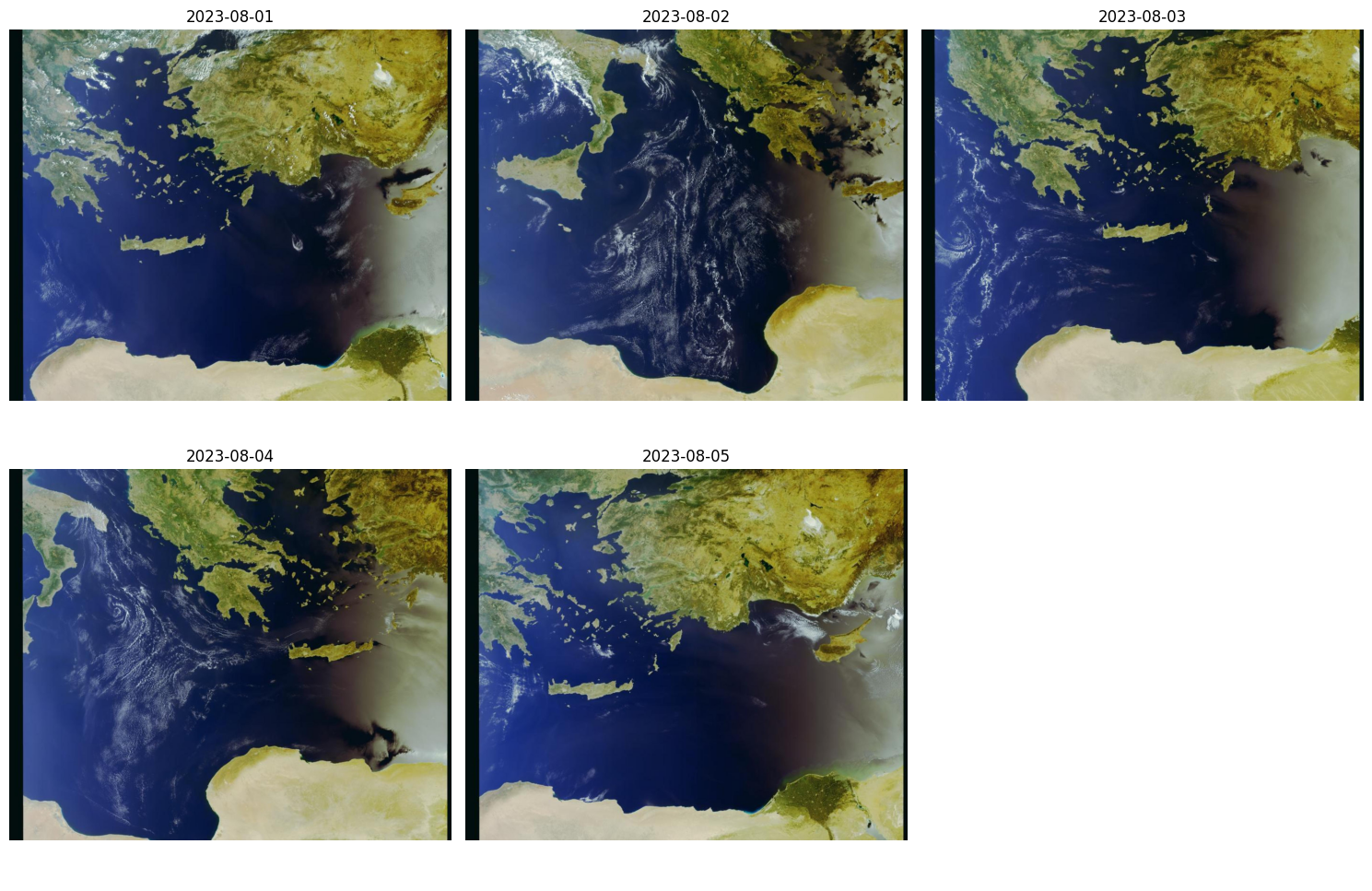
items_s3[0]
- type "Feature"
- stac_version "1.1.0"
stac_extensions[] 11 items
- 0 "https://cs-si.github.io/eopf-stac-extension/v1.2.0/schema.json"
- 1 "https://stac-extensions.github.io/alternate-assets/v1.2.0/schema.json"
- 2 "https://stac-extensions.github.io/authentication/v1.1.0/schema.json"
- 3 "https://stac-extensions.github.io/eo/v2.0.0/schema.json"
- 4 "https://stac-extensions.github.io/file/v2.1.0/schema.json"
- 5 "https://stac-extensions.github.io/processing/v1.2.0/schema.json"
- 6 "https://stac-extensions.github.io/product/v0.1.0/schema.json"
- 7 "https://stac-extensions.github.io/projection/v2.0.0/schema.json"
- 8 "https://stac-extensions.github.io/sat/v1.1.0/schema.json"
- 9 "https://stac-extensions.github.io/storage/v2.0.0/schema.json"
- 10 "https://stac-extensions.github.io/timestamps/v1.1.0/schema.json"
- id "S3A_OL_1_EFR____20230801T082008_20230801T082308_20230802T084940_0179_101_349_2340_PS1_O_NT_003"
geometry
- type "Polygon"
coordinates[] 1 items
0[] 5 items
0[] 2 items
- 0 19.2036
- 1 31.464199999999995
1[] 2 items
- 0 32.57889999999999
- 1 29.0683
2[] 2 items
- 0 36.165699999999994
- 1 39.5445
3[] 2 items
- 0 20.9209
- 1 41.96809999999999
4[] 2 items
- 0 19.2036
- 1 31.464199999999995
bbox[] 4 items
- 0 19.2036
- 1 29.0683
- 2 36.1657
- 3 41.9681
properties
- gsd 300
- created "2023-08-02T08:52:12.444000Z"
- updated "2023-08-02T09:01:44.332910Z"
- datetime "2023-08-01T08:21:37.690782Z"
- platform "sentinel-3a"
- proj:code "EPSG:4326"
- published "2023-08-02T08:59:02.695635Z"
proj:shape[] 2 items
- 0 4090
- 1 4865
statistics
- bright 7.0
- coastal 0.0
- invalid 4.0
- cosmetic 0.0
- saturated 1.2e-05
- duplicated 22.0
- saline_water 56.0
- tidal_region 0.0
- dubious_samples 0.0
- fresh_inland_water 1.0
instruments[] 1 items
- 0 "olci"
auth:schemes
s3
- type "s3"
oidc
- type "openIdConnect"
- openIdConnectUrl "https://identity.dataspace.copernicus.eu/auth/realms/CDSE/.well-known/openid-configuration"
- end_datetime "2023-08-01T08:23:07.690782Z"
- product:type "OL_1_EFR___"
- constellation "sentinel-3"
- start_datetime "2023-08-01T08:20:07.690782Z"
- sat:orbit_cycle 101
- sat:orbit_state "descending"
storage:schemes
cdse-s3
- type "custom-s3"
- title "Copernicus Data Space Ecosystem S3"
- platform "https://eodata.dataspace.copernicus.eu"
- description "This endpoint provides access to EO data which is stored on the object storage of both CloudFerro Cloud and OpenTelekom Cloud (OTC). See the [documentation](https://documentation.dataspace.copernicus.eu/APIs/S3.html) for more information, including how to get credentials."
- requester_pays False
creodias-s3
- type "custom-s3"
- title "CREODIAS S3"
- platform "https://eodata.cloudferro.com"
- description "Comprehensive Earth Observation Data (EODATA) archive offered by CREODIAS as a commercial part of CDSE, designed to provide users with access to a vast repository of satellite data without predefined quota limits."
- requester_pays True
- processing:level "L1"
- processing:version "03.48"
- product:timeliness "P1M"
- sat:absolute_orbit 38822
- sat:relative_orbit 349
- processing:datetime "2023-08-02T08:50:25.000000Z"
- eopf:origin_datetime "2023-08-02T08:52:12.444000Z"
- product:timeliness_category "NT"
- sat:platform_international_designator "2016-011A"
links[] 5 items
0
- rel "collection"
- href "https://stac.dataspace.copernicus.eu/v1/collections/sentinel-3-olci-1-efr-ntc"
- type "application/json"
1
- rel "parent"
- href "https://stac.dataspace.copernicus.eu/v1/collections/sentinel-3-olci-1-efr-ntc"
- type "application/json"
2
- rel "root"
- href "https://stac.dataspace.copernicus.eu/v1/"
- type "application/json"
- title "Copernicus Data Space Ecosystem (CDSE) asset-level STAC catalogue"
3
- rel "self"
- href "https://stac.dataspace.copernicus.eu/v1/collections/sentinel-3-olci-1-efr-ntc/items/S3A_OL_1_EFR____20230801T082008_20230801T082308_20230802T084940_0179_101_349_2340_PS1_O_NT_003"
- type "application/geo+json"
4
- rel "version-history"
- href "https://trace.dataspace.copernicus.eu/api/v1/traces/name/S3A_OL_1_EFR____20230801T082008_20230801T082308_20230802T084940_0179_101_349_2340_PS1_O_NT_003.SEN3.zip"
- type "application/json"
- title "Product history record from the CDSE traceability service"
assets
product
- href "https://download.dataspace.copernicus.eu/odata/v1/Products(fd4d1d68-a585-495b-bc46-7d47ea0be656)/$value"
- type "application/zip"
- title "Zipped product"
- file:size 800281618
- file:checksum "d501102fec9afc2d229f386be57e0bee525a7c"
- file:local_path "S3A_OL_1_EFR____20230801T082008_20230801T082308_20230802T084940_0179_101_349_2340_PS1_O_NT_003.SEN3.zip"
auth:refs[] 1 items
- 0 "oidc"
roles[] 3 items
- 0 "data"
- 1 "metadata"
- 2 "archive"
thumbnail
- href "https://datahub.creodias.eu/odata/v1/Assets(729823bc-6ad9-4a8a-b0f7-7d9da5170607)/$value"
- type "image/jpeg"
- title "Thumbnail"
alternate
s3
- href "s3://eodata/Sentinel-3/OLCI/OL_1_EFR___/2023/08/01/S3A_OL_1_EFR____20230801T082008_20230801T082308_20230802T084940_0179_101_349_2340_PS1_O_NT_003.SEN3/quicklook.jpg"
auth:refs[] 1 items
- 0 "s3"
storage:refs[] 2 items
- 0 "cdse-s3"
- 1 "creodias-s3"
- alternate:name "S3"
- file:local_path "S3A_OL_1_EFR____20230801T082008_20230801T082308_20230802T084940_0179_101_349_2340_PS1_O_NT_003.SEN3/quicklook.jpg"
- proj:code None
- alternate:name "HTTPS"
roles[] 1 items
- 0 "thumbnail"
tie-meteo
- href "s3://eodata/Sentinel-3/OLCI/OL_1_EFR___/2023/08/01/S3A_OL_1_EFR____20230801T082008_20230801T082308_20230802T084940_0179_101_349_2340_PS1_O_NT_003.SEN3/tie_meteo.nc"
- type "application/netcdf"
- title "Tie Meteo Annotations"
alternate
https
- href "https://zipper.dataspace.copernicus.eu/odata/v1/Products(fd4d1d68-a585-495b-bc46-7d47ea0be656)/Nodes(S3A_OL_1_EFR____20230801T082008_20230801T082308_20230802T084940_0179_101_349_2340_PS1_O_NT_003.SEN3)/Nodes(tie_meteo.nc)/$value"
auth:refs[] 1 items
- 0 "oidc"
storage:refs[] 0 items
- alternate:name "HTTPS"
- file:size 19321637
- file:checksum "d5011016c327d1e05471709793adfa49fdeba8"
- file:local_path "S3A_OL_1_EFR____20230801T082008_20230801T082308_20230802T084940_0179_101_349_2340_PS1_O_NT_003.SEN3/tie_meteo.nc"
auth:refs[] 1 items
- 0 "s3"
storage:refs[] 2 items
- 0 "cdse-s3"
- 1 "creodias-s3"
- alternate:name "S3"
roles[] 1 items
- 0 "data"
xfdumanifest
- href "s3://eodata/Sentinel-3/OLCI/OL_1_EFR___/2023/08/01/S3A_OL_1_EFR____20230801T082008_20230801T082308_20230802T084940_0179_101_349_2340_PS1_O_NT_003.SEN3/xfdumanifest.xml"
- type "application/xml"
- title "Product manifest"
alternate
https
- href "https://zipper.dataspace.copernicus.eu/odata/v1/Products(fd4d1d68-a585-495b-bc46-7d47ea0be656)/Nodes(S3A_OL_1_EFR____20230801T082008_20230801T082308_20230802T084940_0179_101_349_2340_PS1_O_NT_003.SEN3)/Nodes(xfdumanifest.xml)/$value"
auth:refs[] 1 items
- 0 "oidc"
storage:refs[] 0 items
- alternate:name "HTTPS"
- file:local_path "S3A_OL_1_EFR____20230801T082008_20230801T082308_20230802T084940_0179_101_349_2340_PS1_O_NT_003.SEN3/xfdumanifest.xml"
auth:refs[] 1 items
- 0 "s3"
storage:refs[] 2 items
- 0 "cdse-s3"
- 1 "creodias-s3"
- alternate:name "S3"
roles[] 1 items
- 0 "metadata"
quality-flags
- href "s3://eodata/Sentinel-3/OLCI/OL_1_EFR___/2023/08/01/S3A_OL_1_EFR____20230801T082008_20230801T082308_20230802T084940_0179_101_349_2340_PS1_O_NT_003.SEN3/qualityFlags.nc"
- type "application/netcdf"
- title "Quality Flags Annotations"
alternate
https
- href "https://zipper.dataspace.copernicus.eu/odata/v1/Products(fd4d1d68-a585-495b-bc46-7d47ea0be656)/Nodes(S3A_OL_1_EFR____20230801T082008_20230801T082308_20230802T084940_0179_101_349_2340_PS1_O_NT_003.SEN3)/Nodes(qualityFlags.nc)/$value"
auth:refs[] 1 items
- 0 "oidc"
storage:refs[] 0 items
- alternate:name "HTTPS"
- file:size 2110538
- file:checksum "d501106643159ab936d0ca2a359e3bb9200e9e"
- file:local_path "S3A_OL_1_EFR____20230801T082008_20230801T082308_20230802T084940_0179_101_349_2340_PS1_O_NT_003.SEN3/qualityFlags.nc"
auth:refs[] 1 items
- 0 "s3"
storage:refs[] 2 items
- 0 "cdse-s3"
- 1 "creodias-s3"
- alternate:name "S3"
roles[] 1 items
- 0 "data"
removed-pixels
- href "s3://eodata/Sentinel-3/OLCI/OL_1_EFR___/2023/08/01/S3A_OL_1_EFR____20230801T082008_20230801T082308_20230802T084940_0179_101_349_2340_PS1_O_NT_003.SEN3/removed_pixels.nc"
- type "application/netcdf"
- title "Removed Pixels information used for SYN L1c reconstruction"
alternate
https
- href "https://zipper.dataspace.copernicus.eu/odata/v1/Products(fd4d1d68-a585-495b-bc46-7d47ea0be656)/Nodes(S3A_OL_1_EFR____20230801T082008_20230801T082308_20230802T084940_0179_101_349_2340_PS1_O_NT_003.SEN3)/Nodes(removed_pixels.nc)/$value"
auth:refs[] 1 items
- 0 "oidc"
storage:refs[] 0 items
- alternate:name "HTTPS"
auth:refs[] 1 items
- 0 "s3"
- file:size 22061221
storage:refs[] 2 items
- 0 "cdse-s3"
- 1 "creodias-s3"
- file:checksum "d501101fdf2e3b97ef6ddc42cf58d759b719de"
- alternate:name "S3"
- file:local_path "S3A_OL_1_EFR____20230801T082008_20230801T082308_20230802T084940_0179_101_349_2340_PS1_O_NT_003.SEN3/removed_pixels.nc"
roles[] 1 items
- 0 "data"
tie-geometries
- href "s3://eodata/Sentinel-3/OLCI/OL_1_EFR___/2023/08/01/S3A_OL_1_EFR____20230801T082008_20230801T082308_20230802T084940_0179_101_349_2340_PS1_O_NT_003.SEN3/tie_geometries.nc"
- type "application/netcdf"
- title "Tie Geometries Annotations"
alternate
https
- href "https://zipper.dataspace.copernicus.eu/odata/v1/Products(fd4d1d68-a585-495b-bc46-7d47ea0be656)/Nodes(S3A_OL_1_EFR____20230801T082008_20230801T082308_20230802T084940_0179_101_349_2340_PS1_O_NT_003.SEN3)/Nodes(tie_geometries.nc)/$value"
auth:refs[] 1 items
- 0 "oidc"
storage:refs[] 0 items
- alternate:name "HTTPS"
- file:size 2146385
- file:checksum "d50110378fcbf852ad3a6214dcbfd35419be3f"
- file:local_path "S3A_OL_1_EFR____20230801T082008_20230801T082308_20230802T084940_0179_101_349_2340_PS1_O_NT_003.SEN3/tie_geometries.nc"
auth:refs[] 1 items
- 0 "s3"
storage:refs[] 2 items
- 0 "cdse-s3"
- 1 "creodias-s3"
- alternate:name "S3"
roles[] 1 items
- 0 "data"
geo-coordinates
- href "s3://eodata/Sentinel-3/OLCI/OL_1_EFR___/2023/08/01/S3A_OL_1_EFR____20230801T082008_20230801T082308_20230802T084940_0179_101_349_2340_PS1_O_NT_003.SEN3/geo_coordinates.nc"
- type "application/netcdf"
- title "Geo Coordinates Annotations"
alternate
https
- href "https://zipper.dataspace.copernicus.eu/odata/v1/Products(fd4d1d68-a585-495b-bc46-7d47ea0be656)/Nodes(S3A_OL_1_EFR____20230801T082008_20230801T082308_20230802T084940_0179_101_349_2340_PS1_O_NT_003.SEN3)/Nodes(geo_coordinates.nc)/$value"
auth:refs[] 1 items
- 0 "oidc"
storage:refs[] 0 items
- alternate:name "HTTPS"
- file:size 58336614
- file:checksum "d501106661893cd2f36f22dce2873cd10e8b8e"
- file:local_path "S3A_OL_1_EFR____20230801T082008_20230801T082308_20230802T084940_0179_101_349_2340_PS1_O_NT_003.SEN3/geo_coordinates.nc"
auth:refs[] 1 items
- 0 "s3"
storage:refs[] 2 items
- 0 "cdse-s3"
- 1 "creodias-s3"
- alternate:name "S3"
roles[] 1 items
- 0 "data"
instrument-data
- href "s3://eodata/Sentinel-3/OLCI/OL_1_EFR___/2023/08/01/S3A_OL_1_EFR____20230801T082008_20230801T082308_20230802T084940_0179_101_349_2340_PS1_O_NT_003.SEN3/instrument_data.nc"
- type "application/netcdf"
- title "Instrument Data Annotations"
alternate
https
- href "https://zipper.dataspace.copernicus.eu/odata/v1/Products(fd4d1d68-a585-495b-bc46-7d47ea0be656)/Nodes(S3A_OL_1_EFR____20230801T082008_20230801T082308_20230802T084940_0179_101_349_2340_PS1_O_NT_003.SEN3)/Nodes(instrument_data.nc)/$value"
auth:refs[] 1 items
- 0 "oidc"
storage:refs[] 0 items
- alternate:name "HTTPS"
- file:size 1203119
- file:checksum "d50110394ac5977a21dbc36c88c07c28ce5aba"
- file:local_path "S3A_OL_1_EFR____20230801T082008_20230801T082308_20230802T084940_0179_101_349_2340_PS1_O_NT_003.SEN3/instrument_data.nc"
auth:refs[] 1 items
- 0 "s3"
storage:refs[] 2 items
- 0 "cdse-s3"
- 1 "creodias-s3"
- alternate:name "S3"
roles[] 1 items
- 0 "data"
time-coordinates
- href "s3://eodata/Sentinel-3/OLCI/OL_1_EFR___/2023/08/01/S3A_OL_1_EFR____20230801T082008_20230801T082308_20230802T084940_0179_101_349_2340_PS1_O_NT_003.SEN3/time_coordinates.nc"
- type "application/netcdf"
- title "Time Coordinates Annotations"
alternate
https
- href "https://zipper.dataspace.copernicus.eu/odata/v1/Products(fd4d1d68-a585-495b-bc46-7d47ea0be656)/Nodes(S3A_OL_1_EFR____20230801T082008_20230801T082308_20230802T084940_0179_101_349_2340_PS1_O_NT_003.SEN3)/Nodes(time_coordinates.nc)/$value"
auth:refs[] 1 items
- 0 "oidc"
storage:refs[] 0 items
- alternate:name "HTTPS"
- file:size 15782
- file:checksum "d50110a8434043553c10138fe79b7cf5a32a0a"
- file:local_path "S3A_OL_1_EFR____20230801T082008_20230801T082308_20230802T084940_0179_101_349_2340_PS1_O_NT_003.SEN3/time_coordinates.nc"
auth:refs[] 1 items
- 0 "s3"
storage:refs[] 2 items
- 0 "cdse-s3"
- 1 "creodias-s3"
- alternate:name "S3"
roles[] 1 items
- 0 "data"
Oa01_radianceData
- href "s3://eodata/Sentinel-3/OLCI/OL_1_EFR___/2023/08/01/S3A_OL_1_EFR____20230801T082008_20230801T082308_20230802T084940_0179_101_349_2340_PS1_O_NT_003.SEN3/Oa01_radiance.nc"
- type "application/netcdf"
- title "TOA radiance for OLCI acquisition band Oa01"
alternate
https
- href "https://zipper.dataspace.copernicus.eu/odata/v1/Products(fd4d1d68-a585-495b-bc46-7d47ea0be656)/Nodes(S3A_OL_1_EFR____20230801T082008_20230801T082308_20230802T084940_0179_101_349_2340_PS1_O_NT_003.SEN3)/Nodes(Oa01_radiance.nc)/$value"
auth:refs[] 1 items
- 0 "oidc"
storage:refs[] 0 items
- alternate:name "HTTPS"
- file:size 21134539
- file:checksum "d50110b73e7ff8b4f8f3d5f0bb2e28c136b78f"
- file:local_path "S3A_OL_1_EFR____20230801T082008_20230801T082308_20230802T084940_0179_101_349_2340_PS1_O_NT_003.SEN3/Oa01_radiance.nc"
bands[] 1 items
0
- name "Oa01"
- description "Aerosol correction, improved water constituent retrieval"
- eo:center_wavelength 0.4
- eo:full_width_half_max 0.015
auth:refs[] 1 items
- 0 "s3"
storage:refs[] 2 items
- 0 "cdse-s3"
- 1 "creodias-s3"
- alternate:name "S3"
roles[] 1 items
- 0 "data"
Oa02_radianceData
- href "s3://eodata/Sentinel-3/OLCI/OL_1_EFR___/2023/08/01/S3A_OL_1_EFR____20230801T082008_20230801T082308_20230802T084940_0179_101_349_2340_PS1_O_NT_003.SEN3/Oa02_radiance.nc"
- type "application/netcdf"
- title "TOA radiance for OLCI acquisition band Oa02"
alternate
https
- href "https://zipper.dataspace.copernicus.eu/odata/v1/Products(fd4d1d68-a585-495b-bc46-7d47ea0be656)/Nodes(S3A_OL_1_EFR____20230801T082008_20230801T082308_20230802T084940_0179_101_349_2340_PS1_O_NT_003.SEN3)/Nodes(Oa02_radiance.nc)/$value"
auth:refs[] 1 items
- 0 "oidc"
storage:refs[] 0 items
- alternate:name "HTTPS"
- file:size 21749091
- file:checksum "d501107ce24b7dc55658b911429c65b224f930"
- file:local_path "S3A_OL_1_EFR____20230801T082008_20230801T082308_20230802T084940_0179_101_349_2340_PS1_O_NT_003.SEN3/Oa02_radiance.nc"
bands[] 1 items
0
- name "Oa02"
- description "Yellow substance and detrital pigments (turbidity)"
- eo:center_wavelength 0.4125
- eo:full_width_half_max 0.01
auth:refs[] 1 items
- 0 "s3"
storage:refs[] 2 items
- 0 "cdse-s3"
- 1 "creodias-s3"
- alternate:name "S3"
roles[] 1 items
- 0 "data"
Oa03_radianceData
- href "s3://eodata/Sentinel-3/OLCI/OL_1_EFR___/2023/08/01/S3A_OL_1_EFR____20230801T082008_20230801T082308_20230802T084940_0179_101_349_2340_PS1_O_NT_003.SEN3/Oa03_radiance.nc"
- type "application/netcdf"
- title "TOA radiance for OLCI acquisition band Oa03"
alternate
https
- href "https://zipper.dataspace.copernicus.eu/odata/v1/Products(fd4d1d68-a585-495b-bc46-7d47ea0be656)/Nodes(S3A_OL_1_EFR____20230801T082008_20230801T082308_20230802T084940_0179_101_349_2340_PS1_O_NT_003.SEN3)/Nodes(Oa03_radiance.nc)/$value"
auth:refs[] 1 items
- 0 "oidc"
storage:refs[] 0 items
- alternate:name "HTTPS"
- file:size 22645077
- file:checksum "d50110eebcceb986a5fd086a55fec8027e8d93"
- file:local_path "S3A_OL_1_EFR____20230801T082008_20230801T082308_20230802T084940_0179_101_349_2340_PS1_O_NT_003.SEN3/Oa03_radiance.nc"
bands[] 1 items
0
- name "Oa03"
- description "Chlorophyll absorption maximum, biogeochemistry, vegetation"
- eo:center_wavelength 0.4425
- eo:full_width_half_max 0.01
auth:refs[] 1 items
- 0 "s3"
storage:refs[] 2 items
- 0 "cdse-s3"
- 1 "creodias-s3"
- alternate:name "S3"
roles[] 1 items
- 0 "data"
Oa04_radianceData
- href "s3://eodata/Sentinel-3/OLCI/OL_1_EFR___/2023/08/01/S3A_OL_1_EFR____20230801T082008_20230801T082308_20230802T084940_0179_101_349_2340_PS1_O_NT_003.SEN3/Oa04_radiance.nc"
- type "application/netcdf"
- title "TOA radiance for OLCI acquisition band Oa04"
alternate
https
- href "https://zipper.dataspace.copernicus.eu/odata/v1/Products(fd4d1d68-a585-495b-bc46-7d47ea0be656)/Nodes(S3A_OL_1_EFR____20230801T082008_20230801T082308_20230802T084940_0179_101_349_2340_PS1_O_NT_003.SEN3)/Nodes(Oa04_radiance.nc)/$value"
auth:refs[] 1 items
- 0 "oidc"
storage:refs[] 0 items
- alternate:name "HTTPS"
- file:size 23174852
- file:checksum "d501101a37c843ae9d6cefe9835f4a85f5df08"
- file:local_path "S3A_OL_1_EFR____20230801T082008_20230801T082308_20230802T084940_0179_101_349_2340_PS1_O_NT_003.SEN3/Oa04_radiance.nc"
bands[] 1 items
0
- name "Oa04"
- description "Chlorophyll"
- eo:center_wavelength 0.49
- eo:full_width_half_max 0.01
auth:refs[] 1 items
- 0 "s3"
storage:refs[] 2 items
- 0 "cdse-s3"
- 1 "creodias-s3"
- alternate:name "S3"
roles[] 1 items
- 0 "data"
Oa05_radianceData
- href "s3://eodata/Sentinel-3/OLCI/OL_1_EFR___/2023/08/01/S3A_OL_1_EFR____20230801T082008_20230801T082308_20230802T084940_0179_101_349_2340_PS1_O_NT_003.SEN3/Oa05_radiance.nc"
- type "application/netcdf"
- title "TOA radiance for OLCI acquisition band Oa05"
alternate
https
- href "https://zipper.dataspace.copernicus.eu/odata/v1/Products(fd4d1d68-a585-495b-bc46-7d47ea0be656)/Nodes(S3A_OL_1_EFR____20230801T082008_20230801T082308_20230802T084940_0179_101_349_2340_PS1_O_NT_003.SEN3)/Nodes(Oa05_radiance.nc)/$value"
auth:refs[] 1 items
- 0 "oidc"
storage:refs[] 0 items
- alternate:name "HTTPS"
- file:size 23537701
- file:checksum "d50110f5f781ed71475bbb85366f3154c284dd"
- file:local_path "S3A_OL_1_EFR____20230801T082008_20230801T082308_20230802T084940_0179_101_349_2340_PS1_O_NT_003.SEN3/Oa05_radiance.nc"
bands[] 1 items
0
- name "Oa05"
- description "Chlorophyll, sediment, turbidity, red tide"
- eo:center_wavelength 0.51
- eo:full_width_half_max 0.01
auth:refs[] 1 items
- 0 "s3"
storage:refs[] 2 items
- 0 "cdse-s3"
- 1 "creodias-s3"
- alternate:name "S3"
roles[] 1 items
- 0 "data"
Oa06_radianceData
- href "s3://eodata/Sentinel-3/OLCI/OL_1_EFR___/2023/08/01/S3A_OL_1_EFR____20230801T082008_20230801T082308_20230802T084940_0179_101_349_2340_PS1_O_NT_003.SEN3/Oa06_radiance.nc"
- type "application/netcdf"
- title "TOA radiance for OLCI acquisition band Oa06"
alternate
https
- href "https://zipper.dataspace.copernicus.eu/odata/v1/Products(fd4d1d68-a585-495b-bc46-7d47ea0be656)/Nodes(S3A_OL_1_EFR____20230801T082008_20230801T082308_20230802T084940_0179_101_349_2340_PS1_O_NT_003.SEN3)/Nodes(Oa06_radiance.nc)/$value"
auth:refs[] 1 items
- 0 "oidc"
storage:refs[] 0 items
- alternate:name "HTTPS"
- file:size 22860584
- file:checksum "d5011027965d7d908b04d55226a0ef22dfb1ea"
- file:local_path "S3A_OL_1_EFR____20230801T082008_20230801T082308_20230802T084940_0179_101_349_2340_PS1_O_NT_003.SEN3/Oa06_radiance.nc"
bands[] 1 items
0
- name "Oa06"
- description "Chlorophyll reference (minimum)"
- eo:center_wavelength 0.56
- eo:full_width_half_max 0.01
auth:refs[] 1 items
- 0 "s3"
storage:refs[] 2 items
- 0 "cdse-s3"
- 1 "creodias-s3"
- alternate:name "S3"
roles[] 1 items
- 0 "data"
Oa07_radianceData
- href "s3://eodata/Sentinel-3/OLCI/OL_1_EFR___/2023/08/01/S3A_OL_1_EFR____20230801T082008_20230801T082308_20230802T084940_0179_101_349_2340_PS1_O_NT_003.SEN3/Oa07_radiance.nc"
- type "application/netcdf"
- title "TOA radiance for OLCI acquisition band Oa07"
alternate
https
- href "https://zipper.dataspace.copernicus.eu/odata/v1/Products(fd4d1d68-a585-495b-bc46-7d47ea0be656)/Nodes(S3A_OL_1_EFR____20230801T082008_20230801T082308_20230802T084940_0179_101_349_2340_PS1_O_NT_003.SEN3)/Nodes(Oa07_radiance.nc)/$value"
auth:refs[] 1 items
- 0 "oidc"
storage:refs[] 0 items
- alternate:name "HTTPS"
- file:size 23906678
- file:checksum "d50110cd02a9196b8e07cb617485d6bd193e3f"
- file:local_path "S3A_OL_1_EFR____20230801T082008_20230801T082308_20230802T084940_0179_101_349_2340_PS1_O_NT_003.SEN3/Oa07_radiance.nc"
bands[] 1 items
0
- name "Oa07"
- description "Sediment loading"
- eo:center_wavelength 0.62
- eo:full_width_half_max 0.01
auth:refs[] 1 items
- 0 "s3"
storage:refs[] 2 items
- 0 "cdse-s3"
- 1 "creodias-s3"
- alternate:name "S3"
roles[] 1 items
- 0 "data"
Oa08_radianceData
- href "s3://eodata/Sentinel-3/OLCI/OL_1_EFR___/2023/08/01/S3A_OL_1_EFR____20230801T082008_20230801T082308_20230802T084940_0179_101_349_2340_PS1_O_NT_003.SEN3/Oa08_radiance.nc"
- type "application/netcdf"
- title "TOA radiance for OLCI acquisition band Oa08"
alternate
https
- href "https://zipper.dataspace.copernicus.eu/odata/v1/Products(fd4d1d68-a585-495b-bc46-7d47ea0be656)/Nodes(S3A_OL_1_EFR____20230801T082008_20230801T082308_20230802T084940_0179_101_349_2340_PS1_O_NT_003.SEN3)/Nodes(Oa08_radiance.nc)/$value"
auth:refs[] 1 items
- 0 "oidc"
storage:refs[] 0 items
- alternate:name "HTTPS"
- file:size 23955468
- file:checksum "d501104ddfff5a1e161bb50ec171f63f8080c3"
- file:local_path "S3A_OL_1_EFR____20230801T082008_20230801T082308_20230802T084940_0179_101_349_2340_PS1_O_NT_003.SEN3/Oa08_radiance.nc"
bands[] 1 items
0
- name "Oa08"
- description "2nd Chlorophyll absorption maximum, sediment, yellow substance / vegetation"
- eo:center_wavelength 0.665
- eo:full_width_half_max 0.01
auth:refs[] 1 items
- 0 "s3"
storage:refs[] 2 items
- 0 "cdse-s3"
- 1 "creodias-s3"
- alternate:name "S3"
roles[] 1 items
- 0 "data"
Oa09_radianceData
- href "s3://eodata/Sentinel-3/OLCI/OL_1_EFR___/2023/08/01/S3A_OL_1_EFR____20230801T082008_20230801T082308_20230802T084940_0179_101_349_2340_PS1_O_NT_003.SEN3/Oa09_radiance.nc"
- type "application/netcdf"
- title "TOA radiance for OLCI acquisition band Oa09"
alternate
https
- href "https://zipper.dataspace.copernicus.eu/odata/v1/Products(fd4d1d68-a585-495b-bc46-7d47ea0be656)/Nodes(S3A_OL_1_EFR____20230801T082008_20230801T082308_20230802T084940_0179_101_349_2340_PS1_O_NT_003.SEN3)/Nodes(Oa09_radiance.nc)/$value"
auth:refs[] 1 items
- 0 "oidc"
storage:refs[] 0 items
- alternate:name "HTTPS"
- file:size 23748506
- file:checksum "d5011002fe5f775d5a20c17bc1dbf2154fbffd"
- file:local_path "S3A_OL_1_EFR____20230801T082008_20230801T082308_20230802T084940_0179_101_349_2340_PS1_O_NT_003.SEN3/Oa09_radiance.nc"
bands[] 1 items
0
- name "Oa09"
- description "Improved fluorescence retrieval"
- eo:center_wavelength 0.67375
- eo:full_width_half_max 0.0075
auth:refs[] 1 items
- 0 "s3"
storage:refs[] 2 items
- 0 "cdse-s3"
- 1 "creodias-s3"
- alternate:name "S3"
roles[] 1 items
- 0 "data"
Oa10_radianceData
- href "s3://eodata/Sentinel-3/OLCI/OL_1_EFR___/2023/08/01/S3A_OL_1_EFR____20230801T082008_20230801T082308_20230802T084940_0179_101_349_2340_PS1_O_NT_003.SEN3/Oa10_radiance.nc"
- type "application/netcdf"
- title "TOA radiance for OLCI acquisition band Oa10"
alternate
https
- href "https://zipper.dataspace.copernicus.eu/odata/v1/Products(fd4d1d68-a585-495b-bc46-7d47ea0be656)/Nodes(S3A_OL_1_EFR____20230801T082008_20230801T082308_20230802T084940_0179_101_349_2340_PS1_O_NT_003.SEN3)/Nodes(Oa10_radiance.nc)/$value"
auth:refs[] 1 items
- 0 "oidc"
storage:refs[] 0 items
- alternate:name "HTTPS"
- file:size 24378930
- file:checksum "d50110533060c86036adb8a674aeb38be102f7"
- file:local_path "S3A_OL_1_EFR____20230801T082008_20230801T082308_20230802T084940_0179_101_349_2340_PS1_O_NT_003.SEN3/Oa10_radiance.nc"
bands[] 1 items
0
- name "Oa10"
- description "Chlorophyll fluorescence peak, red edge"
- eo:center_wavelength 0.68125
- eo:full_width_half_max 0.0075
auth:refs[] 1 items
- 0 "s3"
storage:refs[] 2 items
- 0 "cdse-s3"
- 1 "creodias-s3"
- alternate:name "S3"
roles[] 1 items
- 0 "data"
Oa11_radianceData
- href "s3://eodata/Sentinel-3/OLCI/OL_1_EFR___/2023/08/01/S3A_OL_1_EFR____20230801T082008_20230801T082308_20230802T084940_0179_101_349_2340_PS1_O_NT_003.SEN3/Oa11_radiance.nc"
- type "application/netcdf"
- title "TOA radiance for OLCI acquisition band Oa11"
alternate
https
- href "https://zipper.dataspace.copernicus.eu/odata/v1/Products(fd4d1d68-a585-495b-bc46-7d47ea0be656)/Nodes(S3A_OL_1_EFR____20230801T082008_20230801T082308_20230802T084940_0179_101_349_2340_PS1_O_NT_003.SEN3)/Nodes(Oa11_radiance.nc)/$value"
auth:refs[] 1 items
- 0 "oidc"
storage:refs[] 0 items
- alternate:name "HTTPS"
- file:size 24376489
- file:checksum "d501108e2ce834661f93d3b398c8565c16f607"
- file:local_path "S3A_OL_1_EFR____20230801T082008_20230801T082308_20230802T084940_0179_101_349_2340_PS1_O_NT_003.SEN3/Oa11_radiance.nc"
bands[] 1 items
0
- name "Oa11"
- description "Chlorophyll fluorescence baseline, red edge transition"
- eo:center_wavelength 0.70875
- eo:full_width_half_max 0.01
auth:refs[] 1 items
- 0 "s3"
storage:refs[] 2 items
- 0 "cdse-s3"
- 1 "creodias-s3"
- alternate:name "S3"
roles[] 1 items
- 0 "data"
Oa12_radianceData
- href "s3://eodata/Sentinel-3/OLCI/OL_1_EFR___/2023/08/01/S3A_OL_1_EFR____20230801T082008_20230801T082308_20230802T084940_0179_101_349_2340_PS1_O_NT_003.SEN3/Oa12_radiance.nc"
- type "application/netcdf"
- title "TOA radiance for OLCI acquisition band Oa12"
alternate
https
- href "https://zipper.dataspace.copernicus.eu/odata/v1/Products(fd4d1d68-a585-495b-bc46-7d47ea0be656)/Nodes(S3A_OL_1_EFR____20230801T082008_20230801T082308_20230802T084940_0179_101_349_2340_PS1_O_NT_003.SEN3)/Nodes(Oa12_radiance.nc)/$value"
auth:refs[] 1 items
- 0 "oidc"
storage:refs[] 0 items
- alternate:name "HTTPS"
- file:size 24195239
- file:checksum "d501106f2c586af8e22d2a532e1791aea2f9d2"
- file:local_path "S3A_OL_1_EFR____20230801T082008_20230801T082308_20230802T084940_0179_101_349_2340_PS1_O_NT_003.SEN3/Oa12_radiance.nc"
bands[] 1 items
0
- name "Oa12"
- description "O2 absorption / clouds, vegetation"
- eo:center_wavelength 0.75375
- eo:full_width_half_max 0.0075
auth:refs[] 1 items
- 0 "s3"
storage:refs[] 2 items
- 0 "cdse-s3"
- 1 "creodias-s3"
- alternate:name "S3"
roles[] 1 items
- 0 "data"
Oa13_radianceData
- href "s3://eodata/Sentinel-3/OLCI/OL_1_EFR___/2023/08/01/S3A_OL_1_EFR____20230801T082008_20230801T082308_20230802T084940_0179_101_349_2340_PS1_O_NT_003.SEN3/Oa13_radiance.nc"
- type "application/netcdf"
- title "TOA radiance for OLCI acquisition band Oa13"
alternate
https
- href "https://zipper.dataspace.copernicus.eu/odata/v1/Products(fd4d1d68-a585-495b-bc46-7d47ea0be656)/Nodes(S3A_OL_1_EFR____20230801T082008_20230801T082308_20230802T084940_0179_101_349_2340_PS1_O_NT_003.SEN3)/Nodes(Oa13_radiance.nc)/$value"
auth:refs[] 1 items
- 0 "oidc"
storage:refs[] 0 items
- alternate:name "HTTPS"
- file:size 21347915
- file:checksum "d50110a7d4a0b7f5371ff1c6e259f0723f6a96"
- file:local_path "S3A_OL_1_EFR____20230801T082008_20230801T082308_20230802T084940_0179_101_349_2340_PS1_O_NT_003.SEN3/Oa13_radiance.nc"
bands[] 1 items
0
- name "Oa13"
- description "O2 absorption / aerosol correction"
- eo:center_wavelength 0.76125
- eo:full_width_half_max 0.0025
auth:refs[] 1 items
- 0 "s3"
storage:refs[] 2 items
- 0 "cdse-s3"
- 1 "creodias-s3"
- alternate:name "S3"
roles[] 1 items
- 0 "data"
Oa14_radianceData
- href "s3://eodata/Sentinel-3/OLCI/OL_1_EFR___/2023/08/01/S3A_OL_1_EFR____20230801T082008_20230801T082308_20230802T084940_0179_101_349_2340_PS1_O_NT_003.SEN3/Oa14_radiance.nc"
- type "application/netcdf"
- title "TOA radiance for OLCI acquisition band Oa14"
alternate
https
- href "https://zipper.dataspace.copernicus.eu/odata/v1/Products(fd4d1d68-a585-495b-bc46-7d47ea0be656)/Nodes(S3A_OL_1_EFR____20230801T082008_20230801T082308_20230802T084940_0179_101_349_2340_PS1_O_NT_003.SEN3)/Nodes(Oa14_radiance.nc)/$value"
auth:refs[] 1 items
- 0 "oidc"
storage:refs[] 0 items
- alternate:name "HTTPS"
- file:size 22121655
- file:checksum "d50110b6e51774e4206eee3f4155cf51c2f374"
- file:local_path "S3A_OL_1_EFR____20230801T082008_20230801T082308_20230802T084940_0179_101_349_2340_PS1_O_NT_003.SEN3/Oa14_radiance.nc"
bands[] 1 items
0
- name "Oa14"
- description "Atmospheric correction"
- eo:center_wavelength 0.764375
- eo:full_width_half_max 0.00375
auth:refs[] 1 items
- 0 "s3"
storage:refs[] 2 items
- 0 "cdse-s3"
- 1 "creodias-s3"
- alternate:name "S3"
roles[] 1 items
- 0 "data"
Oa15_radianceData
- href "s3://eodata/Sentinel-3/OLCI/OL_1_EFR___/2023/08/01/S3A_OL_1_EFR____20230801T082008_20230801T082308_20230802T084940_0179_101_349_2340_PS1_O_NT_003.SEN3/Oa15_radiance.nc"
- type "application/netcdf"
- title "TOA radiance for OLCI acquisition band Oa15"
alternate
https
- href "https://zipper.dataspace.copernicus.eu/odata/v1/Products(fd4d1d68-a585-495b-bc46-7d47ea0be656)/Nodes(S3A_OL_1_EFR____20230801T082008_20230801T082308_20230802T084940_0179_101_349_2340_PS1_O_NT_003.SEN3)/Nodes(Oa15_radiance.nc)/$value"
auth:refs[] 1 items
- 0 "oidc"
storage:refs[] 0 items
- alternate:name "HTTPS"
- file:size 25162392
- file:checksum "d5011007339c0e46432cfa12a02fd43b44cb37"
- file:local_path "S3A_OL_1_EFR____20230801T082008_20230801T082308_20230802T084940_0179_101_349_2340_PS1_O_NT_003.SEN3/Oa15_radiance.nc"
bands[] 1 items
0
- name "Oa15"
- description "O2 absorption used for cloud top pressure, fluorescence over land"
- eo:center_wavelength 0.7675
- eo:full_width_half_max 0.0025
auth:refs[] 1 items
- 0 "s3"
storage:refs[] 2 items
- 0 "cdse-s3"
- 1 "creodias-s3"
- alternate:name "S3"
roles[] 1 items
- 0 "data"
Oa16_radianceData
- href "s3://eodata/Sentinel-3/OLCI/OL_1_EFR___/2023/08/01/S3A_OL_1_EFR____20230801T082008_20230801T082308_20230802T084940_0179_101_349_2340_PS1_O_NT_003.SEN3/Oa16_radiance.nc"
- type "application/netcdf"
- title "TOA radiance for OLCI acquisition band Oa16"
alternate
https
- href "https://zipper.dataspace.copernicus.eu/odata/v1/Products(fd4d1d68-a585-495b-bc46-7d47ea0be656)/Nodes(S3A_OL_1_EFR____20230801T082008_20230801T082308_20230802T084940_0179_101_349_2340_PS1_O_NT_003.SEN3)/Nodes(Oa16_radiance.nc)/$value"
auth:refs[] 1 items
- 0 "oidc"
storage:refs[] 0 items
- alternate:name "HTTPS"
- file:size 24838284
- file:checksum "d501102bcbdebbfe8a1be61d31f285155d7ddd"
- file:local_path "S3A_OL_1_EFR____20230801T082008_20230801T082308_20230802T084940_0179_101_349_2340_PS1_O_NT_003.SEN3/Oa16_radiance.nc"
bands[] 1 items
0
- name "Oa16"
- description "Atmospheric / aerosol correction"
- eo:center_wavelength 0.77875
- eo:full_width_half_max 0.015
auth:refs[] 1 items
- 0 "s3"
storage:refs[] 2 items
- 0 "cdse-s3"
- 1 "creodias-s3"
- alternate:name "S3"
roles[] 1 items
- 0 "data"
Oa17_radianceData
- href "s3://eodata/Sentinel-3/OLCI/OL_1_EFR___/2023/08/01/S3A_OL_1_EFR____20230801T082008_20230801T082308_20230802T084940_0179_101_349_2340_PS1_O_NT_003.SEN3/Oa17_radiance.nc"
- type "application/netcdf"
- title "TOA radiance for OLCI acquisition band Oa17"
alternate
https
- href "https://zipper.dataspace.copernicus.eu/odata/v1/Products(fd4d1d68-a585-495b-bc46-7d47ea0be656)/Nodes(S3A_OL_1_EFR____20230801T082008_20230801T082308_20230802T084940_0179_101_349_2340_PS1_O_NT_003.SEN3)/Nodes(Oa17_radiance.nc)/$value"
auth:refs[] 1 items
- 0 "oidc"
storage:refs[] 0 items
- alternate:name "HTTPS"
- file:size 24581577
- file:checksum "d5011057507fd4af166fc4792c2d5bba91da3f"
- file:local_path "S3A_OL_1_EFR____20230801T082008_20230801T082308_20230802T084940_0179_101_349_2340_PS1_O_NT_003.SEN3/Oa17_radiance.nc"
bands[] 1 items
0
- name "Oa17"
- description "Atmospheric / aerosol correction, clouds, pixel co-registration"
- eo:center_wavelength 0.865
- eo:full_width_half_max 0.02
auth:refs[] 1 items
- 0 "s3"
storage:refs[] 2 items
- 0 "cdse-s3"
- 1 "creodias-s3"
- alternate:name "S3"
roles[] 1 items
- 0 "data"
Oa18_radianceData
- href "s3://eodata/Sentinel-3/OLCI/OL_1_EFR___/2023/08/01/S3A_OL_1_EFR____20230801T082008_20230801T082308_20230802T084940_0179_101_349_2340_PS1_O_NT_003.SEN3/Oa18_radiance.nc"
- type "application/netcdf"
- title "TOA radiance for OLCI acquisition band Oa18"
alternate
https
- href "https://zipper.dataspace.copernicus.eu/odata/v1/Products(fd4d1d68-a585-495b-bc46-7d47ea0be656)/Nodes(S3A_OL_1_EFR____20230801T082008_20230801T082308_20230802T084940_0179_101_349_2340_PS1_O_NT_003.SEN3)/Nodes(Oa18_radiance.nc)/$value"
auth:refs[] 1 items
- 0 "oidc"
storage:refs[] 0 items
- alternate:name "HTTPS"
- file:size 24388716
- file:checksum "d501103fcd68e4106e72173160dcb9e6a123cf"
- file:local_path "S3A_OL_1_EFR____20230801T082008_20230801T082308_20230802T084940_0179_101_349_2340_PS1_O_NT_003.SEN3/Oa18_radiance.nc"
bands[] 1 items
0
- name "Oa18"
- description "Water vapour absorption reference. Common reference band with SLSTR. Vegetation monitoring"
- eo:center_wavelength 0.885
- eo:full_width_half_max 0.01
auth:refs[] 1 items
- 0 "s3"
storage:refs[] 2 items
- 0 "cdse-s3"
- 1 "creodias-s3"
- alternate:name "S3"
roles[] 1 items
- 0 "data"
Oa19_radianceData
- href "s3://eodata/Sentinel-3/OLCI/OL_1_EFR___/2023/08/01/S3A_OL_1_EFR____20230801T082008_20230801T082308_20230802T084940_0179_101_349_2340_PS1_O_NT_003.SEN3/Oa19_radiance.nc"
- type "application/netcdf"
- title "TOA radiance for OLCI acquisition band Oa19"
alternate
https
- href "https://zipper.dataspace.copernicus.eu/odata/v1/Products(fd4d1d68-a585-495b-bc46-7d47ea0be656)/Nodes(S3A_OL_1_EFR____20230801T082008_20230801T082308_20230802T084940_0179_101_349_2340_PS1_O_NT_003.SEN3)/Nodes(Oa19_radiance.nc)/$value"
auth:refs[] 1 items
- 0 "oidc"
storage:refs[] 0 items
- alternate:name "HTTPS"
- file:size 23556351
- file:checksum "d50110fa0a48d9d9c7eddfa2f3f392c1bd7189"
- file:local_path "S3A_OL_1_EFR____20230801T082008_20230801T082308_20230802T084940_0179_101_349_2340_PS1_O_NT_003.SEN3/Oa19_radiance.nc"
bands[] 1 items
0
- name "Oa19"
- description "Water vapour absorption, vegetation monitoring (maximum REFLECTANCE)"
- eo:center_wavelength 0.9
- eo:full_width_half_max 0.01
auth:refs[] 1 items
- 0 "s3"
storage:refs[] 2 items
- 0 "cdse-s3"
- 1 "creodias-s3"
- alternate:name "S3"
roles[] 1 items
- 0 "data"
Oa20_radianceData
- href "s3://eodata/Sentinel-3/OLCI/OL_1_EFR___/2023/08/01/S3A_OL_1_EFR____20230801T082008_20230801T082308_20230802T084940_0179_101_349_2340_PS1_O_NT_003.SEN3/Oa20_radiance.nc"
- type "application/netcdf"
- title "TOA radiance for OLCI acquisition band Oa20"
alternate
https
- href "https://zipper.dataspace.copernicus.eu/odata/v1/Products(fd4d1d68-a585-495b-bc46-7d47ea0be656)/Nodes(S3A_OL_1_EFR____20230801T082008_20230801T082308_20230802T084940_0179_101_349_2340_PS1_O_NT_003.SEN3)/Nodes(Oa20_radiance.nc)/$value"
auth:refs[] 1 items
- 0 "oidc"
storage:refs[] 0 items
- alternate:name "HTTPS"
- file:size 22113405
- file:checksum "d50110ebcbd4e1b21d8e7f32c12d9b6b26599d"
- file:local_path "S3A_OL_1_EFR____20230801T082008_20230801T082308_20230802T084940_0179_101_349_2340_PS1_O_NT_003.SEN3/Oa20_radiance.nc"
bands[] 1 items
0
- name "Oa20"
- description "Water vapour absorption, atmospheric / aerosol correction"
- eo:center_wavelength 0.94
- eo:full_width_half_max 0.02
auth:refs[] 1 items
- 0 "s3"
storage:refs[] 2 items
- 0 "cdse-s3"
- 1 "creodias-s3"
- alternate:name "S3"
roles[] 1 items
- 0 "data"
Oa21_radianceData
- href "s3://eodata/Sentinel-3/OLCI/OL_1_EFR___/2023/08/01/S3A_OL_1_EFR____20230801T082008_20230801T082308_20230802T084940_0179_101_349_2340_PS1_O_NT_003.SEN3/Oa21_radiance.nc"
- type "application/netcdf"
- title "TOA radiance for OLCI acquisition band Oa21"
alternate
https
- href "https://zipper.dataspace.copernicus.eu/odata/v1/Products(fd4d1d68-a585-495b-bc46-7d47ea0be656)/Nodes(S3A_OL_1_EFR____20230801T082008_20230801T082308_20230802T084940_0179_101_349_2340_PS1_O_NT_003.SEN3)/Nodes(Oa21_radiance.nc)/$value"
auth:refs[] 1 items
- 0 "oidc"
storage:refs[] 0 items
- alternate:name "HTTPS"
- file:size 26081655
- file:checksum "d50110fd215cbfe72c874d46499763fc5cd17e"
- file:local_path "S3A_OL_1_EFR____20230801T082008_20230801T082308_20230802T084940_0179_101_349_2340_PS1_O_NT_003.SEN3/Oa21_radiance.nc"
bands[] 1 items
0
- name "Oa21"
- description "Water vapour absorption, atmospheric / aerosol correction"
- eo:center_wavelength 1.02
- eo:full_width_half_max 0.04
auth:refs[] 1 items
- 0 "s3"
storage:refs[] 2 items
- 0 "cdse-s3"
- 1 "creodias-s3"
- alternate:name "S3"
roles[] 1 items
- 0 "data"
tie-geo-coordinates
- href "s3://eodata/Sentinel-3/OLCI/OL_1_EFR___/2023/08/01/S3A_OL_1_EFR____20230801T082008_20230801T082308_20230802T084940_0179_101_349_2340_PS1_O_NT_003.SEN3/tie_geo_coordinates.nc"
- type "application/netcdf"
- title "Tie Geo Coordinates Annotations"
alternate
https
- href "https://zipper.dataspace.copernicus.eu/odata/v1/Products(fd4d1d68-a585-495b-bc46-7d47ea0be656)/Nodes(S3A_OL_1_EFR____20230801T082008_20230801T082308_20230802T084940_0179_101_349_2340_PS1_O_NT_003.SEN3)/Nodes(tie_geo_coordinates.nc)/$value"
auth:refs[] 1 items
- 0 "oidc"
storage:refs[] 0 items
- alternate:name "HTTPS"
- file:size 1173321
- file:checksum "d50110a32b078ec3b9cf14bed8d3ecade61994"
- file:local_path "S3A_OL_1_EFR____20230801T082008_20230801T082308_20230802T084940_0179_101_349_2340_PS1_O_NT_003.SEN3/tie_geo_coordinates.nc"
auth:refs[] 1 items
- 0 "s3"
storage:refs[] 2 items
- 0 "cdse-s3"
- 1 "creodias-s3"
- alternate:name "S3"
roles[] 1 items
- 0 "data"
Oa01_radiance_uncData
- href "s3://eodata/Sentinel-3/OLCI/OL_1_EFR___/2023/08/01/S3A_OL_1_EFR____20230801T082008_20230801T082308_20230802T084940_0179_101_349_2340_PS1_O_NT_003.SEN3/Oa01_radiance_unc.nc"
- type "application/netcdf"
- title "Log10 scaled Radiometric Uncertainty Estimate for OLCI acquisition band Oa01"
alternate
https
- href "https://zipper.dataspace.copernicus.eu/odata/v1/Products(fd4d1d68-a585-495b-bc46-7d47ea0be656)/Nodes(S3A_OL_1_EFR____20230801T082008_20230801T082308_20230802T084940_0179_101_349_2340_PS1_O_NT_003.SEN3)/Nodes(Oa01_radiance_unc.nc)/$value"
auth:refs[] 1 items
- 0 "oidc"
storage:refs[] 0 items
- alternate:name "HTTPS"
- file:size 7394677
- file:checksum "d501101ff50e0883619463d23d3bdfd3e10262"
- file:local_path "S3A_OL_1_EFR____20230801T082008_20230801T082308_20230802T084940_0179_101_349_2340_PS1_O_NT_003.SEN3/Oa01_radiance_unc.nc"
bands[] 1 items
0
- name "Oa01"
- description "Aerosol correction, improved water constituent retrieval"
- eo:center_wavelength 0.4
- eo:full_width_half_max 0.015
auth:refs[] 1 items
- 0 "s3"
storage:refs[] 2 items
- 0 "cdse-s3"
- 1 "creodias-s3"
- alternate:name "S3"
roles[] 1 items
- 0 "data"
Oa02_radiance_uncData
- href "s3://eodata/Sentinel-3/OLCI/OL_1_EFR___/2023/08/01/S3A_OL_1_EFR____20230801T082008_20230801T082308_20230802T084940_0179_101_349_2340_PS1_O_NT_003.SEN3/Oa02_radiance_unc.nc"
- type "application/netcdf"
- title "Log10 scaled Radiometric Uncertainty Estimate for OLCI acquisition band Oa02"
alternate
https
- href "https://zipper.dataspace.copernicus.eu/odata/v1/Products(fd4d1d68-a585-495b-bc46-7d47ea0be656)/Nodes(S3A_OL_1_EFR____20230801T082008_20230801T082308_20230802T084940_0179_101_349_2340_PS1_O_NT_003.SEN3)/Nodes(Oa02_radiance_unc.nc)/$value"
auth:refs[] 1 items
- 0 "oidc"
storage:refs[] 0 items
- alternate:name "HTTPS"
- file:size 7608002
- file:checksum "d50110ecbadd6e5c177f6c20af8e2d438055da"
- file:local_path "S3A_OL_1_EFR____20230801T082008_20230801T082308_20230802T084940_0179_101_349_2340_PS1_O_NT_003.SEN3/Oa02_radiance_unc.nc"
bands[] 1 items
0
- name "Oa02"
- description "Yellow substance and detrital pigments (turbidity)"
- eo:center_wavelength 0.4125
- eo:full_width_half_max 0.01
auth:refs[] 1 items
- 0 "s3"
storage:refs[] 2 items
- 0 "cdse-s3"
- 1 "creodias-s3"
- alternate:name "S3"
roles[] 1 items
- 0 "data"
Oa03_radiance_uncData
- href "s3://eodata/Sentinel-3/OLCI/OL_1_EFR___/2023/08/01/S3A_OL_1_EFR____20230801T082008_20230801T082308_20230802T084940_0179_101_349_2340_PS1_O_NT_003.SEN3/Oa03_radiance_unc.nc"
- type "application/netcdf"
- title "Log10 scaled Radiometric Uncertainty Estimate for OLCI acquisition band Oa03"
alternate
https
- href "https://zipper.dataspace.copernicus.eu/odata/v1/Products(fd4d1d68-a585-495b-bc46-7d47ea0be656)/Nodes(S3A_OL_1_EFR____20230801T082008_20230801T082308_20230802T084940_0179_101_349_2340_PS1_O_NT_003.SEN3)/Nodes(Oa03_radiance_unc.nc)/$value"
auth:refs[] 1 items
- 0 "oidc"
storage:refs[] 0 items
- alternate:name "HTTPS"
- file:size 8622354
- file:checksum "d501103d1f9e002b8193bb64766852fd368f64"
- file:local_path "S3A_OL_1_EFR____20230801T082008_20230801T082308_20230802T084940_0179_101_349_2340_PS1_O_NT_003.SEN3/Oa03_radiance_unc.nc"
bands[] 1 items
0
- name "Oa03"
- description "Chlorophyll absorption maximum, biogeochemistry, vegetation"
- eo:center_wavelength 0.4425
- eo:full_width_half_max 0.01
auth:refs[] 1 items
- 0 "s3"
storage:refs[] 2 items
- 0 "cdse-s3"
- 1 "creodias-s3"
- alternate:name "S3"
roles[] 1 items
- 0 "data"
Oa04_radiance_uncData
- href "s3://eodata/Sentinel-3/OLCI/OL_1_EFR___/2023/08/01/S3A_OL_1_EFR____20230801T082008_20230801T082308_20230802T084940_0179_101_349_2340_PS1_O_NT_003.SEN3/Oa04_radiance_unc.nc"
- type "application/netcdf"
- title "Log10 scaled Radiometric Uncertainty Estimate for OLCI acquisition band Oa04"
alternate
https
- href "https://zipper.dataspace.copernicus.eu/odata/v1/Products(fd4d1d68-a585-495b-bc46-7d47ea0be656)/Nodes(S3A_OL_1_EFR____20230801T082008_20230801T082308_20230802T084940_0179_101_349_2340_PS1_O_NT_003.SEN3)/Nodes(Oa04_radiance_unc.nc)/$value"
auth:refs[] 1 items
- 0 "oidc"
storage:refs[] 0 items
- alternate:name "HTTPS"
- file:size 8978362
- file:checksum "d50110b10f9e026ad2e60016f4530062cd4962"
- file:local_path "S3A_OL_1_EFR____20230801T082008_20230801T082308_20230802T084940_0179_101_349_2340_PS1_O_NT_003.SEN3/Oa04_radiance_unc.nc"
bands[] 1 items
0
- name "Oa04"
- description "Chlorophyll"
- eo:center_wavelength 0.49
- eo:full_width_half_max 0.01
auth:refs[] 1 items
- 0 "s3"
storage:refs[] 2 items
- 0 "cdse-s3"
- 1 "creodias-s3"
- alternate:name "S3"
roles[] 1 items
- 0 "data"
Oa05_radiance_uncData
- href "s3://eodata/Sentinel-3/OLCI/OL_1_EFR___/2023/08/01/S3A_OL_1_EFR____20230801T082008_20230801T082308_20230802T084940_0179_101_349_2340_PS1_O_NT_003.SEN3/Oa05_radiance_unc.nc"
- type "application/netcdf"
- title "Log10 scaled Radiometric Uncertainty Estimate for OLCI acquisition band Oa05"
alternate
https
- href "https://zipper.dataspace.copernicus.eu/odata/v1/Products(fd4d1d68-a585-495b-bc46-7d47ea0be656)/Nodes(S3A_OL_1_EFR____20230801T082008_20230801T082308_20230802T084940_0179_101_349_2340_PS1_O_NT_003.SEN3)/Nodes(Oa05_radiance_unc.nc)/$value"
auth:refs[] 1 items
- 0 "oidc"
storage:refs[] 0 items
- alternate:name "HTTPS"
- file:size 9767172
- file:checksum "d50110cff52762175d1a4f8425bf994e8a0d57"
- file:local_path "S3A_OL_1_EFR____20230801T082008_20230801T082308_20230802T084940_0179_101_349_2340_PS1_O_NT_003.SEN3/Oa05_radiance_unc.nc"
bands[] 1 items
0
- name "Oa05"
- description "Chlorophyll, sediment, turbidity, red tide"
- eo:center_wavelength 0.51
- eo:full_width_half_max 0.01
auth:refs[] 1 items
- 0 "s3"
storage:refs[] 2 items
- 0 "cdse-s3"
- 1 "creodias-s3"
- alternate:name "S3"
roles[] 1 items
- 0 "data"
Oa06_radiance_uncData
- href "s3://eodata/Sentinel-3/OLCI/OL_1_EFR___/2023/08/01/S3A_OL_1_EFR____20230801T082008_20230801T082308_20230802T084940_0179_101_349_2340_PS1_O_NT_003.SEN3/Oa06_radiance_unc.nc"
- type "application/netcdf"
- title "Log10 scaled Radiometric Uncertainty Estimate for OLCI acquisition band Oa06"
alternate
https
- href "https://zipper.dataspace.copernicus.eu/odata/v1/Products(fd4d1d68-a585-495b-bc46-7d47ea0be656)/Nodes(S3A_OL_1_EFR____20230801T082008_20230801T082308_20230802T084940_0179_101_349_2340_PS1_O_NT_003.SEN3)/Nodes(Oa06_radiance_unc.nc)/$value"
auth:refs[] 1 items
- 0 "oidc"
storage:refs[] 0 items
- alternate:name "HTTPS"
- file:size 10044087
- file:checksum "d50110231fb203a2b8f4c2260fcd978a30685f"
- file:local_path "S3A_OL_1_EFR____20230801T082008_20230801T082308_20230802T084940_0179_101_349_2340_PS1_O_NT_003.SEN3/Oa06_radiance_unc.nc"
bands[] 1 items
0
- name "Oa06"
- description "Chlorophyll reference (minimum)"
- eo:center_wavelength 0.56
- eo:full_width_half_max 0.01
auth:refs[] 1 items
- 0 "s3"
storage:refs[] 2 items
- 0 "cdse-s3"
- 1 "creodias-s3"
- alternate:name "S3"
roles[] 1 items
- 0 "data"
Oa07_radiance_uncData
- href "s3://eodata/Sentinel-3/OLCI/OL_1_EFR___/2023/08/01/S3A_OL_1_EFR____20230801T082008_20230801T082308_20230802T084940_0179_101_349_2340_PS1_O_NT_003.SEN3/Oa07_radiance_unc.nc"
- type "application/netcdf"
- title "Log10 scaled Radiometric Uncertainty Estimate for OLCI acquisition band Oa07"
alternate
https
- href "https://zipper.dataspace.copernicus.eu/odata/v1/Products(fd4d1d68-a585-495b-bc46-7d47ea0be656)/Nodes(S3A_OL_1_EFR____20230801T082008_20230801T082308_20230802T084940_0179_101_349_2340_PS1_O_NT_003.SEN3)/Nodes(Oa07_radiance_unc.nc)/$value"
auth:refs[] 1 items
- 0 "oidc"
storage:refs[] 0 items
- alternate:name "HTTPS"
- file:size 9200502
- file:checksum "d501103f8053a125b208ba975568d9ea0b394d"
- file:local_path "S3A_OL_1_EFR____20230801T082008_20230801T082308_20230802T084940_0179_101_349_2340_PS1_O_NT_003.SEN3/Oa07_radiance_unc.nc"
bands[] 1 items
0
- name "Oa07"
- description "Sediment loading"
- eo:center_wavelength 0.62
- eo:full_width_half_max 0.01
auth:refs[] 1 items
- 0 "s3"
storage:refs[] 2 items
- 0 "cdse-s3"
- 1 "creodias-s3"
- alternate:name "S3"
roles[] 1 items
- 0 "data"
Oa08_radiance_uncData
- href "s3://eodata/Sentinel-3/OLCI/OL_1_EFR___/2023/08/01/S3A_OL_1_EFR____20230801T082008_20230801T082308_20230802T084940_0179_101_349_2340_PS1_O_NT_003.SEN3/Oa08_radiance_unc.nc"
- type "application/netcdf"
- title "Log10 scaled Radiometric Uncertainty Estimate for OLCI acquisition band Oa08"
alternate
https
- href "https://zipper.dataspace.copernicus.eu/odata/v1/Products(fd4d1d68-a585-495b-bc46-7d47ea0be656)/Nodes(S3A_OL_1_EFR____20230801T082008_20230801T082308_20230802T084940_0179_101_349_2340_PS1_O_NT_003.SEN3)/Nodes(Oa08_radiance_unc.nc)/$value"
auth:refs[] 1 items
- 0 "oidc"
storage:refs[] 0 items
- alternate:name "HTTPS"
- file:size 10254964
- file:checksum "d501105308f5924136bda76f0ceff2878287df"
- file:local_path "S3A_OL_1_EFR____20230801T082008_20230801T082308_20230802T084940_0179_101_349_2340_PS1_O_NT_003.SEN3/Oa08_radiance_unc.nc"
bands[] 1 items
0
- name "Oa08"
- description "2nd Chlorophyll absorption maximum, sediment, yellow substance / vegetation"
- eo:center_wavelength 0.665
- eo:full_width_half_max 0.01
auth:refs[] 1 items
- 0 "s3"
storage:refs[] 2 items
- 0 "cdse-s3"
- 1 "creodias-s3"
- alternate:name "S3"
roles[] 1 items
- 0 "data"
Oa09_radiance_uncData
- href "s3://eodata/Sentinel-3/OLCI/OL_1_EFR___/2023/08/01/S3A_OL_1_EFR____20230801T082008_20230801T082308_20230802T084940_0179_101_349_2340_PS1_O_NT_003.SEN3/Oa09_radiance_unc.nc"
- type "application/netcdf"
- title "Log10 scaled Radiometric Uncertainty Estimate for OLCI acquisition band Oa09"
alternate
https
- href "https://zipper.dataspace.copernicus.eu/odata/v1/Products(fd4d1d68-a585-495b-bc46-7d47ea0be656)/Nodes(S3A_OL_1_EFR____20230801T082008_20230801T082308_20230802T084940_0179_101_349_2340_PS1_O_NT_003.SEN3)/Nodes(Oa09_radiance_unc.nc)/$value"
auth:refs[] 1 items
- 0 "oidc"
storage:refs[] 0 items
- alternate:name "HTTPS"
- file:size 10396788
- file:checksum "d501103b8b04936046b7a9af089fdd332c3226"
- file:local_path "S3A_OL_1_EFR____20230801T082008_20230801T082308_20230802T084940_0179_101_349_2340_PS1_O_NT_003.SEN3/Oa09_radiance_unc.nc"
bands[] 1 items
0
- name "Oa09"
- description "Improved fluorescence retrieval"
- eo:center_wavelength 0.67375
- eo:full_width_half_max 0.0075
auth:refs[] 1 items
- 0 "s3"
storage:refs[] 2 items
- 0 "cdse-s3"
- 1 "creodias-s3"
- alternate:name "S3"
roles[] 1 items
- 0 "data"
Oa10_radiance_uncData
- href "s3://eodata/Sentinel-3/OLCI/OL_1_EFR___/2023/08/01/S3A_OL_1_EFR____20230801T082008_20230801T082308_20230802T084940_0179_101_349_2340_PS1_O_NT_003.SEN3/Oa10_radiance_unc.nc"
- type "application/netcdf"
- title "Log10 scaled Radiometric Uncertainty Estimate for OLCI acquisition band Oa10"
alternate
https
- href "https://zipper.dataspace.copernicus.eu/odata/v1/Products(fd4d1d68-a585-495b-bc46-7d47ea0be656)/Nodes(S3A_OL_1_EFR____20230801T082008_20230801T082308_20230802T084940_0179_101_349_2340_PS1_O_NT_003.SEN3)/Nodes(Oa10_radiance_unc.nc)/$value"
auth:refs[] 1 items
- 0 "oidc"
storage:refs[] 0 items
- alternate:name "HTTPS"
- file:size 10202717
- file:checksum "d50110131350bb03c63a74cfbd2162a44bd9c9"
- file:local_path "S3A_OL_1_EFR____20230801T082008_20230801T082308_20230802T084940_0179_101_349_2340_PS1_O_NT_003.SEN3/Oa10_radiance_unc.nc"
bands[] 1 items
0
- name "Oa10"
- description "Chlorophyll fluorescence peak, red edge"
- eo:center_wavelength 0.68125
- eo:full_width_half_max 0.0075
auth:refs[] 1 items
- 0 "s3"
storage:refs[] 2 items
- 0 "cdse-s3"
- 1 "creodias-s3"
- alternate:name "S3"
roles[] 1 items
- 0 "data"
Oa11_radiance_uncData
- href "s3://eodata/Sentinel-3/OLCI/OL_1_EFR___/2023/08/01/S3A_OL_1_EFR____20230801T082008_20230801T082308_20230802T084940_0179_101_349_2340_PS1_O_NT_003.SEN3/Oa11_radiance_unc.nc"
- type "application/netcdf"
- title "Log10 scaled Radiometric Uncertainty Estimate for OLCI acquisition band Oa11"
alternate
https
- href "https://zipper.dataspace.copernicus.eu/odata/v1/Products(fd4d1d68-a585-495b-bc46-7d47ea0be656)/Nodes(S3A_OL_1_EFR____20230801T082008_20230801T082308_20230802T084940_0179_101_349_2340_PS1_O_NT_003.SEN3)/Nodes(Oa11_radiance_unc.nc)/$value"
auth:refs[] 1 items
- 0 "oidc"
storage:refs[] 0 items
- alternate:name "HTTPS"
- file:size 9056755
- file:checksum "d50110da5e4cd263b1442de4d764ee2d43571c"
- file:local_path "S3A_OL_1_EFR____20230801T082008_20230801T082308_20230802T084940_0179_101_349_2340_PS1_O_NT_003.SEN3/Oa11_radiance_unc.nc"
bands[] 1 items
0
- name "Oa11"
- description "Chlorophyll fluorescence baseline, red edge transition"
- eo:center_wavelength 0.70875
- eo:full_width_half_max 0.01
auth:refs[] 1 items
- 0 "s3"
storage:refs[] 2 items
- 0 "cdse-s3"
- 1 "creodias-s3"
- alternate:name "S3"
roles[] 1 items
- 0 "data"
Oa12_radiance_uncData
- href "s3://eodata/Sentinel-3/OLCI/OL_1_EFR___/2023/08/01/S3A_OL_1_EFR____20230801T082008_20230801T082308_20230802T084940_0179_101_349_2340_PS1_O_NT_003.SEN3/Oa12_radiance_unc.nc"
- type "application/netcdf"
- title "Log10 scaled Radiometric Uncertainty Estimate for OLCI acquisition band Oa12"
alternate
https
- href "https://zipper.dataspace.copernicus.eu/odata/v1/Products(fd4d1d68-a585-495b-bc46-7d47ea0be656)/Nodes(S3A_OL_1_EFR____20230801T082008_20230801T082308_20230802T084940_0179_101_349_2340_PS1_O_NT_003.SEN3)/Nodes(Oa12_radiance_unc.nc)/$value"
auth:refs[] 1 items
- 0 "oidc"
storage:refs[] 0 items
- alternate:name "HTTPS"
- file:size 9382011
- file:checksum "d5011050e89b9adeca10886d1b518080012c38"
- file:local_path "S3A_OL_1_EFR____20230801T082008_20230801T082308_20230802T084940_0179_101_349_2340_PS1_O_NT_003.SEN3/Oa12_radiance_unc.nc"
bands[] 1 items
0
- name "Oa12"
- description "O2 absorption / clouds, vegetation"
- eo:center_wavelength 0.75375
- eo:full_width_half_max 0.0075
auth:refs[] 1 items
- 0 "s3"
storage:refs[] 2 items
- 0 "cdse-s3"
- 1 "creodias-s3"
- alternate:name "S3"
roles[] 1 items
- 0 "data"
Oa13_radiance_uncData
- href "s3://eodata/Sentinel-3/OLCI/OL_1_EFR___/2023/08/01/S3A_OL_1_EFR____20230801T082008_20230801T082308_20230802T084940_0179_101_349_2340_PS1_O_NT_003.SEN3/Oa13_radiance_unc.nc"
- type "application/netcdf"
- title "Log10 scaled Radiometric Uncertainty Estimate for OLCI acquisition band Oa13"
alternate
https
- href "https://zipper.dataspace.copernicus.eu/odata/v1/Products(fd4d1d68-a585-495b-bc46-7d47ea0be656)/Nodes(S3A_OL_1_EFR____20230801T082008_20230801T082308_20230802T084940_0179_101_349_2340_PS1_O_NT_003.SEN3)/Nodes(Oa13_radiance_unc.nc)/$value"
auth:refs[] 1 items
- 0 "oidc"
storage:refs[] 0 items
- alternate:name "HTTPS"
- file:size 10719693
- file:checksum "d501108ebf4a8d8be0ed58a9bb3b1d4386697f"
- file:local_path "S3A_OL_1_EFR____20230801T082008_20230801T082308_20230802T084940_0179_101_349_2340_PS1_O_NT_003.SEN3/Oa13_radiance_unc.nc"
bands[] 1 items
0
- name "Oa13"
- description "O2 absorption / aerosol correction"
- eo:center_wavelength 0.76125
- eo:full_width_half_max 0.0025
auth:refs[] 1 items
- 0 "s3"
storage:refs[] 2 items
- 0 "cdse-s3"
- 1 "creodias-s3"
- alternate:name "S3"
roles[] 1 items
- 0 "data"
Oa14_radiance_uncData
- href "s3://eodata/Sentinel-3/OLCI/OL_1_EFR___/2023/08/01/S3A_OL_1_EFR____20230801T082008_20230801T082308_20230802T084940_0179_101_349_2340_PS1_O_NT_003.SEN3/Oa14_radiance_unc.nc"
- type "application/netcdf"
- title "Log10 scaled Radiometric Uncertainty Estimate for OLCI acquisition band Oa14"
alternate
https
- href "https://zipper.dataspace.copernicus.eu/odata/v1/Products(fd4d1d68-a585-495b-bc46-7d47ea0be656)/Nodes(S3A_OL_1_EFR____20230801T082008_20230801T082308_20230802T084940_0179_101_349_2340_PS1_O_NT_003.SEN3)/Nodes(Oa14_radiance_unc.nc)/$value"
auth:refs[] 1 items
- 0 "oidc"
storage:refs[] 0 items
- alternate:name "HTTPS"
- file:size 9743569
- file:checksum "d5011009925fbfae71ded5864b38f468904c69"
- file:local_path "S3A_OL_1_EFR____20230801T082008_20230801T082308_20230802T084940_0179_101_349_2340_PS1_O_NT_003.SEN3/Oa14_radiance_unc.nc"
bands[] 1 items
0
- name "Oa14"
- description "Atmospheric correction"
- eo:center_wavelength 0.764375
- eo:full_width_half_max 0.00375
auth:refs[] 1 items
- 0 "s3"
storage:refs[] 2 items
- 0 "cdse-s3"
- 1 "creodias-s3"
- alternate:name "S3"
roles[] 1 items
- 0 "data"
Oa15_radiance_uncData
- href "s3://eodata/Sentinel-3/OLCI/OL_1_EFR___/2023/08/01/S3A_OL_1_EFR____20230801T082008_20230801T082308_20230802T084940_0179_101_349_2340_PS1_O_NT_003.SEN3/Oa15_radiance_unc.nc"
- type "application/netcdf"
- title "Log10 scaled Radiometric Uncertainty Estimate for OLCI acquisition band Oa15"
alternate
https
- href "https://zipper.dataspace.copernicus.eu/odata/v1/Products(fd4d1d68-a585-495b-bc46-7d47ea0be656)/Nodes(S3A_OL_1_EFR____20230801T082008_20230801T082308_20230802T084940_0179_101_349_2340_PS1_O_NT_003.SEN3)/Nodes(Oa15_radiance_unc.nc)/$value"
auth:refs[] 1 items
- 0 "oidc"
storage:refs[] 0 items
- alternate:name "HTTPS"
- file:size 10149320
- file:checksum "d5011065f805c65d84213e65bc28cda3b59749"
- file:local_path "S3A_OL_1_EFR____20230801T082008_20230801T082308_20230802T084940_0179_101_349_2340_PS1_O_NT_003.SEN3/Oa15_radiance_unc.nc"
bands[] 1 items
0
- name "Oa15"
- description "O2 absorption used for cloud top pressure, fluorescence over land"
- eo:center_wavelength 0.7675
- eo:full_width_half_max 0.0025
auth:refs[] 1 items
- 0 "s3"
storage:refs[] 2 items
- 0 "cdse-s3"
- 1 "creodias-s3"
- alternate:name "S3"
roles[] 1 items
- 0 "data"
Oa16_radiance_uncData
- href "s3://eodata/Sentinel-3/OLCI/OL_1_EFR___/2023/08/01/S3A_OL_1_EFR____20230801T082008_20230801T082308_20230802T084940_0179_101_349_2340_PS1_O_NT_003.SEN3/Oa16_radiance_unc.nc"
- type "application/netcdf"
- title "Log10 scaled Radiometric Uncertainty Estimate for OLCI acquisition band Oa16"
alternate
https
- href "https://zipper.dataspace.copernicus.eu/odata/v1/Products(fd4d1d68-a585-495b-bc46-7d47ea0be656)/Nodes(S3A_OL_1_EFR____20230801T082008_20230801T082308_20230802T084940_0179_101_349_2340_PS1_O_NT_003.SEN3)/Nodes(Oa16_radiance_unc.nc)/$value"
auth:refs[] 1 items
- 0 "oidc"
storage:refs[] 0 items
- alternate:name "HTTPS"
- file:size 8352524
- file:checksum "d50110c352f204dfce7249ab107e7ce015ae7d"
- file:local_path "S3A_OL_1_EFR____20230801T082008_20230801T082308_20230802T084940_0179_101_349_2340_PS1_O_NT_003.SEN3/Oa16_radiance_unc.nc"
bands[] 1 items
0
- name "Oa16"
- description "Atmospheric / aerosol correction"
- eo:center_wavelength 0.77875
- eo:full_width_half_max 0.015
auth:refs[] 1 items
- 0 "s3"
storage:refs[] 2 items
- 0 "cdse-s3"
- 1 "creodias-s3"
- alternate:name "S3"
roles[] 1 items
- 0 "data"
Oa17_radiance_uncData
- href "s3://eodata/Sentinel-3/OLCI/OL_1_EFR___/2023/08/01/S3A_OL_1_EFR____20230801T082008_20230801T082308_20230802T084940_0179_101_349_2340_PS1_O_NT_003.SEN3/Oa17_radiance_unc.nc"
- type "application/netcdf"
- title "Log10 scaled Radiometric Uncertainty Estimate for OLCI acquisition band Oa17"
alternate
https
- href "https://zipper.dataspace.copernicus.eu/odata/v1/Products(fd4d1d68-a585-495b-bc46-7d47ea0be656)/Nodes(S3A_OL_1_EFR____20230801T082008_20230801T082308_20230802T084940_0179_101_349_2340_PS1_O_NT_003.SEN3)/Nodes(Oa17_radiance_unc.nc)/$value"
auth:refs[] 1 items
- 0 "oidc"
storage:refs[] 0 items
- alternate:name "HTTPS"
- file:size 9723765
- file:checksum "d5011038ea7bc099cdd2cde04cc89577396046"
- file:local_path "S3A_OL_1_EFR____20230801T082008_20230801T082308_20230802T084940_0179_101_349_2340_PS1_O_NT_003.SEN3/Oa17_radiance_unc.nc"
bands[] 1 items
0
- name "Oa17"
- description "Atmospheric / aerosol correction, clouds, pixel co-registration"
- eo:center_wavelength 0.865
- eo:full_width_half_max 0.02
auth:refs[] 1 items
- 0 "s3"
storage:refs[] 2 items
- 0 "cdse-s3"
- 1 "creodias-s3"
- alternate:name "S3"
roles[] 1 items
- 0 "data"
Oa18_radiance_uncData
- href "s3://eodata/Sentinel-3/OLCI/OL_1_EFR___/2023/08/01/S3A_OL_1_EFR____20230801T082008_20230801T082308_20230802T084940_0179_101_349_2340_PS1_O_NT_003.SEN3/Oa18_radiance_unc.nc"
- type "application/netcdf"
- title "Log10 scaled Radiometric Uncertainty Estimate for OLCI acquisition band Oa18"
alternate
https
- href "https://zipper.dataspace.copernicus.eu/odata/v1/Products(fd4d1d68-a585-495b-bc46-7d47ea0be656)/Nodes(S3A_OL_1_EFR____20230801T082008_20230801T082308_20230802T084940_0179_101_349_2340_PS1_O_NT_003.SEN3)/Nodes(Oa18_radiance_unc.nc)/$value"
auth:refs[] 1 items
- 0 "oidc"
storage:refs[] 0 items
- alternate:name "HTTPS"
- file:size 9354589
- file:checksum "d50110709f183206fb42d3b0efa7aeba82bd08"
- file:local_path "S3A_OL_1_EFR____20230801T082008_20230801T082308_20230802T084940_0179_101_349_2340_PS1_O_NT_003.SEN3/Oa18_radiance_unc.nc"
bands[] 1 items
0
- name "Oa18"
- description "Water vapour absorption reference. Common reference band with SLSTR. Vegetation monitoring"
- eo:center_wavelength 0.885
- eo:full_width_half_max 0.01
auth:refs[] 1 items
- 0 "s3"
storage:refs[] 2 items
- 0 "cdse-s3"
- 1 "creodias-s3"
- alternate:name "S3"
roles[] 1 items
- 0 "data"
Oa19_radiance_uncData
- href "s3://eodata/Sentinel-3/OLCI/OL_1_EFR___/2023/08/01/S3A_OL_1_EFR____20230801T082008_20230801T082308_20230802T084940_0179_101_349_2340_PS1_O_NT_003.SEN3/Oa19_radiance_unc.nc"
- type "application/netcdf"
- title "Log10 scaled Radiometric Uncertainty Estimate for OLCI acquisition band Oa19"
alternate
https
- href "https://zipper.dataspace.copernicus.eu/odata/v1/Products(fd4d1d68-a585-495b-bc46-7d47ea0be656)/Nodes(S3A_OL_1_EFR____20230801T082008_20230801T082308_20230802T084940_0179_101_349_2340_PS1_O_NT_003.SEN3)/Nodes(Oa19_radiance_unc.nc)/$value"
auth:refs[] 1 items
- 0 "oidc"
storage:refs[] 0 items
- alternate:name "HTTPS"
- file:size 9092968
- file:checksum "d50110a2155a816a1c6e1832cba7b3ac7f7a77"
- file:local_path "S3A_OL_1_EFR____20230801T082008_20230801T082308_20230802T084940_0179_101_349_2340_PS1_O_NT_003.SEN3/Oa19_radiance_unc.nc"
bands[] 1 items
0
- name "Oa19"
- description "Water vapour absorption, vegetation monitoring (maximum REFLECTANCE)"
- eo:center_wavelength 0.9
- eo:full_width_half_max 0.01
auth:refs[] 1 items
- 0 "s3"
storage:refs[] 2 items
- 0 "cdse-s3"
- 1 "creodias-s3"
- alternate:name "S3"
roles[] 1 items
- 0 "data"
Oa20_radiance_uncData
- href "s3://eodata/Sentinel-3/OLCI/OL_1_EFR___/2023/08/01/S3A_OL_1_EFR____20230801T082008_20230801T082308_20230802T084940_0179_101_349_2340_PS1_O_NT_003.SEN3/Oa20_radiance_unc.nc"
- type "application/netcdf"
- title "Log10 scaled Radiometric Uncertainty Estimate for OLCI acquisition band Oa20"
alternate
https
- href "https://zipper.dataspace.copernicus.eu/odata/v1/Products(fd4d1d68-a585-495b-bc46-7d47ea0be656)/Nodes(S3A_OL_1_EFR____20230801T082008_20230801T082308_20230802T084940_0179_101_349_2340_PS1_O_NT_003.SEN3)/Nodes(Oa20_radiance_unc.nc)/$value"
auth:refs[] 1 items
- 0 "oidc"
storage:refs[] 0 items
- alternate:name "HTTPS"
- file:size 10888483
- file:checksum "d501107ce3230f34d0c2741e6cce2f170372aa"
- file:local_path "S3A_OL_1_EFR____20230801T082008_20230801T082308_20230802T084940_0179_101_349_2340_PS1_O_NT_003.SEN3/Oa20_radiance_unc.nc"
bands[] 1 items
0
- name "Oa20"
- description "Water vapour absorption, atmospheric / aerosol correction"
- eo:center_wavelength 0.94
- eo:full_width_half_max 0.02
auth:refs[] 1 items
- 0 "s3"
storage:refs[] 2 items
- 0 "cdse-s3"
- 1 "creodias-s3"
- alternate:name "S3"
roles[] 1 items
- 0 "data"
Oa21_radiance_uncData
- href "s3://eodata/Sentinel-3/OLCI/OL_1_EFR___/2023/08/01/S3A_OL_1_EFR____20230801T082008_20230801T082308_20230802T084940_0179_101_349_2340_PS1_O_NT_003.SEN3/Oa21_radiance_unc.nc"
- type "application/netcdf"
- title "Log10 scaled Radiometric Uncertainty Estimate for OLCI acquisition band Oa21"
alternate
https
- href "https://zipper.dataspace.copernicus.eu/odata/v1/Products(fd4d1d68-a585-495b-bc46-7d47ea0be656)/Nodes(S3A_OL_1_EFR____20230801T082008_20230801T082308_20230802T084940_0179_101_349_2340_PS1_O_NT_003.SEN3)/Nodes(Oa21_radiance_unc.nc)/$value"
auth:refs[] 1 items
- 0 "oidc"
storage:refs[] 0 items
- alternate:name "HTTPS"
- file:size 10503611
- file:checksum "d501109ee1759e738e707cb5a9d249c4faaea9"
- file:local_path "S3A_OL_1_EFR____20230801T082008_20230801T082308_20230802T084940_0179_101_349_2340_PS1_O_NT_003.SEN3/Oa21_radiance_unc.nc"
bands[] 1 items
0
- name "Oa21"
- description "Water vapour absorption, atmospheric / aerosol correction"
- eo:center_wavelength 1.02
- eo:full_width_half_max 0.04
auth:refs[] 1 items
- 0 "s3"
storage:refs[] 2 items
- 0 "cdse-s3"
- 1 "creodias-s3"
- alternate:name "S3"
roles[] 1 items
- 0 "data"
- collection "sentinel-3-olci-1-efr-ntc"